
















August 9, 2009
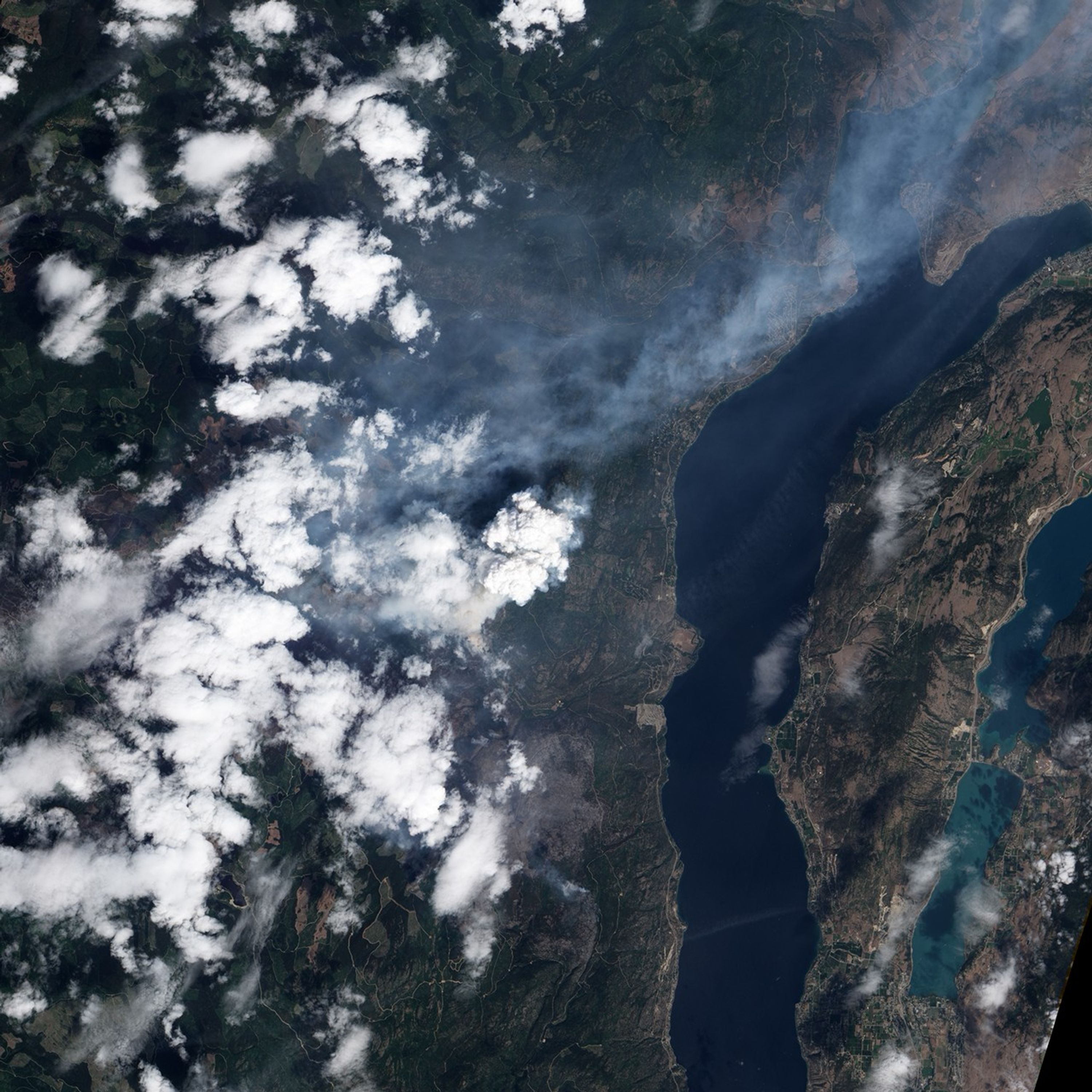
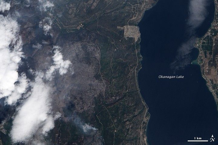
On August 9, 2009, the Advanced Land Imager on NASA’s Earth Observing-1 (EO-1) satellite captured this image of the Terrace Mountain Fire, west of Okanogan Lake in British Columbia, Canada. The large charcoal-colored patch of ground emerging from the clouds at image left is part of the burned area. Forested areas are deep green. An isolated hot spot to the southeast of the main burned area is generating smoke. According to the situation report from the Canadian Interagency Forest Fire Centre on August 12, 2009, the fire was 9,217 hectares (22,776 acres) and about 75 percent contained.
References & Resources
NASA image created by Jesse Allen, using EO-1 ALI data provided courtesy of the NASA EO-1 Team. Caption by Rebecca Lindsey.