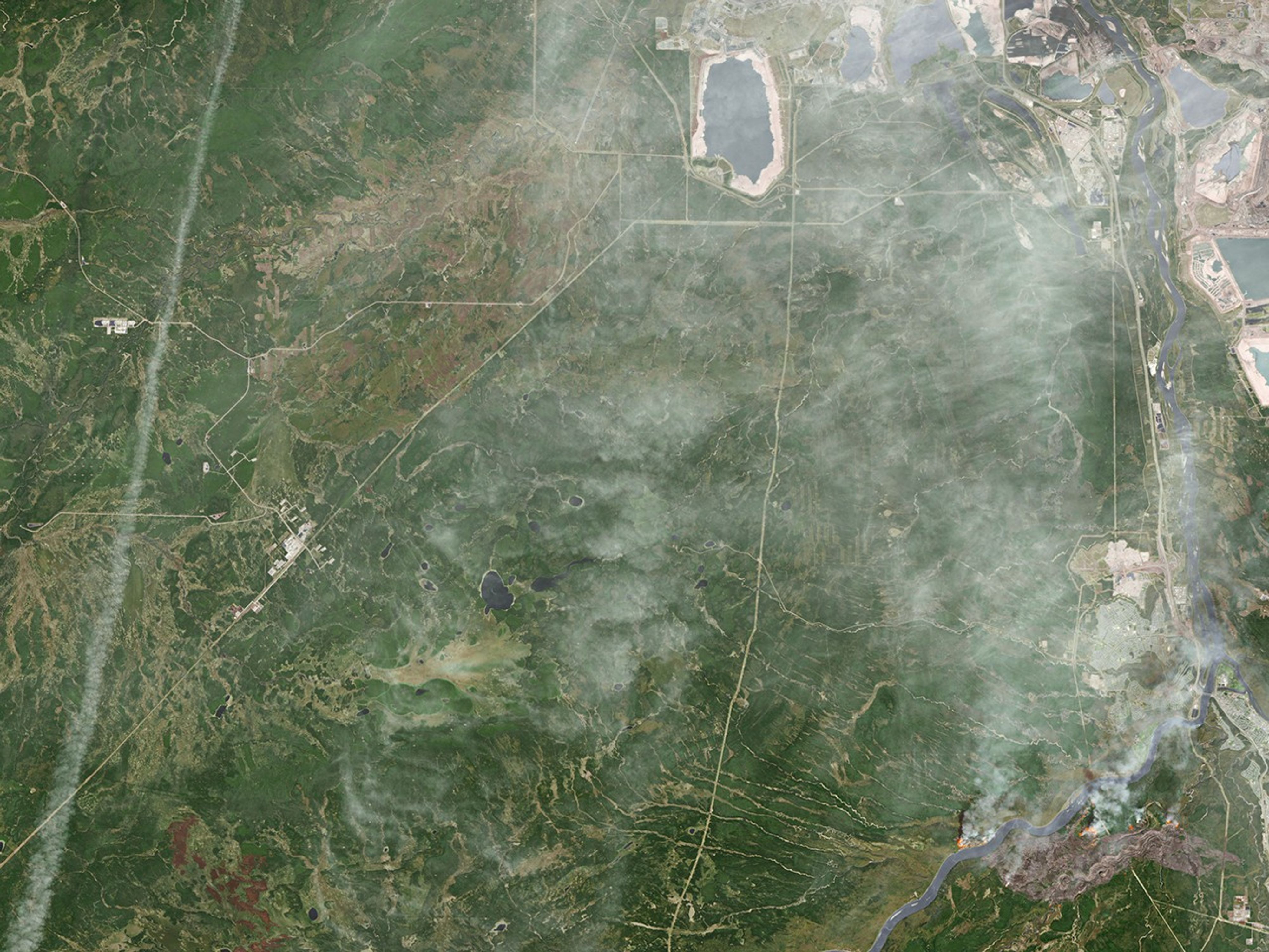

A destructive wildfire burned through Canada’s Northern Alberta region, razing neighborhoods in Fort McMurray and displacing tens of thousands of residents.
At 12:34 p.m. local time on May 3, 2016, the Operational Land Imager (OLI) on the Landsat 8 satellite acquired this false-color image of the fire. The image combines shortwave infrared, near infrared, and green light (OLI bands 7-5-3). Near- and short-wave infrared help penetrate clouds and smoke to reveal the hot spots associated with active fires, which appear red. Smoke appears white and burned areas appear brown.
When this image was acquired, the fire was burning southwest of downtown Fort McMurray. Across the day, a growing number of neighborhoods were placed under mandatory evacuation orders. By the evening of May 3, the mandatory evacuation covered all of Fort McMurray—the largest evacuation on record in Canada.
As of May 4, the fire had burned almost 77 square kilometers (7,700 hectares), and its cause was still under investigation. Fire restrictions were in place for most of the province due to hot, dry conditions.
References & Resources
- Alberta Agriculture and Forestry (2016, May 4) Fort McMurray Area Update. Accessed May 4, 2016.
- Alberta Government (2016, May 4) Emergency updates. Accessed May 4, 2016.
- Regional Municipality of Wood Buffalo (2016, May 4) Fort McMurray Wildfire Updates. Accessed May 4, 2016.
- The Washington Post (2016, May 4) A Canadian oil-sands town is on fire; 80,000 residents must evacuate. Accessed May 4, 2016.
NASA Earth Observatory image by Joshua Stevens, using Landsat data from the U.S. Geological Survey . Caption by Kathryn Hansen.