Urban Heat Islands: Using Simulated Regolith Mars Soil by Christian J. Mercado
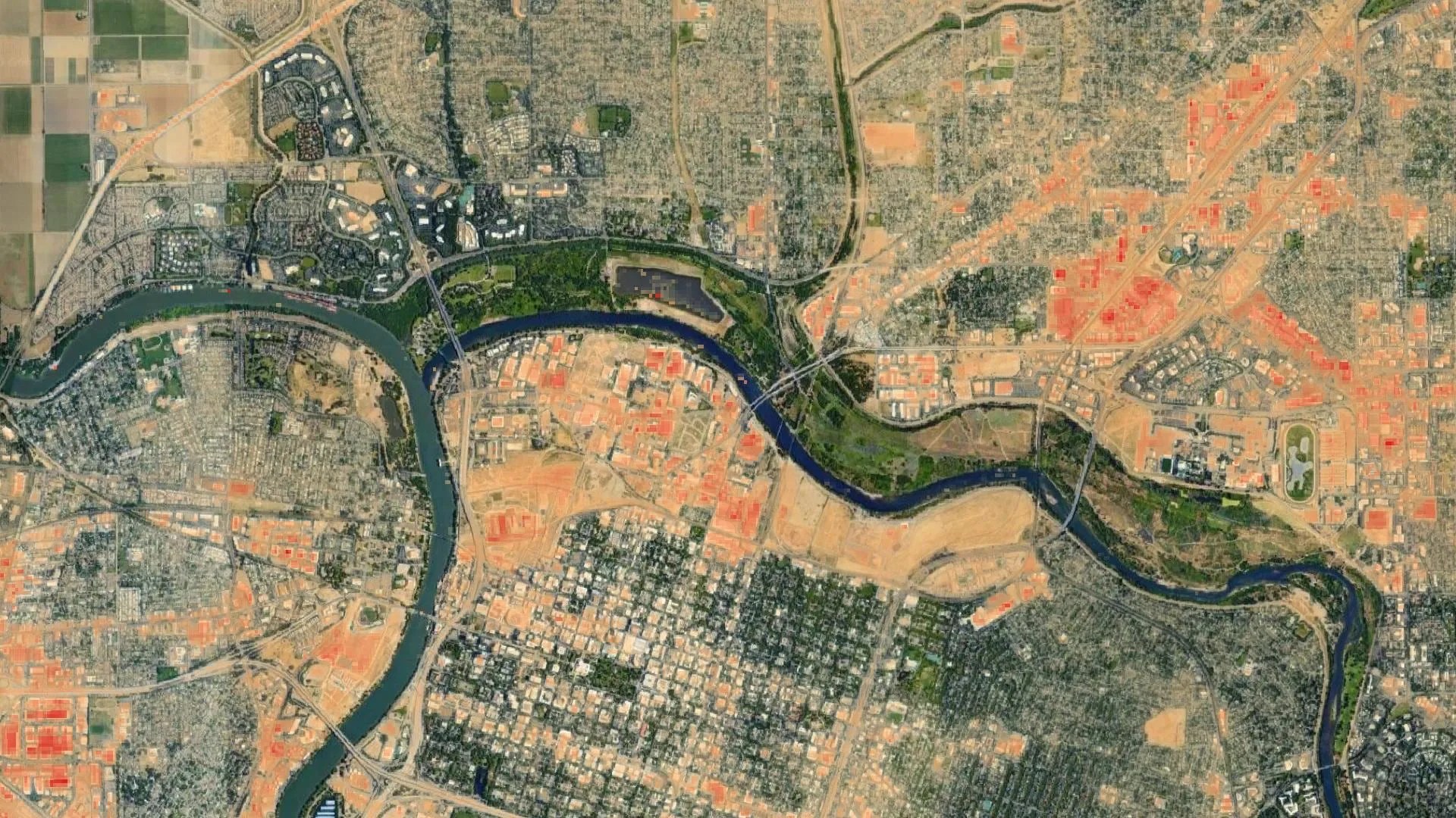
City dwellers are feeling the effects as increasing urbanization and climate change are worsening the effects of Urban Heat Islands and associated temperature-related risks. NASA satellite data are being used to map heat risk potential by neighborhoods, such as shown here for the city of Sacramento. Hotter areas are shown in orange, with darker colors indicating even higher urban heat levels. City officials and urban planners use this data to inform investment in cooling interventions.
| Levels |
|
|---|---|
| Material Type |
|
| Heliophysics Big Ideas |
|
| NGSS |
|
| Heliophysics Topics |
|
| Heliophysics Missions |
|
| Related Missions |
|
| Material Cost per Learner | Free |
| Language | English |
In this 5E lesson students study the effects of human impact on the environment and its relationship to changes in temperature by looking at the processes of heat energy transfer from the Sun to the Earth, how the atmosphere works as a protective shield from the Sun’s energy, why different materials experience differences in surface temperature, and how human activity led to the creation of urban heat islands.
Learn more at: https://outreach.gi.alaska.edu/nasa-heliophysics/heliophysics/urban-heat-islands-using-simulated-regolith-mars-soil-christian-j


