


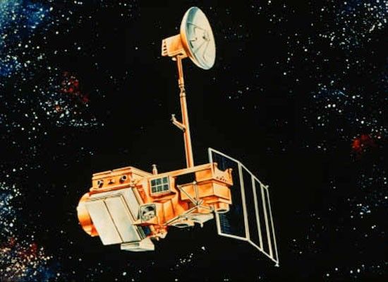
Landsat 4
Landsat 4 represented the next generation Earth resources satellites. It carried the new Thematic Mapper (TM) instrument that provided data in seven spectral bands with greatly improved spectral, spatial, and radiometric resolution compared to earlier Landsat sensors.
Mission Type
Partners
LaunchED
Decommissioned
| Quick Facts | |
|---|---|
| Sensors: TM, MSS | Spatial Resolution: 30 meters (TM VNIR and SWIR), 120 meters (TM thermal); 80 meters (MSS VNIR) |
| Spectral Resolution: 7 bands | Temporal Resolution: 16 days |
| Image Data: 50 scenes/day | Scene size: 170 km (106 mi) x 183 km (114 mi) |
| Swath Width: 183 km (114 mi) | Global Reference Grid System: WRS-2 |
| Altitude: 705 km (438 mi) | Inclination: 98.2 degrees |
| Orbit: Polar, sun-synchronous | Equatorial Crossing Time: Nominally 9:45 am ± 15 minutes local time (descending node) |
| Period of Revolution: 99 minutes; ~14.5 orbits/day | Design Life: 3 years |
Overview
Landsat 4, originally designated Landsat D, was a pioneer of new Earth observation technology. Alongside the proven Multispectral Scanner System (MSS) instrument used on Landsats 1, 2, and 3, Landsat 4 carried the new experimental Thematic Mapper (TM). The TM had seven specialized bands with increased spatial resolution, improved radiometric resolution, and narrower spectral bands across a wider portion of the electromagnetic spectrum. These advancements resulted in the first-ever natural-color Landsat images and enabled new applications such as bathymetry and reef mapping.
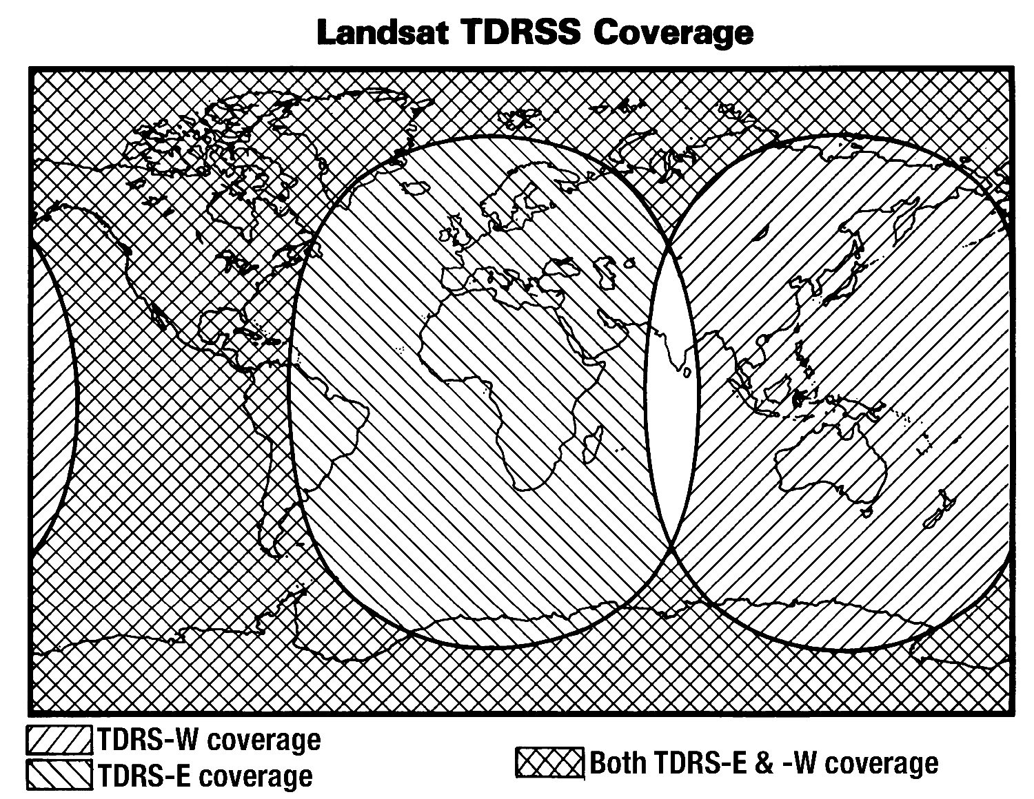
Landsat 4 didn’t operate alone. It was part of a broader story of NASA’s advancing technology. Landsat 4 was the first civilian satellite to carry a spaceborne global positioning system (GPS) receiver package. The satellite was also designed to test NASA’s new Tracking and Data Relay Satellite System (TDRSS) and to rendezvous with the Space Shuttle for servicing. The use of the Space Shuttle for maintenance never came to fruition, but using TDRSS to relay data expanded the global coverage of Landsat data. The GPS experiment was also a success, leading to its use on future Landsat and other NASA missions.
Despite these technological achievements, the mission faced significant challenges with solar panel and X-band downlink failures within a year of launch that limited the transmission of data. Landsat 4 began transmitting TM data again once TDRSS became operational in mid-1983 and continued until the satellite’s last data downlink capability failed in 1993. The spacecraft was kept in orbit for housekeeping telemetry command and tracking data until it was decommissioned in 2001.
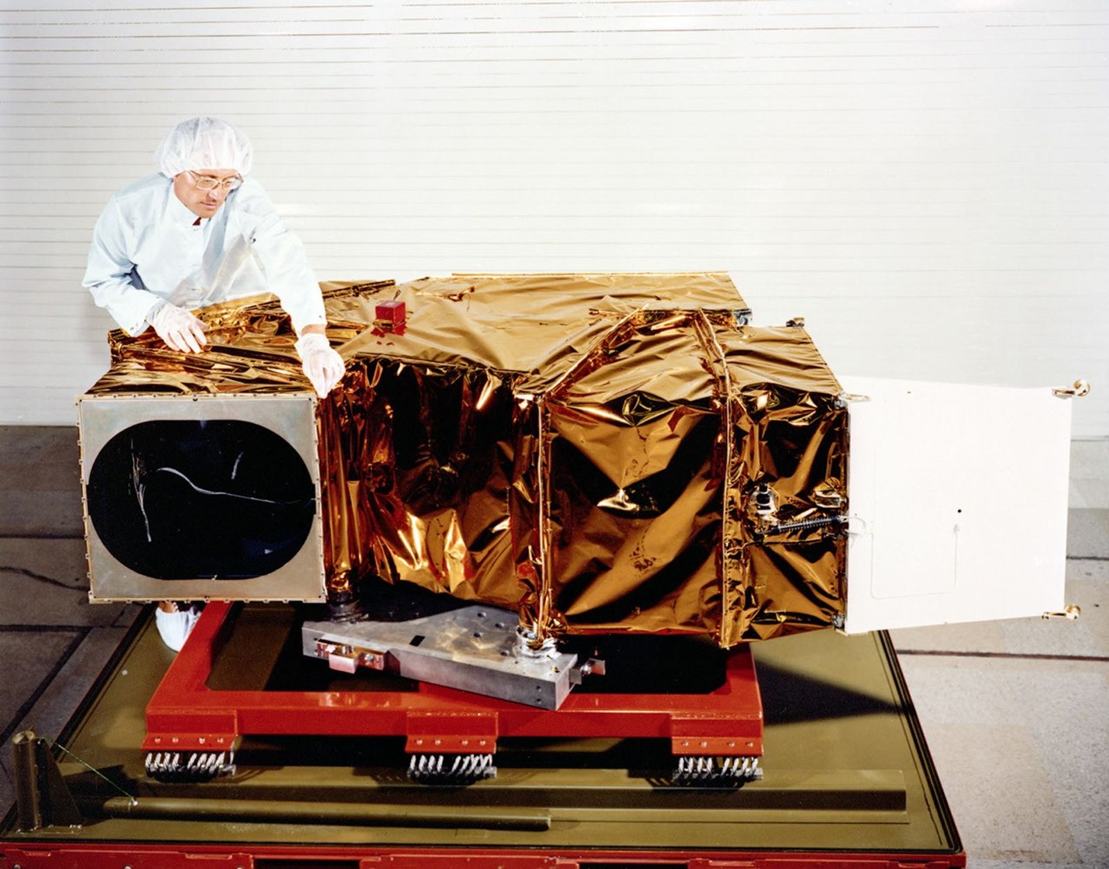
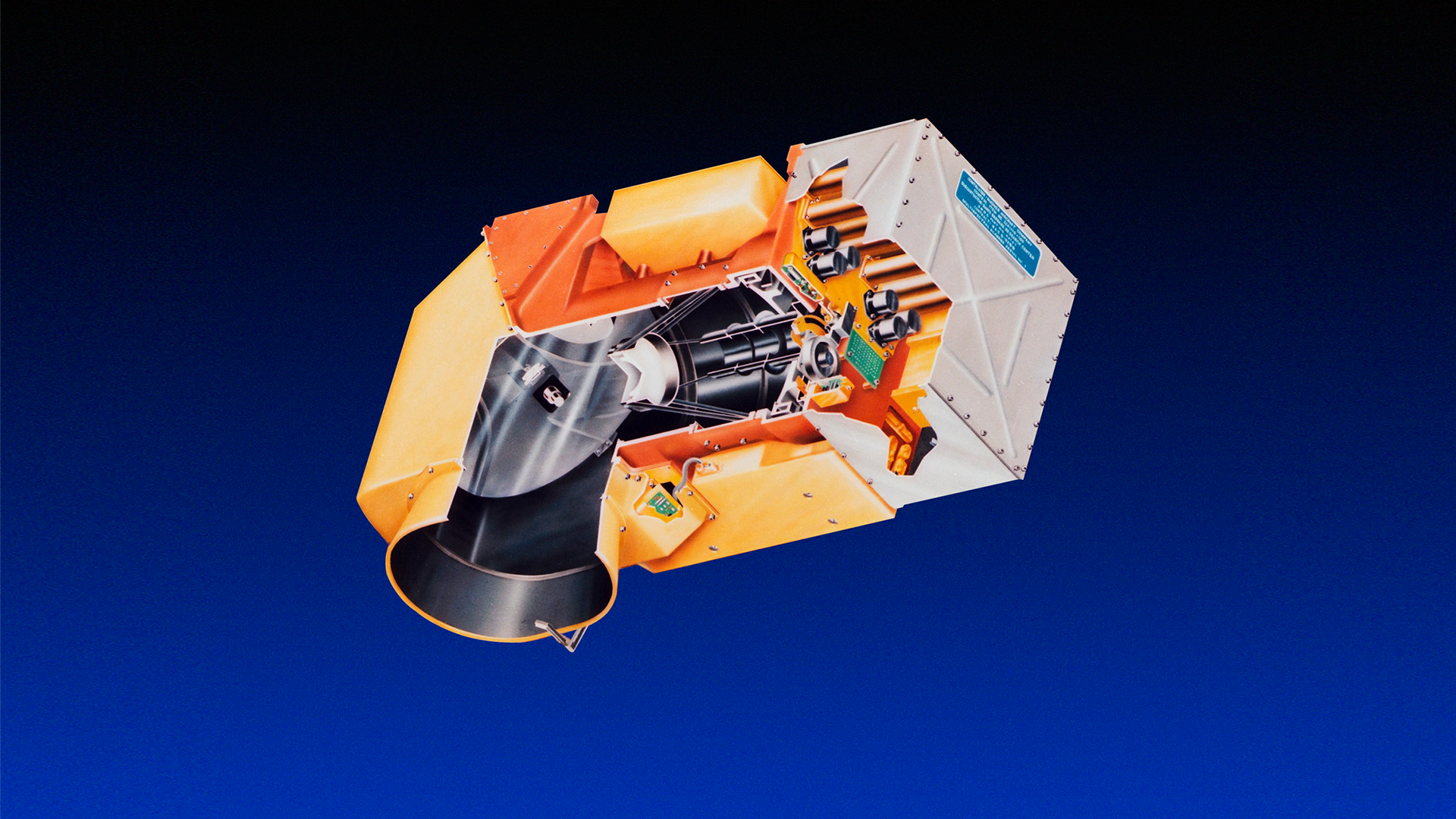
Spacecraft
The Landsat 4 spacecraft represented a significant evolution in satellite design. Instead of the re-purposed Nimbus (weather) satellite bus used by earlier Landsat missions, Landsat 4 was designed using the new Multimission Modular System (MMS). This system standardized spacecrafts to reduce development costs, enabled on-orbit repairs by shuttle astronauts, and allowed each mission to customize subsystems for their needs.
The custom Landsat 4 spacecraft included a Ku-band antenna (mounted on a 12.5 foot boom) for high-bandwidth data transmission to the tracking and data relay satellite system (TDRSS). Two X-band transmitters were added for redundancy and to accommodate the higher bandwidth (84.9 mbps) required for TM data before the TDRSS became operational. For compatibility with existing ground stations, S-band transmitters were used to transmit MSS data.
The spacecraft had a three-year design life with the intention of using the Space Shuttle for in-orbit maintenance to extend its design life. An identical back-up spacecraft–Landsat-D Prime–was placed in storage and eventually launched as Landsat 5.
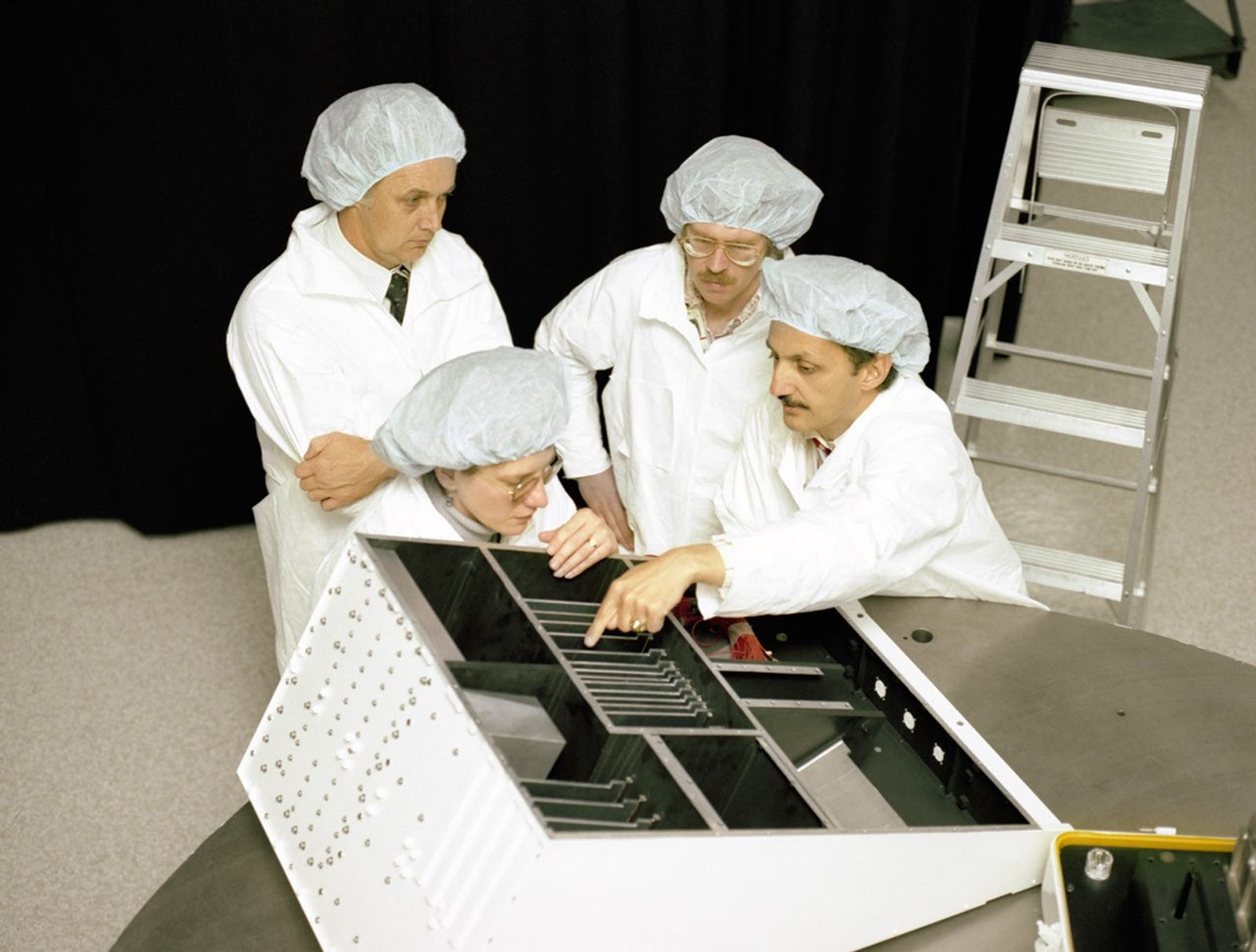
Thematic Mapper (TM)
The Thematic Mapper (TM) measured seven spectral bands, including three enhanced heritage bands—green, red, and near-infrared—with narrower spectral ranges for more precise measurements. These improved bands allowed for more accurate vegetation analysis and crop differentiation than was possible with MSS observations.
The TM added four new bands—blue, two shortwave-infrared bands, and a thermal-infrared band—that allowed researchers to create the first natural-color images of Earth with Landsat data. These new bands also unlocked applications including water quality analysis, vegetation mapping, and surface temperature monitoring.
Band 1: Visible Blue (0.45 - 0.52 µm)
Band 2: Visible Green (0.52 - 0.60 µm)
Band 3: Visible Red (0.63 - 0.69 µm)
Band 4: Near-infrared (0.76 - 0.90 µm)
Band 5: Shortwave-infrared (1.55 - 1.75 µm)
Band 6: Thermal-infrared (10.40 - 12.50 µm)
Band 7: Shortwave-infrared (2.08 - 2.35 µm)
Spatial Resolution: 30 m (VSWIR), 120 m (thermal)
Scene size: 170 km x 185 km (106 mi x 115 mi)
Radiometric Resolution: 8-bit

Multispectral Scanner System (MSS)
Landsat 4 carried a Multispectral Scanner System (MSS) sensor to ensure data continuity and enable user transition from the established MSS system to the new Thematic Mapper technology.
The MSS collected imagery in four spectral bands, each at 80-meter resolution, designed to monitor vegetation, land cover, and water features. The MSS no longer included a thermal band, as the new TM sensor collected an improved version.
Band 4: Visible Green (0.5 – 0.6µm)
Band 5: Visible Red (0.6 – 0.7µm)
Band 6: Near-Infrared (0.7 – 0.8µm)
Band 7: Near-Infrared (0.8 – 1.1µm)
Spatial Resolution: 80m (commonly resampled to 60 m)
Ground Sampling Interval (pixel size): 57 x 79 m
Scene size: 170 km x 185 km (106 mi x 115 mi)
Radiometric Resolution: 6-bit (delivered as 8-bit unsigned integers)
July 25, 1982
First Light
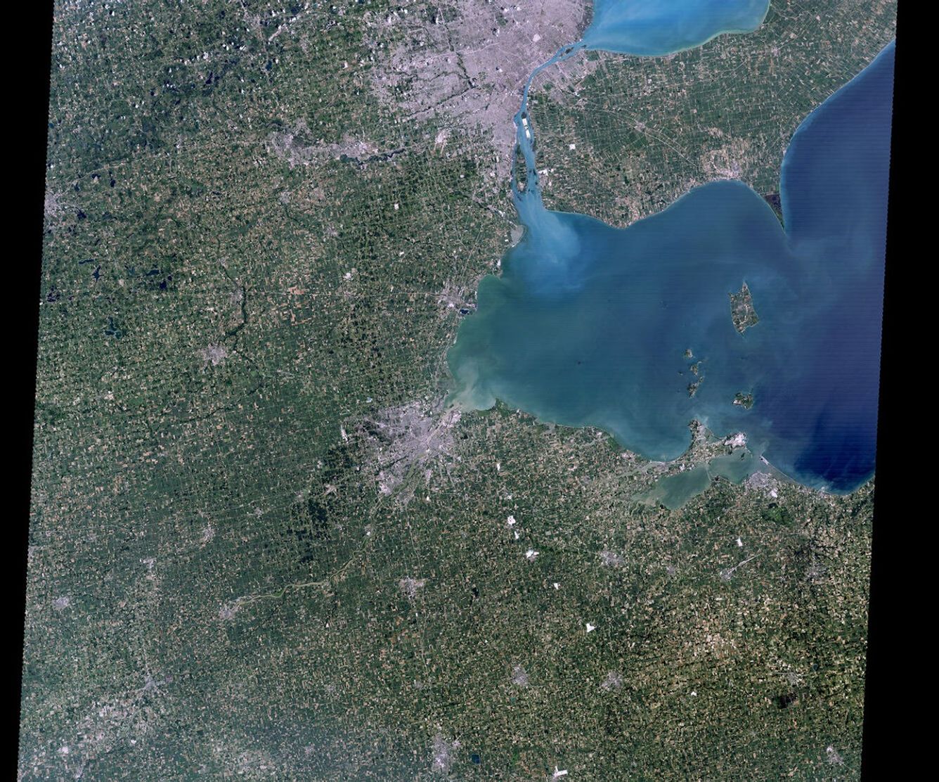
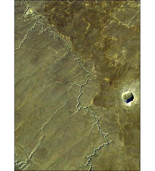
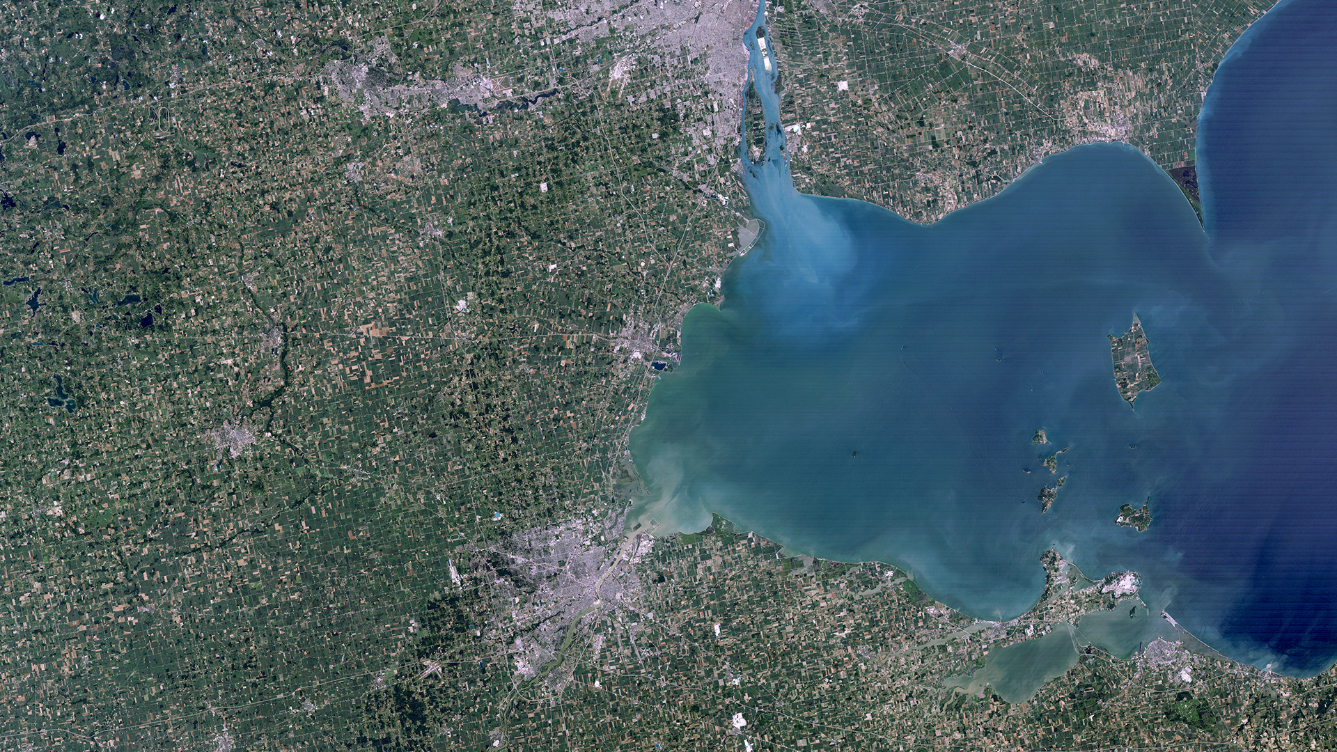
Western Lake Erie
The first natural-color image from Landsat 4 shows the cities of Toledo, Detroit, and Windsor around Lake Erie. Urban areas appear grey against a green, vegetated background. Sediment in Lake Erie appears as cloudy blue or green swirls. Deeper water appears dark blue, whereas shallower water appears lighter, greenish-blue. The new blue band on the Thematic Mapper sensor enabled the Landsat program to depict natural-color imagery for the first time, a major advancement for data users and the general public alike.
Learn More
Mission Objectives
-
• Provide continuing Earth remote sensing information and encourage continued national and international participation in land remote sensing programs.
• Assess the capabilities of the new Thematic Mapper sensing system and to exploit new areas of the infrared and visible light spectrum at higher resolution.
• Establish a technical and operational proficiency which can be used to help define the characteristics necessary for potential future operational land remote sensing systems.
Communications
Unlike Landsats 1, 2, and 3, Landsat 4 did not carry an onboard data recorder. Instead, Landsat 4 was equipped with X-band and wideband Ku-band antennas for real time transmission of the higher 84.9 megabits/second needed for the new Thematic Mapper (TM). The Ku-band was designed to transmit to the new Tracking and Data Relay Satellite System (TDRSS) that launched aboard a Space Shuttle in 1983. For the first year of Landsat 4’s operations, it communicated with the Ground Spacecraft Tracking and Data Network (GSTDN) stations. Both communications from the TDRSS and the GSTDN were routed through NASA’s Goddard Space Flight Center (GSFC).
The X-band downlink transmitters failed in September 1982 and February 1983, leaving the spacecraft with no way to transmit the higher-bandwidth TM data until the TDRSS became operational. There were no TM images transmitted from February 15, 1983 through June 29, 1983, when the first TDRSS satellite was finally ready to receive transmissions from Landsat 4. MSS data were transmitted via a lower rate S-band antenna during this period.
Mission Results
-
Data Collection
Landsat 4 collected 291,345 MSS scenes and 45,674 TM scenes over the course of its operation, representing a substantial contribution to the continuous Landsat data record.
However, the technical failures meant that Landsat 4 couldn't achieve its full data acquisition potential. The loss of direct X-band downlink capability limited the mission's ability to collect TM data over areas not covered by TDRSS communication windows, effectively reducing the total possible daily acquisition count.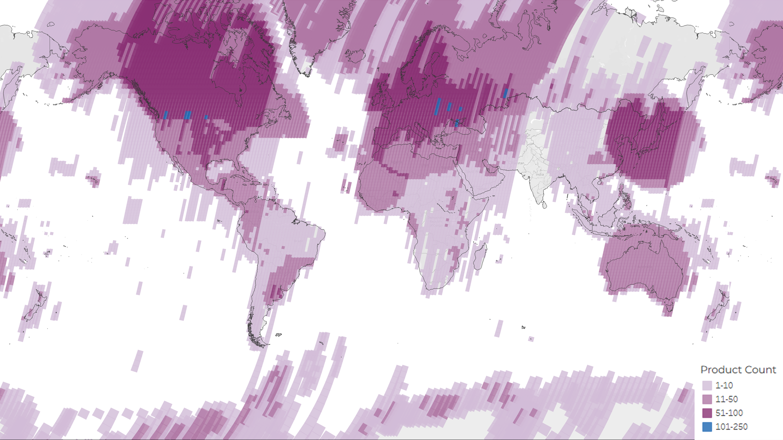 A density map showing the distribution of the total 291,345 MSS and TM scenes acquired and archived during the lifetime of the Landsat 4 mission. The colors represent the number of products per Path/Row.USGS
Legacy
-
First Natural-color Imagery
Landsat 4 was the first satellite in the series to produce natural-color Landsat images. The addition of the new blue band on the Thematic Mapper—alongside refined red and green bands—was a significant milestone that made satellite imagery more intuitive and accessible to users.
Natural-color imagery looked more like what people see with their own eyes, helping the growing user community better understand and accept satellite imagery as a standard tool. The new blue band also allowed scientists to study bathymetry, map reefs, and analyze urban and other non-vegetated areas. This natural color image from Landsat 4 in 1989 shows the Huang He (Yellow River) Delta in northwest China. The name comes from the abundant yellow-tinted silt transported by the river from the surrounding landscapes.NASA/Lauren Dauphin
 -
First Space-based GPS Experiment
Landsat 4 achieved a historic milestone as the first civilian satellite to carry a spaceborne GPS receiver, pioneering the use of satellite navigation for Earth observation missions. Though we now take the technology for granted, GPS was revolutionary at the time. Landsat 4 press materials explained to their audience how the groundbreaking system worked, describing "a new US Air Force satellite navigation system involving orbiting navigational satellites to triangulate the exact position of other satellites."
Landsat 4 provided an experimental platform to evaluate the performance of GPS for satellite navigation when only four of the planned 24 GPS constellation satellites were operational at launch. NASA Goddard researchers Howard Heuberger and Leonard Church demonstrated remarkable results from the Landsat 4 GPS experiment, achieving position accuracy within 50 meters and velocity measurements within six centimeters per second when GPS satellites were in view. The researchers concluded that GPS showed great promise for predicting spacecraft location even with frequent periods when no GPS satellites were accessible to Landsat 4 because only four GPS satellites were operational. While the experiment was deemed successful, it would take nearly three decades before GPS receivers became standard equipment on Landsat spacecraft with the launch of Landsat 8 in 2013.A video documenting the launch of Landsat 4 from Vandenberg Air Force Base in California on July 16, 1982.NASA
Featured Image
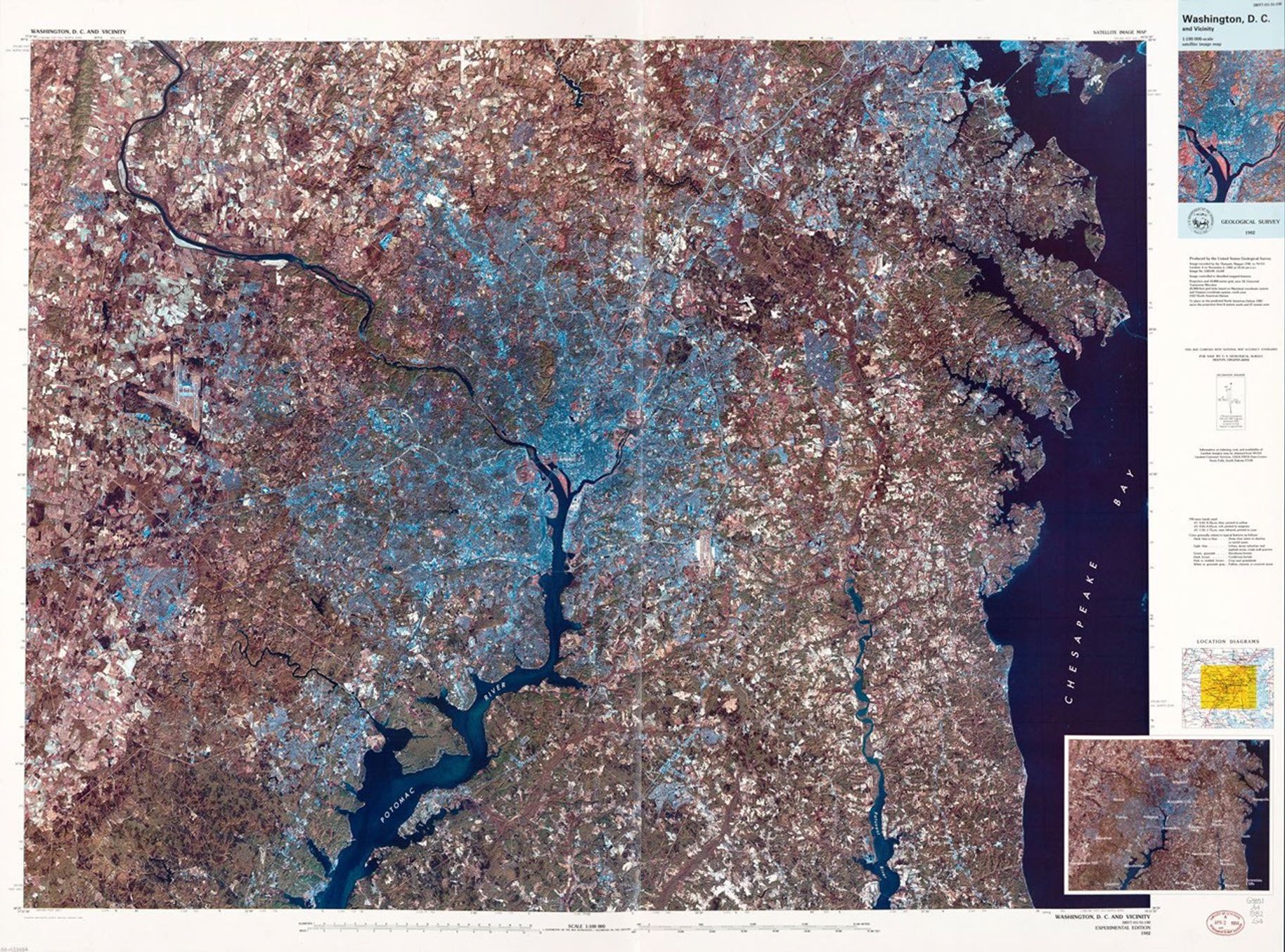
National Capital Region
Satellite Image Map
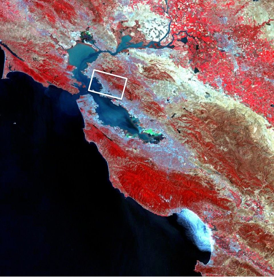
Landsat 4 image of Washington DC and northern Virginia on November 2, 1982 at 10:14am. The image is a composite of TM bands 1, 3, and 5. Dark blue to blue colors represent deep clear water to shallow turbid water. Urban areas appear light blue. Deciduous forests appear greenish and coniferous forests appear dark brown. Pink to reddish brown colors represent crops or grasslands and white to greenish gray are fallow fields or concrete areas.
Learn MoreAgency Roles
The success of the MSS instruments onboard Landsats 1-3 proved the value of the Landsat program. In 1979, President Carter directed NASA to transition the Landsat program from a research and development (R&D) program to an operational one.
NASA was responsible for launching Landsat D (renamed Landsat 4), performing the on-orbit check-out of the spacecraft systems, and establishing the precise orbit. NOAA assumed operations in January 1983 once the spacecraft was fully operational. Since the Thematic Mapper (TM) was an experimental R&D project, NASA (Goddard Space Flight Center) retained management of the instrument.
NOAA was responsible for controlling the spacecraft, scheduling the sensors, processing and distributing MSS data through the United States Geological Survey’s Earth Resources Observation System (EROS) Data Center. NASA provided TM data for public domain distribution.
By 1998, the management of the Landsat 4 (and Landsat 5) operations contract was transferred from NOAA to the USGS before being contracted out to the Earth Observation Satellite Company (EOSAT) corporation in 1984. Operations were continued by the private sector until mid-2001 when Space Imaging (formerly EOSAT) returned the operations contract to the U.S. Government.
Despite the numerous transfers of satellite operation, the USGS has remained responsible for long-term preservation of Landsat data in its National Satellite Land Remote Sensing Data Archive (NSLRSDA) in Sioux Falls, South Dakota.

Project and program management

Vincent Salomonson
Landsat 4 Project Scientist
Darrel Williams
Landsat 4 Deputy Project Scientist

Jon R. Busse
Landsat 4 Project Manager
Luis Gonzales
Former Landsat 4 Deputy Project Manager
Frank L. Heddinger
Former Landsat 4 Deputy Project Manager (resources)

Harry Mannheimer
NASA Headquarters Program Manager Executive
Landsat 4 Graphics Library


Related Resources
Landsat D Press Kit
NASA press release announcing the launch of Landsat D spacecraft with its advanced thematic mapper and multispectral scanner sensors.

Landsat D Brochure
Overview brochure introducing Landsat D as the new era of Earth resources surveying capabilities.

Landsat 4 Science Investigations Summary
Summary of scientific results and early findings from Landsat-4 investigations and workshops conducted in 1983.

A Summary of the Users Perspective of Landsat-D and Reference Document of Landsat Users
Comprehensive user perspective analysis and reference guide documenting federal, state, private, and international Landsat applications.


