Radar Short Course
Fundamentals and Geophysical Application of Imaging Radar Systems
Syllabus
Howard Zebker and Paul Rosen
General Information
Location:
Salvatori Seminar Room
South Mudd Building, Third Floor
Caltech Campus
Northeast corner of California and Wilson
Dates:
Oct. 23-Nov. 3, 2023
Times:
8:30-11:30 Lectures
1:00- Homework/Computer Lab
Intended audience:
This class is aimed at advanced students and radar professionals interested in the physical principles and signal processing and analysis needed to understand and work with radar remote sensing data.
Course goal:
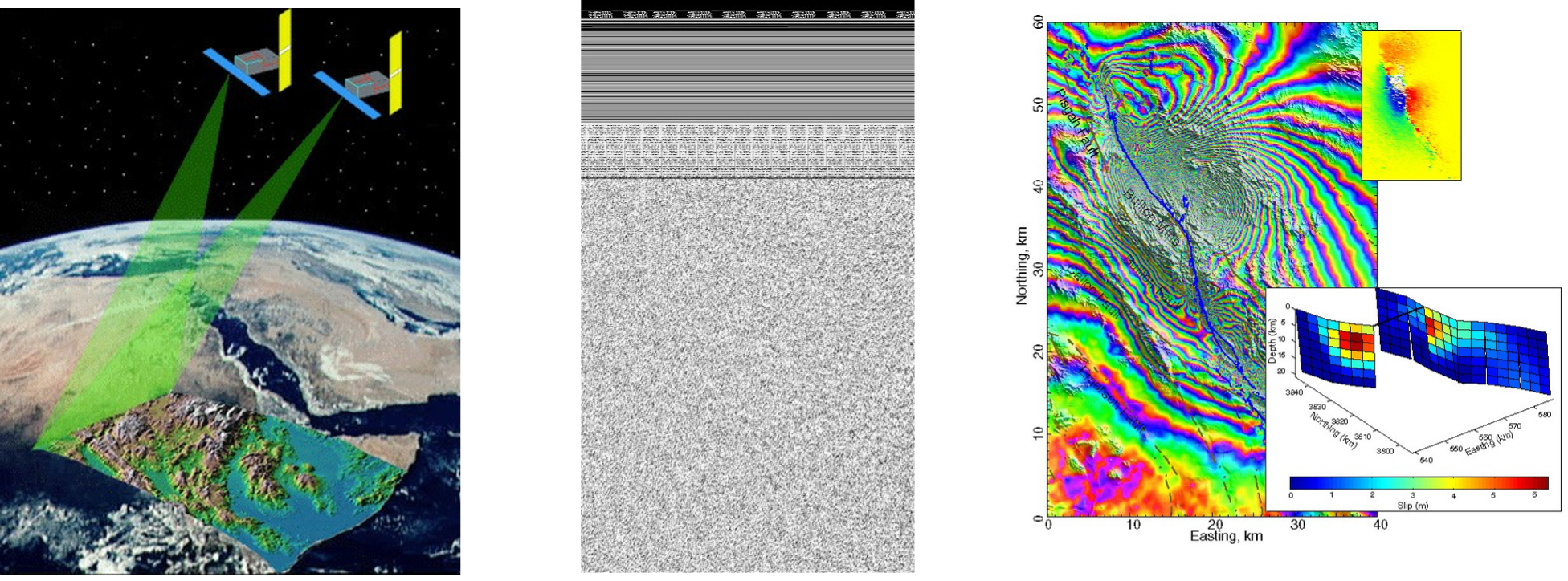
The material presented here enables attendees to derive most properties of radar echoes from first physical principles, and to be able to design and implement processing code that generates high-resolution images from the raw measurements. In addition, you will be able to use multiple channel systems to produce higher order data products such as interferometric and polarimetric analyses. Finally, you will be able to apply these products to a diverse set of geophysical applications.
Course description:
Radar has evolved from a largely military detection system into a sophisticated three dimensional imaging tool with hundreds of applications ranging from commercial aviation to fundamental research in the earth and planetary sciences. The ability to measure and map surface topography and crustal change at unprecedented levels over large areas is fundamentally altering the way in which we can measure and model the processes, natural and man-made, that effect our environment. The interaction of EM waves with different surface types provides a basis for analyzing echoes to discern, for example, the structure of vegetation canopies or surface roughness. In this course we will investigate how radar images are formed and manipulated, as well as applications of the systems. We will be presenting radar as a signal processing problem, rather than the traditional approach as an instrumentation problem, acknowledging the importance of digital computer algorithms in modern radar systems. The first half of the course will be largely devoted to radar image formation, and topics will include system design, range and azimuth processing algorithms, and processor design. In the second half of the course we examine scattering from natural surfaces, polarimetric radars-- which are particularly suited to the study of vegetation cover--, plus the increasingly important field of radar interferometry. Interferometric radar techniques, which have formed a large part of radar-related research over the past 30 years, provide a means to characterize very small changes or motions on the Earth over large areas.
The course will be presented in a lecture/seminar style. Mornings will consistent largely of interactive lectures, while the afternoons will entail a computer exercise to give experience with implementation of the material presented in class. The afternoons will be augmented with guest lectures from senior radar scientists and engineers in order to present diverse ways to look at the problems.
Our approach will be to have students create their own codes to solve each day’s problem, building on the previous days’ exercises to create a full data flow. Lecture notes will be available online, and special handouts will also be distributed from time to time. Cooperation on the exercises is encouraged, with TA support to help with debugging problems quickly. We can grade you if you like but we want everyone to earn an A+ grade(!)
REFERENCES
Several books which may serve as useful references are listed below.
Bracewell, R. N., The Fourier Transform and Its Applications, McGraw-Hill, New York, 2nd edition, 1986.
Carrara, W.G., R.S. Goodman, and R.M. Majewski, Spotlight Synthetic Aperture Radar: Signal Processing Algorithms, Artech House, Norwood, MA, 1995.
Cook, C.E., and M. Bernfeld, Radar Signals, Academic Press, New York, 1967.
Curlander, J.C. and R.N. McDonough, Synthetic Aperture Radar, Wiley Interscience, New York, 1991.
Elachi, C., Introduction to the physics and techniques of remote sensing, Wiley, New York, 1987.
Elachi, C., Spaceborne Radar Remote Sensing: Applications and Techniques, IEEE press, New York, 1988.
Goodman, J.W., Introduction to Fourier Optics, McGraw-Hill, New York, 1968.
Kraus, J.D. Radio Astronomy, McGraw-Hill, New York, 1966. (Later editions good also)
Peebles, P.Z, Radar Principles, Wiley Interscience, New York, 1998.
Press, W.H., B.P. Flannery, S.A. Teukolsky, and W.T. Vetterling, Numerical Recipes in C, the Art of Scientific Computing, Cambridge University Press, New York, 1988. (Any of the Numerical Recipes series will have useful algorithm information)
Sabins, F., Remote Sensing, 3rd ed., Freeman, New York, 1996. Soumekh, M., Fourier Array Imaging, Prentice Hall, Englewood Cliffs, New Jersey, 1994.
Skolnik, M.I., Radar Handbook, McGraw-Hill, New York, 1970.

