![Request for Information – Potential [Placeholder for Prize]](https://assets.science.nasa.gov/dynamicimage/assets/science/missions/a-step/FFR_Earth_Background_20251120%20.png?w=1024)


By Laura E.P. Rocchio
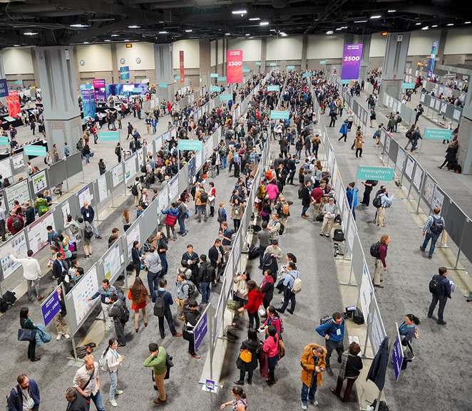 At the 2019 AGU Fall Meeting, over 500 presentations feature research conducted with the aid of NASA/USGS Landsat data. The gamut of focus areas where you can find Landsat-related papers and posters attests to the wide scope and interdisciplinary nature of Landsat data. From beaver-influenced ecosystem functioning to thermal monitoring of volcanic fields, talks and posters on Landsat-aided research will be presented throughout the week. This year we again had the opportunity to speak with a handful of scientists, researchers, and students using Landsat in their studies. The resulting Q&A’s will be posted here throughout the week.
Predicting Waterbird Habitat in California

Understanding the Ecological and Environmental Impacts of Urbanization
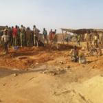
Assessing the Environmental Impacts of Artisanal Gold Mining

Fire & Water: How Wildfires Can Impact Drinking Water
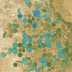
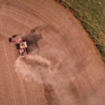
Using NASA’s Harmonized Landsat Sentinel-2 Product to Give Farmers Real-Time Crop Health Information
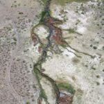
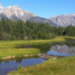
When a River Runs Through Drylands
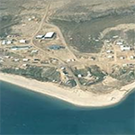
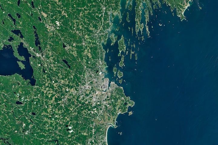
Coastal Change in the Northwest Territories
Tracking New Hydrothermal Activity in Yellowstone
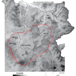
Improving Water Management in New Mexico with Landsat and ECOSTRESS
Smokey the Beaver? Beaver Dams and Wildfire
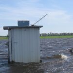
Mapping Past Floods to Help Predict Future Ones
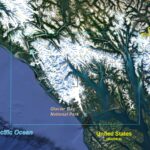
Watching Glacier Bay National Park Change
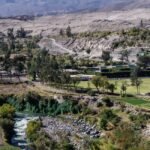
Arid-Region Agriculture in Arequipa, Peru
Landsat Helps Pick Winter Cover Crops
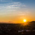
How Urban Heat Affects the Socially Vulnerable in Sun Belt Cities
Press Conference
AGU Press Conference
focusing on new time-lapse imagery of glaciers across Alaska and the Yukon (using Landsat and other satellite imagery).
Ice in Motion: Decades of Satellite Images Illuminate Change
Time: Monday, Dec. 9, 4:30 p.m. EST / 1:30 p.m. PST
With a half-century’s worth of images from Earth-observing satellites, scientists are investigating how ice is changing in a warming climate. In this briefing, researchers illustrate the story of how glaciers got to the state they’re in today and what changes are happening in the interior of Earth’s ice sheets. They will present time-lapse movies of individual glaciers in Alaska and the Yukon over the last 47 years, new findings about how Greenland glaciers have behaved over the past three decades, and a new look at where lakes on top of the Greenland Ice Sheet are popping up.
Participants:
Devon Dunmire, University of Colorado Boulder, Boulder
Mark Fahnestock, University of Alaska, Fairbanks
Michalea King, Ohio State University, Columbus
James Lea, University of Liverpool, Liverpool, United Kingdom
Related Feature Article:
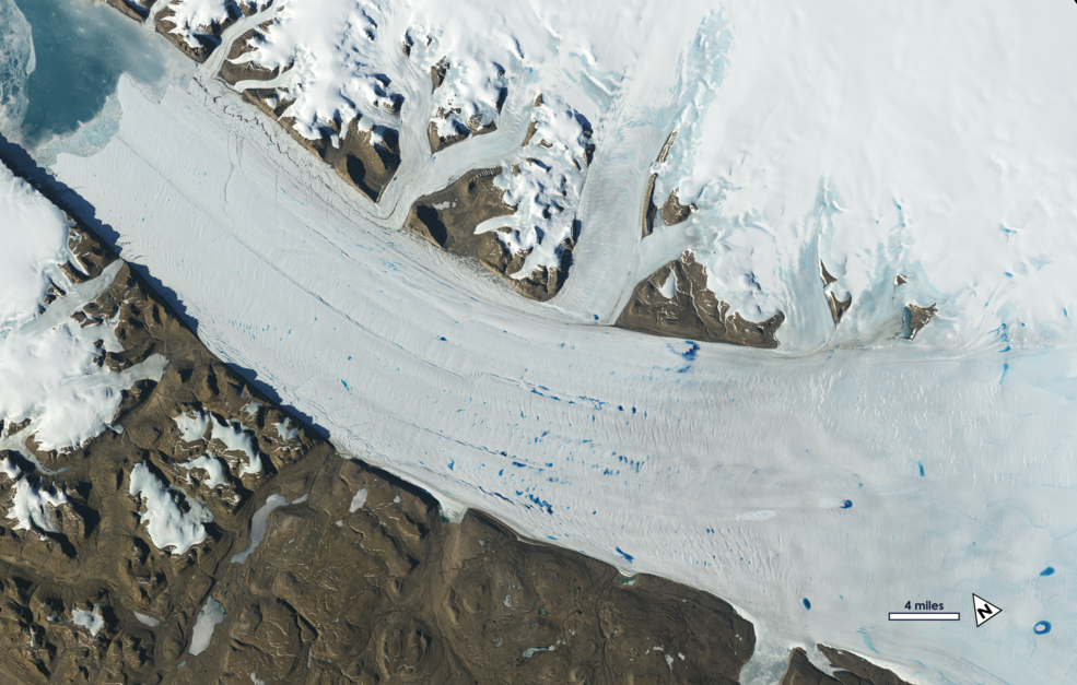 Ice in Motion: Satellites Capture Decades of Change
Related Coverage:
+ See how an Alaskan glacier has shrunk over time, ScienceNews
Presentations by Landsat Science Team Members at #AGU19:
A number of our Landsat Science Team members will be at AGU this year presenting Landsat-related work. A list of those talks can be found below.
Monday, December 9, 2019
8:00 a.m.–12:20 p.m. Validation of high spatial resolution surface reflectance using a camera system (CAMSIS), Eric Vermote, Moscone South – Poster Hall; B11P-2320
8:00 a.m.–12:20 p.m. New Land Disturbance Products for the Conterminous US, Zhe Zhu, Moscone South – Poster Hall; B11I-2302
Tuesday, December 10, 2019
9:30–9:45 a.m. Towards Global Monitoring of Key Commodity Crops Using Multi-Source Data, Matt Hansen, Moscone West – 2007, L2; GC21B-08
9:30–9:45 a.m. Operational Remote Sensing of Agricultural Water Use in Cooperation with Western State Water Resource Agencies for Improved Water Management, Justin Huntington, Moscone West 3024, L3; H21C-07
1:40–6:00 p.m. Mapping Crop Emergence in Near Real-time at Field Scales Using High Temporal and Spatial Resolution Imagery: Challenges and Opportunities, Feng Gao, Moscone South – Poster Hall; GC23G-1431 Wednesday, December 11, 2019
1:40–6:00 p.m. Landsat 9 Thermal Infrared Sensor-2 Prelaunch Characterization Joel McCorkel (2012-2017 cohort) Moscone South – Poster Hall; A33L-2953 Friday, December 13, 2019
2:10–2:25 p.m. ECOSTRESS-Landsat Synergy for Mapping Evapotranspiration and Vegetation Stress in Agricultural Landscapes, Martha Anderson, Moscone West – 2003, L2; GC53A-03 For other NASA-related AGU happenings, visit NASA at AGU.
Related Resources
Anyone can freely download Landsat data from the USGS EarthExplorer or LandsatLook.