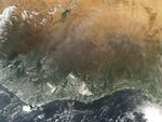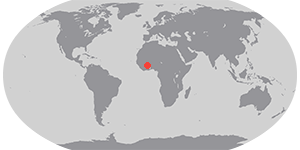

In western Africa, the southern margins of the Sahara Desert transition to a zone called the Sahel. The Sahel becomes savannas and woodlands nearer the coast. On December 6, 2004, numerous fires were burning in the region, and were detected by the Moderate Resolution Imaging Spectroradiometer (MODIS) on NASAâs Aqua satellite. Their locations have been marked with red dots. The highest concentration of fires is located roughly in the center of the image, in the country of Ghana. Fires are also prevalent to the north of Ghana in Burkina; to the west in Cote DâIvoire (Ivory Coast); and to the east in Togo and Benin. The widespread nature of the fires, their location, and the time of year all suggest that these fires are being set intentionally for agricultural purposes. Though not necessarily hazardous, such large-scale burning can have a strong impact on weather, climate, human health, and natural resources.
References & Resources
NASA image created by Jesse Allen, Earth Observatory, using data obtained from the MODIS Rapid Response.