




















July 16, 2005
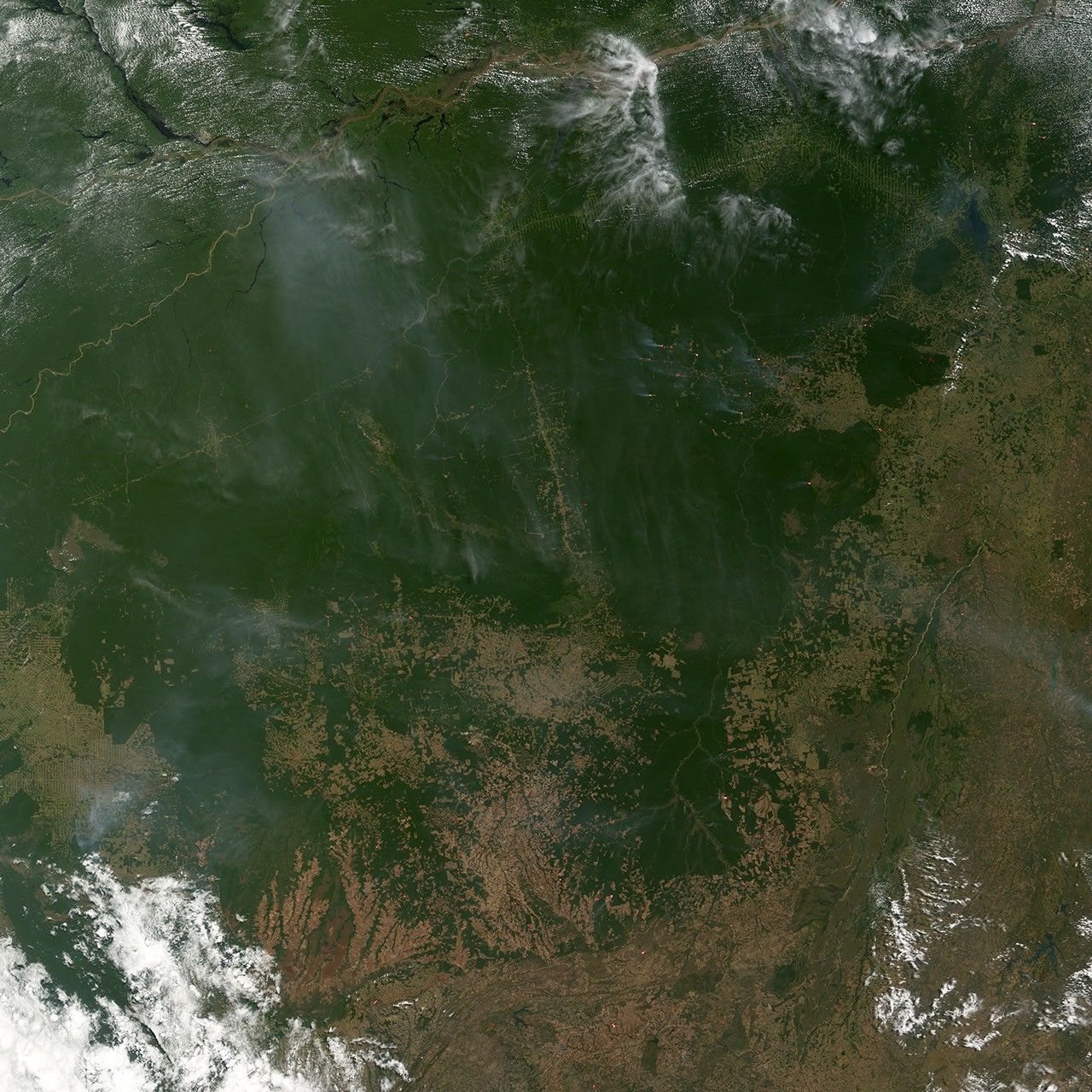
In the southeastern Amazon, biomass burning is transforming the landscape. Fire is commonly used to manage agricultural lands near to forests as well as to clear intact forests for ranching and farming. This image of the region was captured by the Moderate Resolution Imaging Spectroradiometer (MODIS) on NASA’s Terra satellite on July 16, 2005. Active fires are marked with red dots. The fires are burning along the forest margins and alongside several roads that run through the forest toward the Amazon River, which runs in a muddy path across the top of the image.
References & Resources
NASA image created by Jesse Allen, Earth Observatory, using data obtained from the Goddard Earth Sciences DAAC .