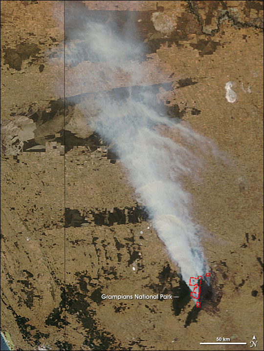
In southwestern Victoria, Australia, a dangerous wildfire was raging on January 24, 2006, when the Moderate Resolution Imaging Spectroradiometer (MODIS) on NASA’s Terra satellite passed overhead and collected this image. The dark green vegetation of Grampians National Park is shrouded with smoke that drifts hundreds of kilometers to the north before crossing westward into South Australia. The actively burning areas of the fire detected by MODIS are outlined in red. According to a news report from January 24, more than a dozen houses had been lost in the fire, which had burned more than 90,000 hectares (900 square kilometers, which is a little more than 222,000 acres).
References & Resources
NASA image courtesy Jeff Schmaltz, MODIS Rapid Response Team, Goddard Space Flight Center