Energy Resources
As the global demand for energy grows, Landsat plays a pivotal role in identifying new energy sources while monitoring the environmental impacts of existing operations.
Landsat's Role in Managing Energy Resources
Energy is a growing necessity for people worldwide. As the demand for energy grows, Landsat plays an important role in identifying new energy sources and mitigating the human and environmental impact of energy development.
Landsat is useful in the energy sector both because of its unparalleled decades-long record of Earth’s land and because of its ability to measure infrared and visible light. With a half-century of imagery, decision makers can monitor the environmental impact of mining and energy generation and track ecological recovery after operations end.
Landsat’s ability to measure infrared light allows farmers and decision makers to gauge the health of biofuel crops and natural vegetation near dams and mining sites. The infrared and visible measurements together help energy companies identify minerals on the surface when plants are sparse.
Landsat satellites have been collecting information about the land and helping people make informed decisions on energy related topics since the 1970s.
Landsat Data for Local and Global Decision-making
- Locating oil, natural gas, geothermal vents and uranium deposits
- Promoting safety through detection of coal mine fires
- Monitoring surface mine reclamation efforts
- Managing biofuel crops
- Mitigating ecological impacts from hydroelectric dams
Locating Oil, Natural Gas, Geothermal Vents, Coal and Uranium Deposits
Many energy sources, including fossil fuels, uranium for nuclear energy, and geothermal vents for geothermal energy, come from minerals or geologic events under the Earth’s surface. Landsat observations of infrared light can distinguish different minerals and geologic features on Earth’s surface, which can provide clues that help identify fuel sources underground. For example in the Southwest, the U.S. Geological Survey (USGS) uses Landsat data to produce mineral classification maps that indicate the presence of geothermal systems and are used by energy companies.
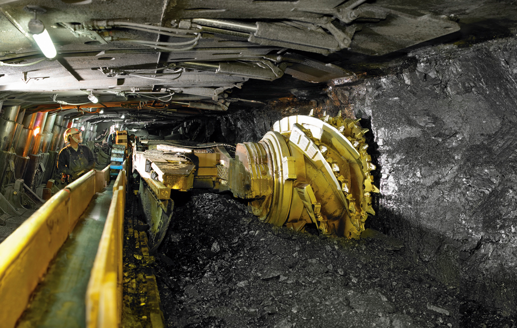
Improving Mining Safety Through Detection of Coal Mine Fires
Coal fires can be caused by spontaneous combustion of coal, by lightening or forest fires igniting a coal seam, or by mine related activities like welding, electrical work or explosives. These fires can burn undetected in mine shafts releasing noxious gases that can cause asphyxiation. The fires can cause life-threatening burns and contribute to coal mine roof instability, causing mines to collapse. Landsat’s thermal bands can detect hot spots near the surface that can indicate the presence of a hidden fire. Without Landsat thermal data, many of these coal mine fires would go undetected, putting miners in danger.
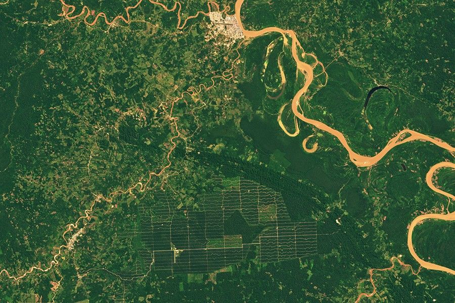
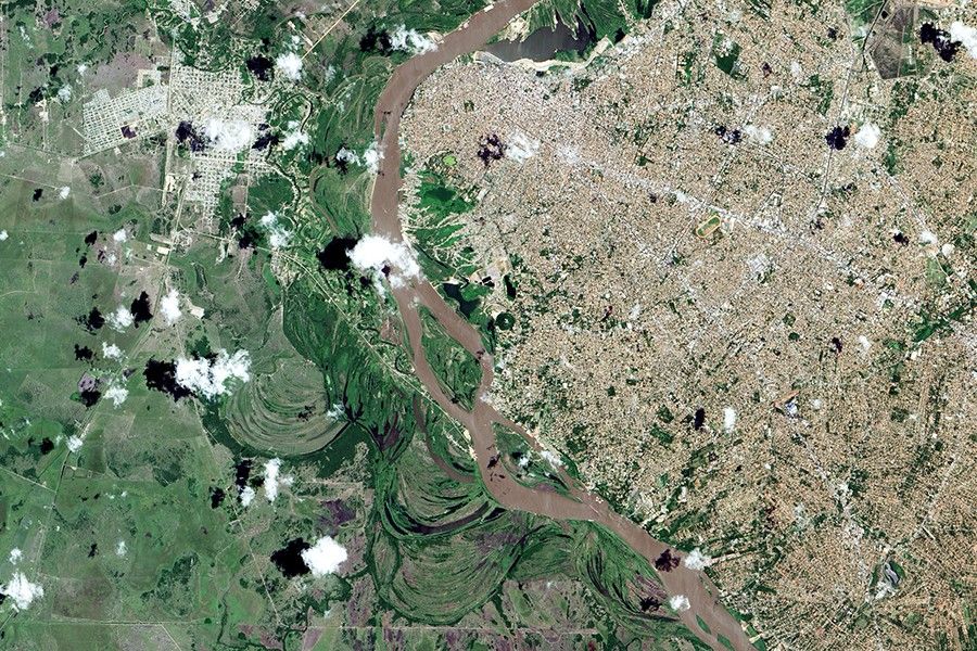
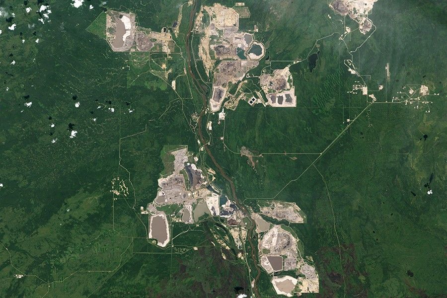
Monitoring Surface Mine Reclamation Efforts
Landsat has collected data on mining sites for over forty years, showing what many of these landscapes looked like before, during, and after surface mining. The record helps monitor vegetative regrowth and valley filling and helps identify impacted areas.
Related Resources
- Miner Safety and Health Administration
- Estimating Hydropower’s Land Use Impacts
- Mapping Minerals with Landsat 8 in the Four-Corners Region
Latest News

With Landsat Next’s 26 new spectral bands, we’ll be able to see our planet like never before. Landsat Next’s enhanced…
The Australian company Indji Systems uses a variety of satellite data to provide real-time hazard monitoring and alerts to utility…
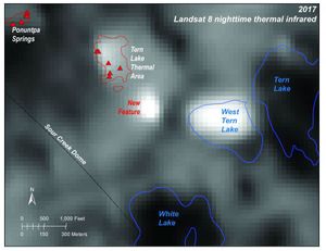
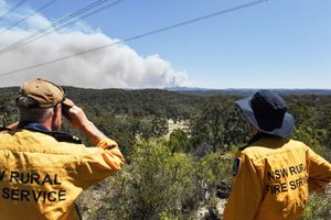
Over the last 20 years, a new thermal area has developed in Yellowstone. Landsat 8 is on the case.