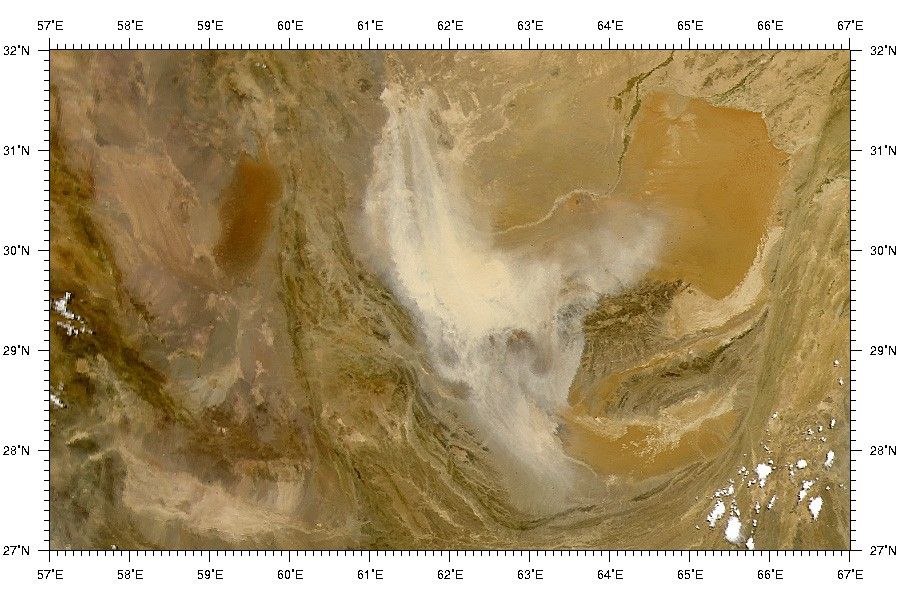
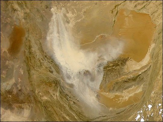
The Sea-viewing Wide Field-of-view Sensor (SeaWiFS) viewed this largedust storm over Iran, Afghanistan, and Pakistan today (May 18, 2001).The dust (tan pixels) appears to be lifted from the Khash and MargowDeserts of Southwestern Afghanistan, carried southward along the Iranborder and then angling eastward into Pakistan.
The various shades of brown reflect a varied landscape containingexpanses of flat open desert, dry lake beds, dune fields, and mountainranges. The large golden-brown, stingray-shaped region toward the upperright corner of this image is a sandy desert known in Afghanistan asRigestan. Roughly 480 km (300 miles) due west (left) of Rigestan is theIranian Lut Desert. The darker brown splotches immediately to the south(below) of Rigestan are Pakistan's Chagai Hills, which mark the borderbetween the two countries. The Siahan Mountains can be seen about 240km (150 miles) due south of the Chagai Hills.
For more details on some of the environmental effects of large-scaledust storms, see: "When the DustSettles" and "From the DustBowl to the Sahel."
References & Resources
Image courtesy the SeaWiFS Project, NASA/Goddard Space Flight Center, and ORBIMAGE