Suggested Searches

1 min read

Flooding Persists in Southeast India

Instruments:
Topics:
October 21, 2015
December 8, 2015
About one week after a deluge of rain led to widespread flooding in southeastern India, some parts of the landscape remain inundated with water.
NASA Earth Observatory images by Joshua Stevens, using Landsat data from the U.S. Geological Survey . Caption by Kathryn Hansen.
About one week after a deluge of rain led to widespread flooding in southeastern India, some parts of the landscape remain inundated with water.
NASA Earth Observatory images by Joshua Stevens, using Landsat data from the U.S. Geological Survey . Caption by Kathryn Hansen.
About one week after a deluge of rain led to widespread flooding in southeastern India, some parts of the landscape remain inundated with water.
NASA Earth Observatory images by Joshua Stevens, using Landsat data from the U.S. Geological Survey . Caption by Kathryn Hansen.
About one week after a deluge of rain led to widespread flooding in southeastern India, some parts of the landscape remain inundated with water.
NASA Earth Observatory images by Joshua Stevens, using Landsat data from the U.S. Geological Survey . Caption by Kathryn Hansen.
October 21, 2015
December 8, 2015

December 8, 2015

Flooding Persists in Southeast India

About one week after a deluge of rain led to widespread flooding in southeastern India, some parts of the landscape remain inundated with water.
Flooding Persists in Southeast India
About one week after a deluge of rain led to widespread flooding in southeastern India, some parts of the landscape remain inundated with water.
NASA Earth Observatory images by Joshua Stevens, using Landsat data from the U.S. Geological Survey . Caption by Kathryn Hansen.

In early December 2015, a deluge of rain led to widespread flooding in southeastern India. One estimate, based on data from a satellite that makes measurements through the cloud layers, found that rainfall totals in the area approached 400 millimeters (16 inches) during a 48-hour period.

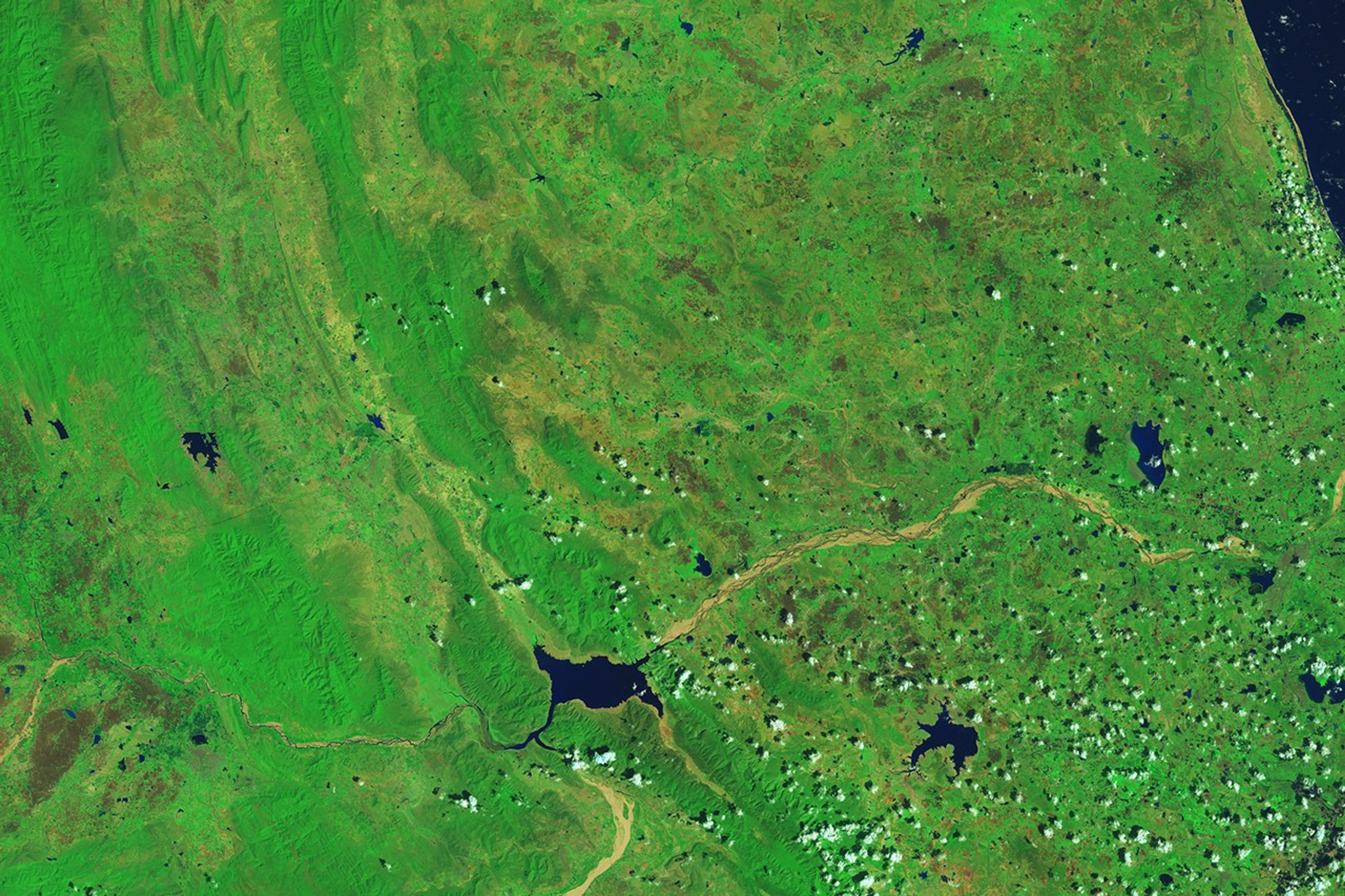
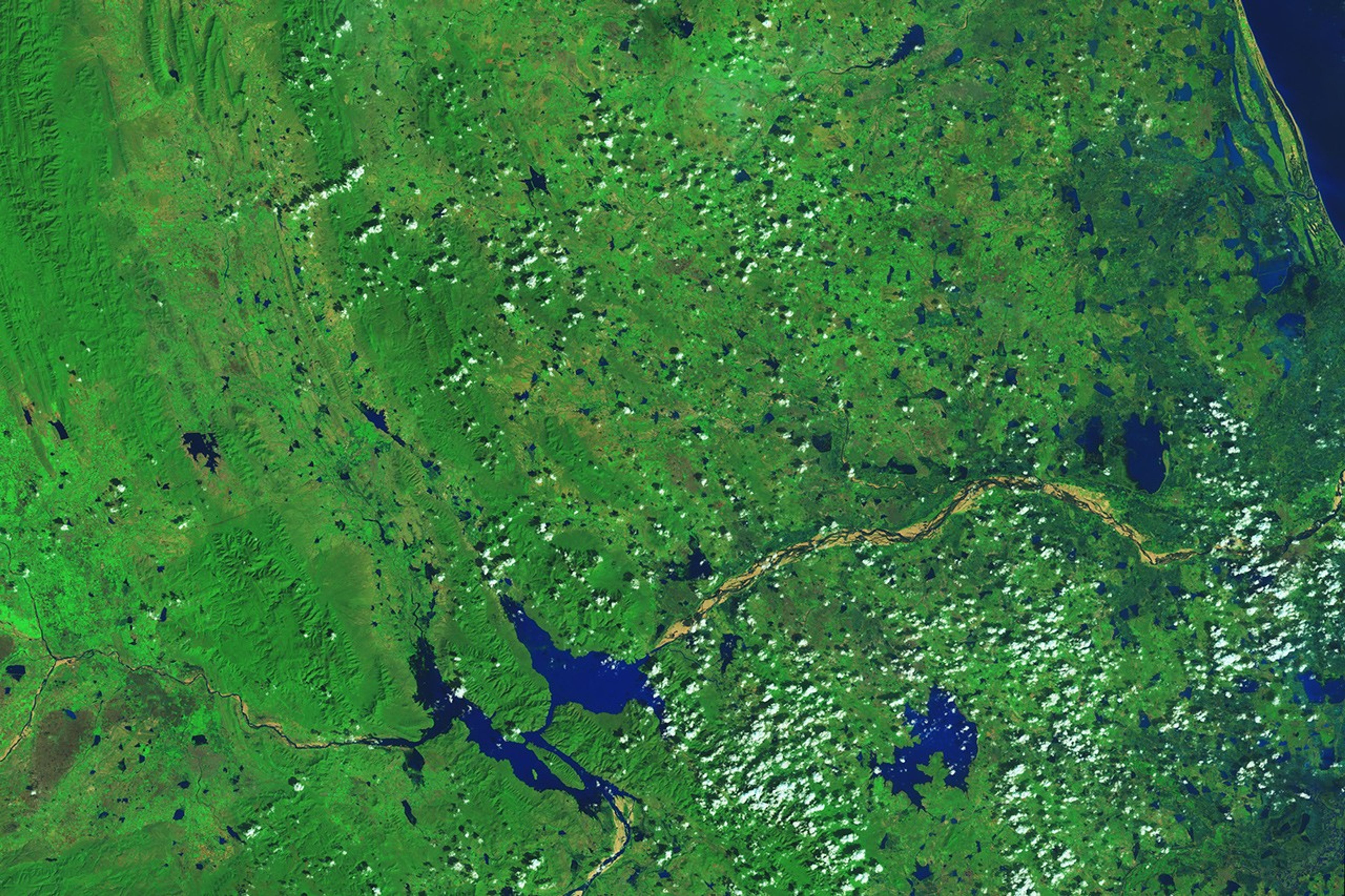
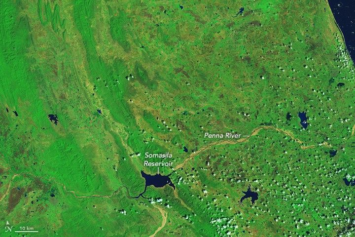
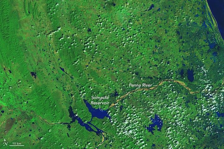
About a week later, clouds cleared and afforded a view of the flooding that persisted. The false-color images above, acquired with the Operational Land Imager (OLI) on Landsat 8, show an area about 200 kilometers northwest of Chennai. The top image was acquired on October 21, before the rains, and the bottom image was acquired on December 8. Turn on the image comparison tool to see the change.

According to a news report on December 2, almost 1,000 cubic meters of water per second were pouring into Somasila Reservoir.

References & Resources

NASA Earth Observatory images by Joshua Stevens, using Landsat data from the U.S. Geological Survey . Caption by Kathryn Hansen.

You may also be interested in:

Stay up-to-date with the latest content from NASA as we explore the universe and discover more about our home planet.

Dry-Season Floods Drench Northern Colombia
3 min read

Villages and farmland were swamped after unusually heavy early-February rains pushed the Sinú River over its banks.

Article
Senyar Swamps Sumatra
3 min read

A rare tropical cyclone dropped torrential rains on the Indonesian island, fueling extensive and destructive floods.

Article
Pacific Moisture Drenches the U.S. Northwest
3 min read

A potent atmospheric river delivered intense rainfall to western Washington, triggering flooding and mudslides.

Article