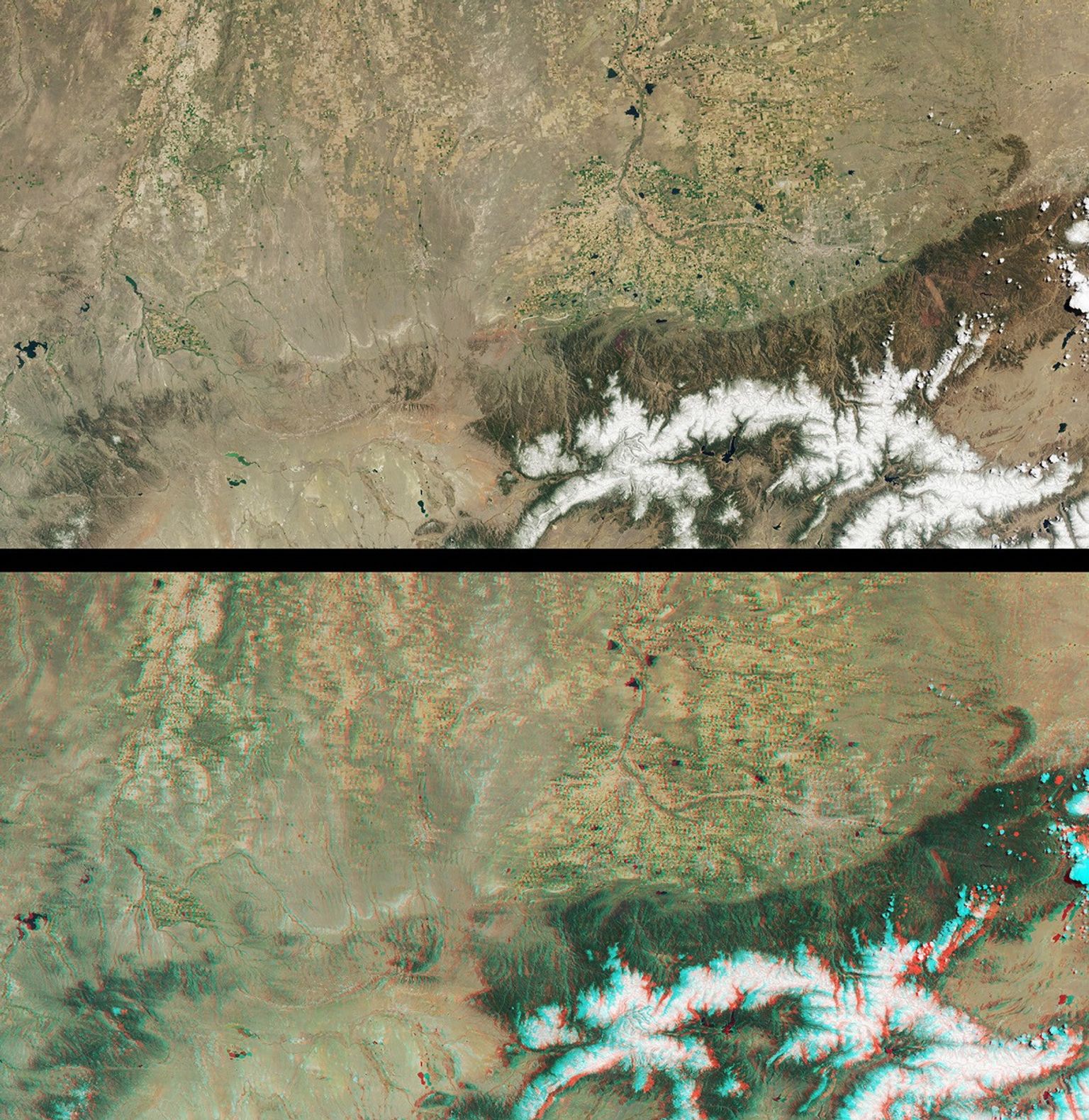
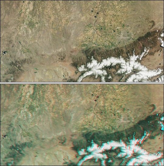
These Multi-angle Imaging Spectroradiometer (MISR) images from May 12,2001, includeportions of southern Wyoming, central Colorado, and western Nebraska.The top view is from the instrument's vertical-viewing (nadir) camera.The bottom image is a stereo "anaglyph" generated using data from thenadir and 46-degree-forward cameras. Viewing the anaglyph with red/blueglasses (red filter over your left eye) gives a 3-D effect. Tofacilitate stereo viewing, the images have been oriented with north atthe left. Each image measures 422 kilometers x 213 kilometers.
The South Platte River enters just to the right of center at the topof the images. It wends its way westward (down), then turns southward(right) where it flows through the city of Denver. Located at thewestern edge of the Great Plains, Denver is nicknamed the "Mile HighCity," a consequence of its 1609-meter (5280-foot) elevation above sealevel. It shows up in the imagery as a grayish patch surrounded bynumerous agricultural fields to the north and east. Denver is situatedjust east of the Front Range of the Rocky Mountains, located in thelower right of the images. The Rockies owe their present forms totectonic uplift and sculpting by millions of years of erosion. Scatteredcumulus clouds floating above the mountain peaks are visible in theseimages, and stand out most dramatically in the 3-D stereo view.
To the north of Denver, other urban areas included within theseimages are Boulder, Greeley, Longmont, and Fort Collins, Colorado;Cheyenne and Laramie, Wyoming; and Scottsbluff, Nebraska.
References & Resources
Image courtesy NASA/GSFC/LaRC/JPL, MISR Team.