Chapter 6: Electromagnetics
Page One | Page Two | Page Three | Page Four | Page Five | Page Six
The Doppler Effect
Regardless of the frequency of a source of electromagnetic waves, they are subject to the Doppler effect.
The effect was discovered by the Austrian mathematician and physicist Christian Doppler (1803-1853). It causes the observed frequency of any source (sound, radio, light, etc.) to differ from the radiated frequency of the source if there is motion that is increasing or decreasing the distance between the source and the observer.
The effect is readily observable as variation in the pitch of sound between a moving source and a stationary observer, or vice-versa.
Consider the following:
- When the distance between the source and receiver of electromagnetic waves remains constant, the frequency of the source and received wave forms is the same.
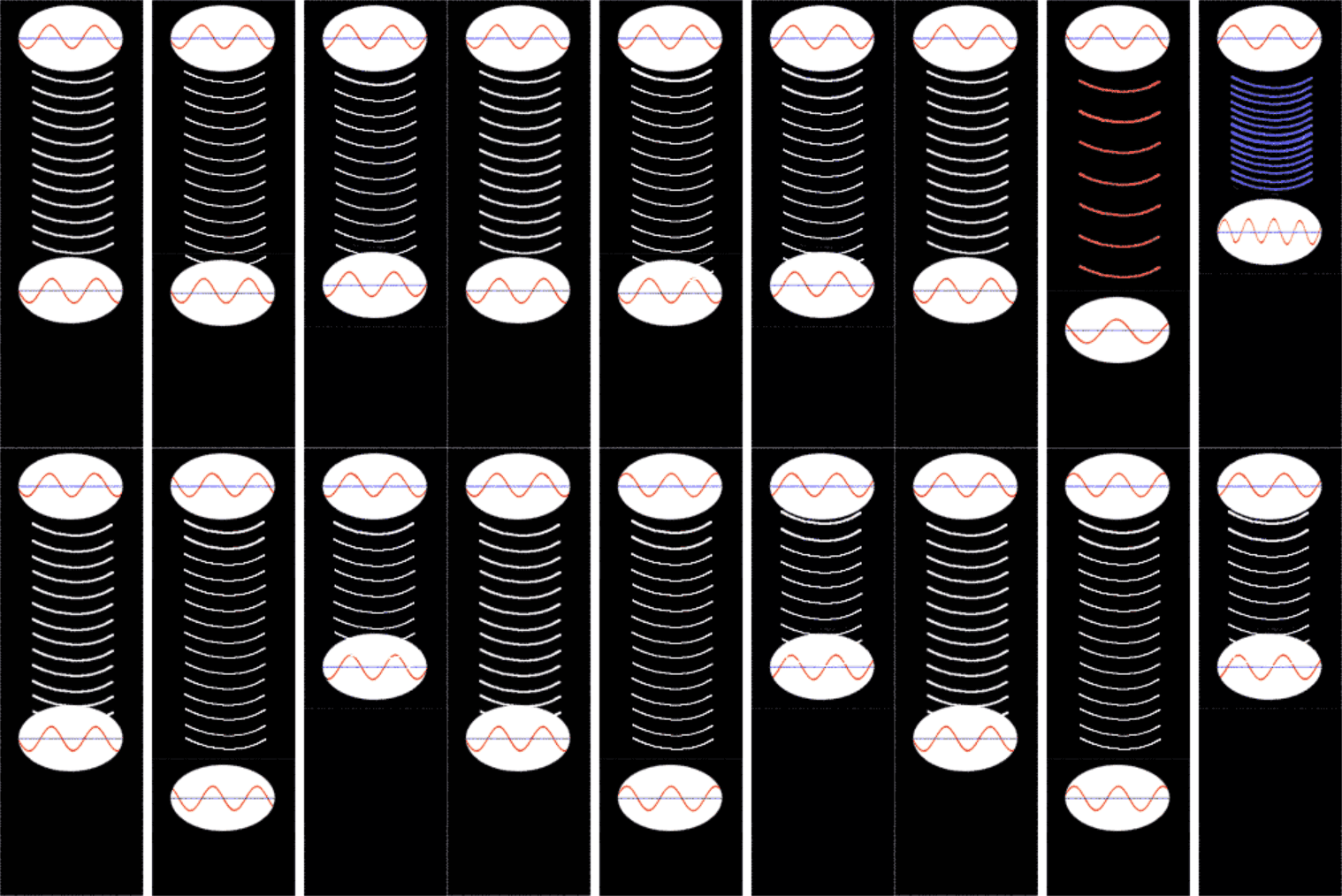
This is illustrated in the left hand panel. The waveform at the top represents the source, and the one at the bottom represents the received signal. Since the source and the receiver are not moving toward or away from each other, the received signal appears the same as the source.
- When the distance between the source and receiver of electromagnetic waves is increasing, the frequency of the received wave forms appears to be lower than the actual frequency of the source wave form. Each time the source has completed a wave, it has also moved farther away from the receiver, so the waves arrive less frequently.
- When the distance is decreasing, the frequency of the received wave form will be higher than the source wave form. Since the source is getting closer, the waves arrive more frequently.
There is a useful interactive graphic linked here. Cases 2 and 3 are illustrated in the center and right panels. Notice that when the receiver is in motion toward or away from the source, the waveform at the receiver (the lower waveform) changes. It only changes, though, while there is actual motion toward or away; when it stops, the received waveform appears the same as the source.
The Doppler effect is routinely measured in the frequency of the signals received by ground receiving stations when tracking spacecraft. The increasing or decreasing distances between the spacecraft and the ground station may be caused by a combination of the spacecraft's trajectory, its orbit around a planet, Earth's revolution about the Sun, and Earth's daily rotation on its axis. A spacecraft approaching Earth will add a positive frequency bias to the received signal. However, if it flies by Earth, the received Doppler bias will become zero as it passes Earth, and then become negative as the spacecraft moves away from Earth.
A spacecraft's revolutions around another planet such as Mars adds alternating positive and negative frequency biases to the received signal, as the spacecraft first moves toward and then away from Earth.
The Earth's daily rotation adds a positive frequency bias to the received signal as the spacecraft rises in the east at a particular tracking station, and it adds a negative frequency bias to the received signal as the spacecraft sets in the west.
The Earth's revolution about the Sun adds a positive frequency bias to the received signal during that portion of the year when the Earth is moving toward the spacecraft, and it adds a negative frequency bias during the part of the year when the Earth is moving away.
If two widely-separated tracking stations on Earth observe a single spacecraft in orbit about another planet, they will each have a slightly different view of the moving spacecraft, and there will be a slight difference in the amount of Doppler shift observed by each station. For example, if one station has a view exactly edge-on to the spacecraft's orbital plane, the other station would have a view slightly to one side of that plane. Information can be extracted from the differencing of the two received signals.
Data obtained from two stations in this way can be combined and interpreted to fully describe the spacecraft's arc through space in three dimensions, rather than just providing a single toward or away component. This data type, differenced Doppler, is a useful form of navigation data that can yield a very high degree of spatial resolution. It is further discussed in Chapter 13, Spacecraft Navigation.


