


2024 Solar Eclipse Interactive Map
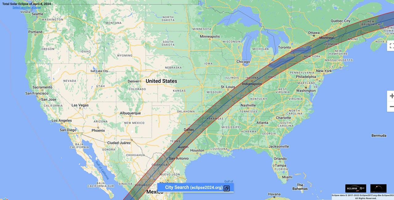
Interactive Map: 2024 Solar Eclipse Across the US
Eclipse2024.org
| Levels |
|
|---|---|
| Material Type |
|
| Heliophysics Big Ideas |
|
| NGSS |
|
| Heliophysics Topics |
|
| Material Cost per Learner | Free |
| Language | English |
Interactive Google map of the US allowing learners to observe the stages of the April 2024 total solar eclipse at different locations on the path of totality. Learners can select any location on the path to view data, including a simulation of what you would see at that location, a shadow map, the time, and the magnitude and obscuration of the Sun. Learners can adjust the speed and time of this simulation as they make observations about how the Sun and Moon move across the sky during a total solar eclipse.