


By Laura E.P. Rocchio
Eight months ago, on June 5, 2013, the U.S. Geological Survey decommissioned the venerable Landsat 5 satellite. That day, the USGS Landsat Flight Operations Team transmitted the last command to Landsat 5, effectively terminating the mission and leaving it in a disposal orbit.
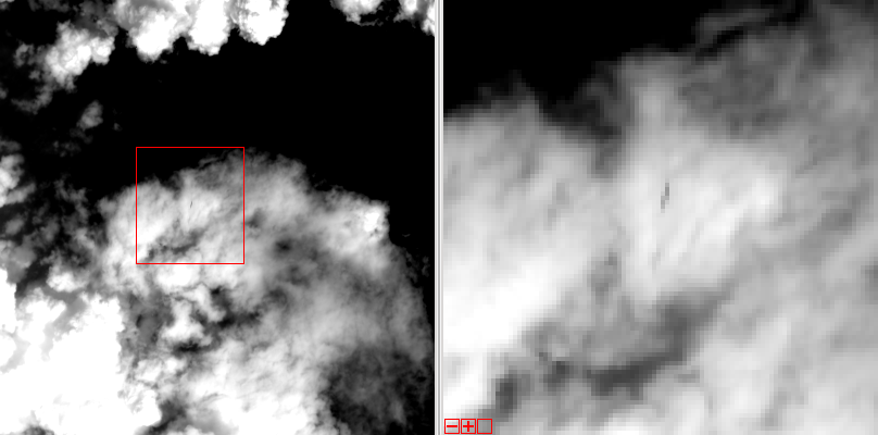
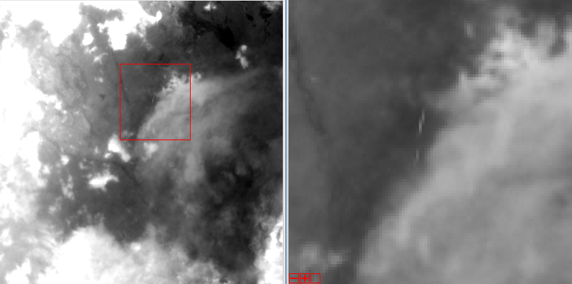
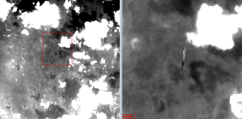
On November 22, 2013, Landsat 8 overflew the defunct Landsat 5 over northwestern Brazil (Path 233 Row 60). Thanks to some clever work by Mike Gartley, a Research Scientist with the Digital Imaging and Remote Sensing group at Rochester Institute of Technology (RIT)—a group that has long participated in Landsat calibration and validation—Landsat 5 was spotted in that Landsat 8 image.
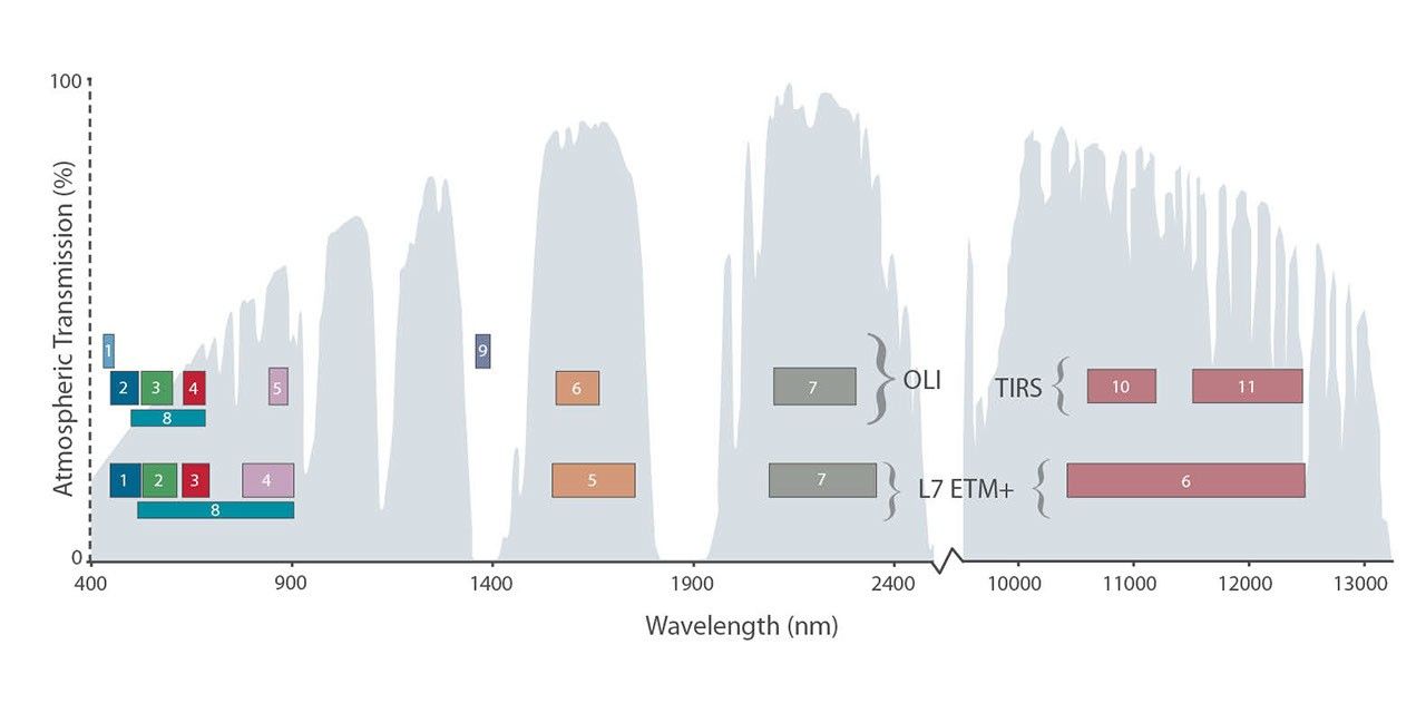
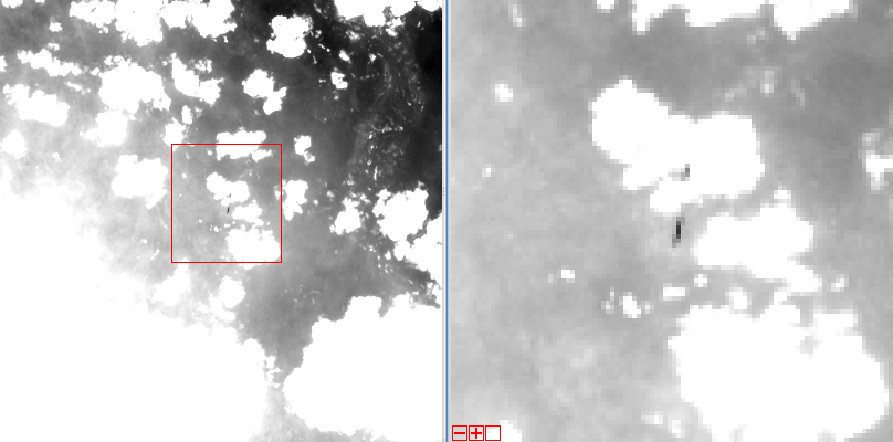
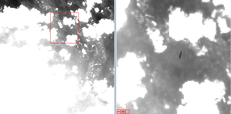
In the image, the Landsat 5 satellite is seen as a streak of pixels (dark or light depending on the spectral band). There is one image from each of Landsat 8’s OLI bands—except for Band 7, or SWIR-2, where she blended into the clouds and was impossible to distinguish. In these images Landsat 5 is much closer to Landsat 8 than she is to the Earth.
+ Landsat 5 in Landsat 8 band 1, coastal, or true-blue, band
+ Landsat 5 in Landsat 8 band 2, blue band
+ Landsat 5 in Landsat 8 band 3, green band
+ Landsat 5 in Landsat 8 band 4, red band
+ Landsat 5 in Landsat 8 band 5, NIR band
+ Landsat 5 in Landsat 8 band 6, SWIR-1 band
+ Landsat 5 in Landsat 8 band 8, panchromatic band
+ Landsat 5 in Landsat 8 band 9, cirrus band
Correction: An earlier version of this article erroneously stated that image was collected “this week,” it was actually acquired on Nov. 22, 2013.
Related Resources
- The Final Journey of Landsat 5: A Decommissioning Story
- How to Manage a Satellite Going 17K MPH
- Landsat 5 Sets Guinness World Record For ‘Longest Operating Earth Observation Satellite’


