Suggested Searches

3 min read

Landsat Abounds at #AGU16

By Laura E.P. Rocchio

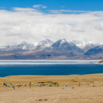
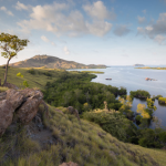
Over 375 presentations at this year’s AGU Fall meeting feature research conducted with the aid of Landsat data. The wide scope and interdisciplinary nature of Landsat data is reflected in the gamut of focus areas that Landsat-related papers and posters can be found: from cryosphere to biogeoscience to hydrology to global environmental change to natural hazards to informatics.

This year we were fortunate to have the opportunity to speak with over thirty scientists, researchers, and students who use Landsat in their studies, the resulting Q&A’s will be posted here throughout the week.

photo of icebergs

Reassessing Mass Balance in West Antarctica

photo of lake and grass

How Louisiana’s Coastal Marshes are Responding to Climate Change

photo of land near water

The Eroding Hamlet of Paulatuk

photo of agriculture

Watching Water Use in the Southwest

photo of snowy mountains

Dust on a Glacier

photo of grass and water

The Poleward March of Mangroves

photo of snowy mountains

The Mechanics of Glacier Motion

photo of arid area

Glacier Behavior in High Mountain Asia

photo of forest fire

How Fire Severity Impacts Soil Microbes

photo of icebergs

The Shifting Boundary Between Grounded Continental Ice and the Ocean in West Antarctica

photo of flooding

Mapping Historic Floods Around the World

photo of flooding

A Spatial Toolbox to Help Deal with Flooding in Vietnam

photo of plains with mountains in distance

A Bounty of New Lakes on the Tibetan Plateau

photo of lush woodland and water body

A New Fire Risk Indicator

photo of old house and road

45 Years of Ecosystem Carbon Storage Change Across the U.S.

photo of logging

Surveying Damage after Severe Weather Events

photo of glacier

Decline of the Last Glaciers in the Eastern Tropics

photo of snowy mountains reflected in water

A Glacierized Volcano in Peru & El Niño

photo of grazing animals

The 2015 Surge of Kelayayilake Glacier

photo of snowy mountains and woods

Mapping Snowmelt in the Arctic

photo of city lights

Mapping Cities Worldwide

photo of old trees

Springtime on a Urban Heat Island

photo of craggy rock features

A More Detailed Map for Forest Managers

photo of forest and snowy mountain

Fingerprinting Carbon Loss in Pacific Northwest Forests

photo of water reflecting sky

Watching Water Dynamics

photo of water

Environmental Flows: Managing Water in the Murray Darling Basin

photo of ducks in water

Tracking Water Resources in California’s Central Valley

photo of glacier

A New Way to Map Glaciers

photo of agriculture and snowy mountain

Extreme Event: 2012-2015 Snowpack Drought in the Sierra Nevada Mountains

photo of dense city

A Map for Preserving a Sustainable Society

photo of forester

How FastEmap is Helping Foresters

photo of water paths

The Secret Lives of Migrating Rivers

photo of bunny

Managing Brush on Western Rangelands

photo of hill with bushes

Managing Water in Conflict-Torn Regions

photo of agriculture

Mapping Croplands Over the U.S. High Plains Aquifer

map of coastline

Uncertainty at the Forest’s Edge

rendering of water bodies

Mapping Dissolved Organic Matter in Tropical Inland Waters with Landsat 8

photo of water and woods

Apalachicola’s Disappearing Swamp

photo of volcanic fissure

Creating a Volcanic Plume Elevation Model

Visit the 2016 AGU Fall Meeting website for more details, including the scientific program and virtual options.

More:

NASA at American Geophysical Union

Long days, fresh ideas, and new connections: USGS scientists sharing science at the 2016 AGU Fall Meeting