1 min read
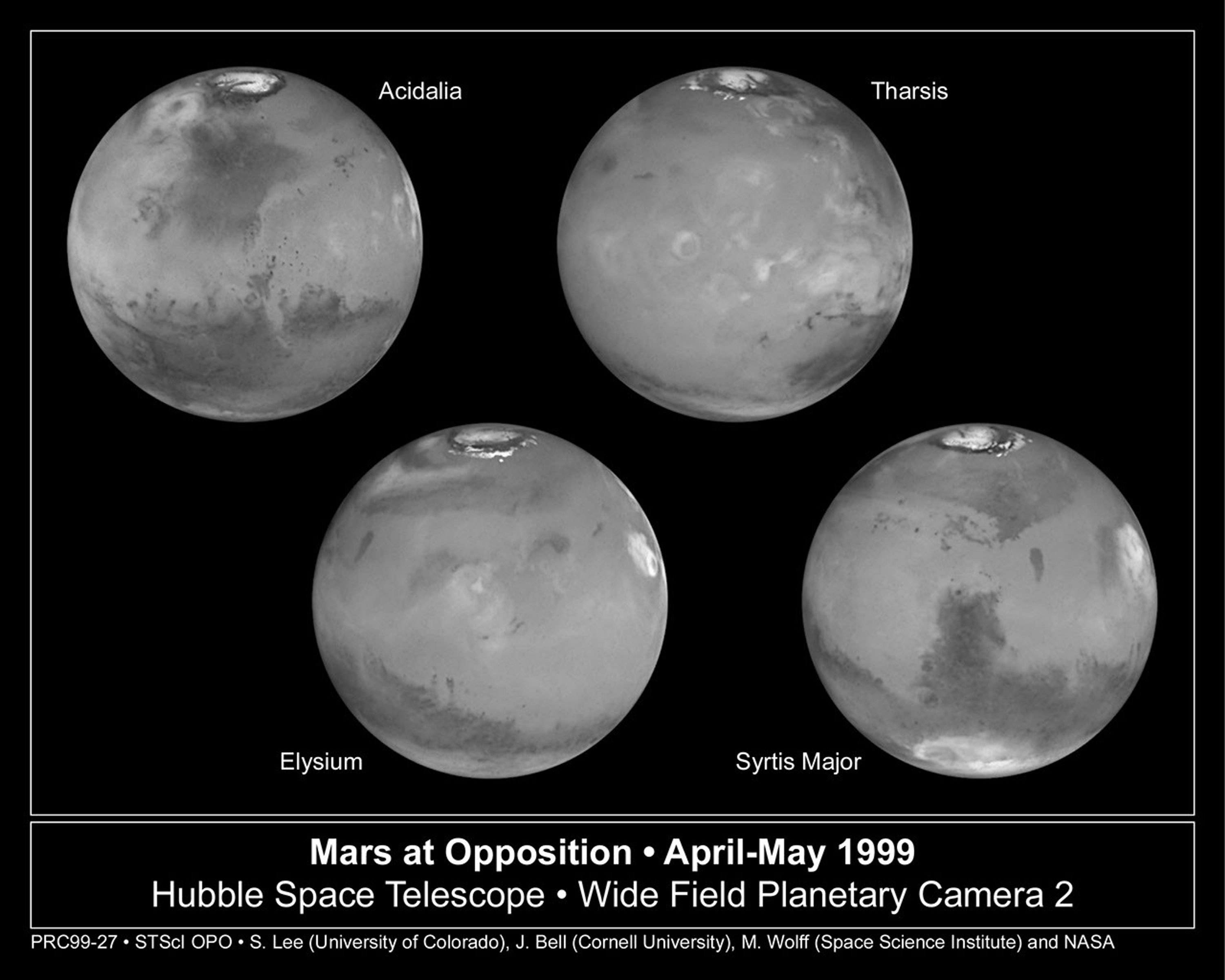
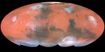
A Global Mars Map

- Object NameObject NameA name or catalog number that astronomers use to identify an astronomical object.Mars
- Release DateJune 30, 1999
- Science ReleaseA Closer Encounter with Mars
- CreditPhoto Credit: Steve Lee (University of Colorado), Jim Bell (Cornell University), Mike Wolff (Space Science Institute), and NASA
Related Images & Videos
Mars at 54 Million Miles (87 Million Km) From Earth
Taking advantage of Mars's closest approach to Earth in eight years, astronomers using NASA's Hubble Space Telescope have taken the space-based observatory's sharpest views yet of the Red Planet. NASA is releasing these images to commemorate the second anniversary of the Mars...
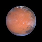
Mars Image Centered Near Location of Pathfinder Landing Site
This image is centered near the location of the Pathfinder landing site. Dark sand dunes that surround the polar cap merge into a large, dark region called Acidalia. This area, as shown by images from the Hubble telescope and other spacecraft, is composed of dark, sand-sized...
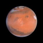
Mars' Tharsis Region, Home of the Solar System's Largest Volcanoes
This image is centered on the region of the planet known as Tharsis, home of the largest volcanoes in the solar system. The bright, ring-like feature just to the left of center is the volcano Olympus Mons, which is more than 340 miles (550 kilometers) across and 17 miles (27...
Mars' Volcanic Elysium Region
This image is centered near another volcanic region known as Elysium. This area shows many small, dark markings that have been observed by the Hubble telescope and other spacecraft to change as a result of the movement of sand and dust across the Martian surface. In the upper...
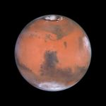
Mars' Syrtis Major Region and Hellas Impact Crater
This image is centered on the dark feature known as Syrtis Major, first seen telescopically by the astronomer Christiaan Huygens in the 17th century. Many small, dark, circular impact craters can be seen in this region, attesting to the Hubble telescope's ability to reveal fine...
Share
Details
Claire Andreoli
NASA’s Goddard Space Flight Center
Greenbelt, Maryland
claire.andreoli@nasa.gov