1 min read
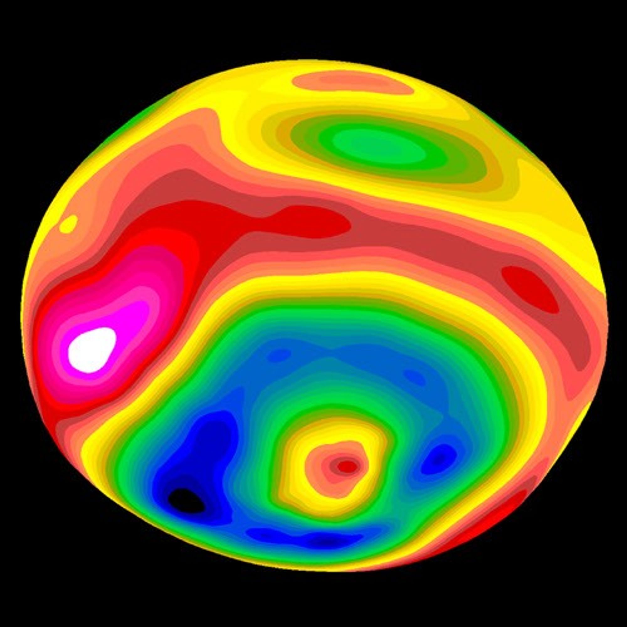
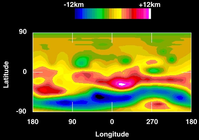
Color-encoded Elevation Map of Vesta
- Object NameObject NameA name or catalog number that astronomers use to identify an astronomical object.Vesta
- Release DateSeptember 4, 1997
- Science ReleaseHubble Reveals Huge Crater on the Surface of the Asteroid Vesta
- CreditBen Zellner (Georgia Southern University), Peter Thomas (Cornell University) and NASA
Related Images & Videos
Hubble Reveals Huge Crater on the Surface of the Asteroid Vesta
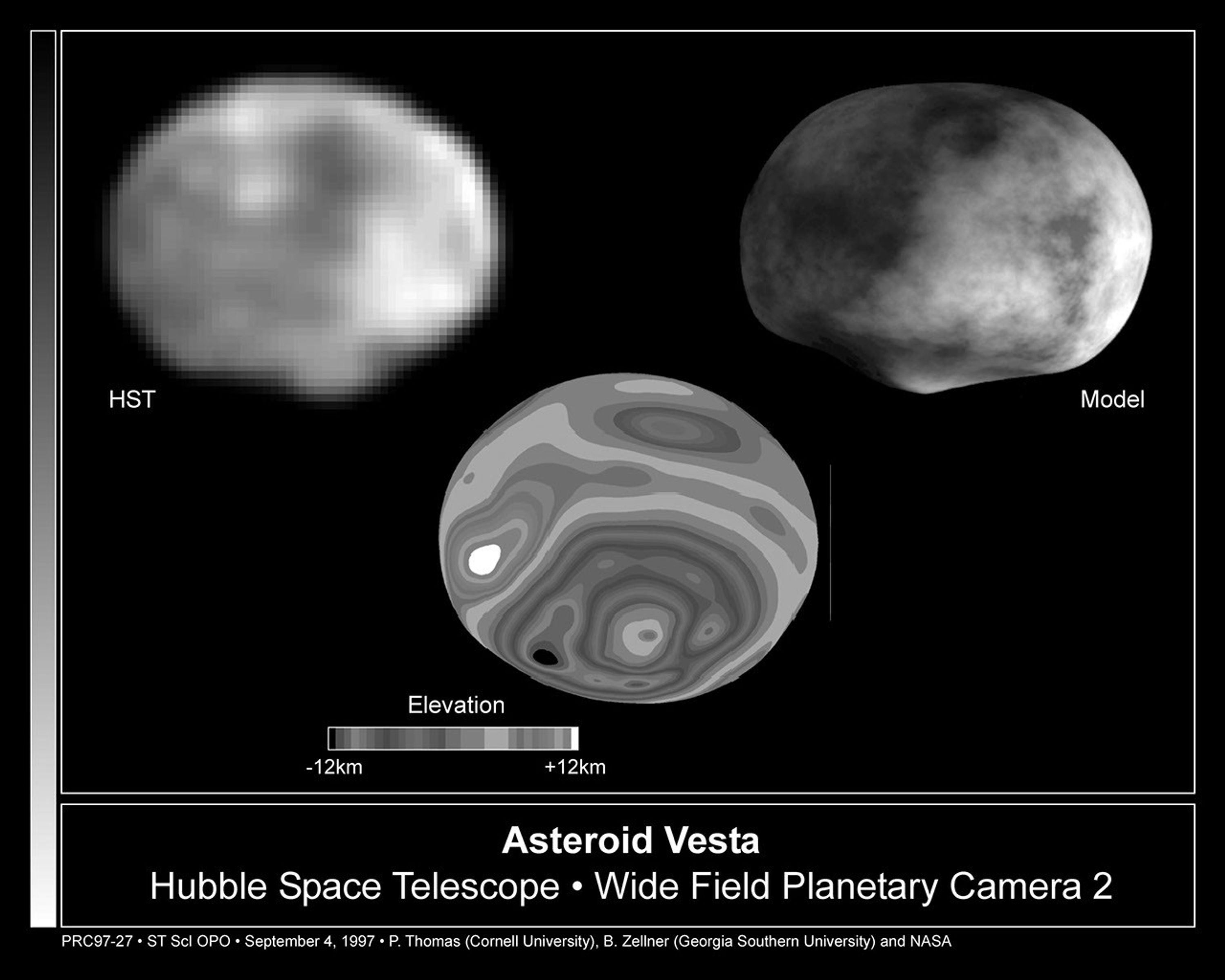
[left] A NASA Hubble Space Telescope image of the asteroid Vesta, taken in May 1996 when the asteroid was 110 million miles from Earth. The asymmetry of the asteroid and "nub" and the south pole is suggestive that it suffered a large impact event. The image was digitally...
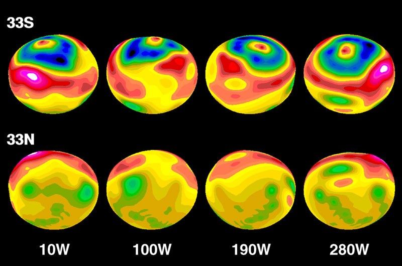
Topographic Map of Vesta's Surface Modeled onto Elliptical Shape
A false-color topographic map, projected onto a model having Vesta's elliptical shape. A circular impact crater, with central peak, clearly dominates the southern hemisphere. The model has bee rotated at 90 degree intervals. The map is based on photo-analysis of Hubble Space...


Computer Model of the Asteroid Vesta
A 3-D computer model of the asteroid Vesta synthesized from Hubble topographic data. The crater's 8-mile high central peak can clearly be seen near the pole. The surface texture on the model is artificial, and is not representative of the true brightness variations on the...
Share
Details
Claire Andreoli
NASA’s Goddard Space Flight Center
Greenbelt, Maryland
claire.andreoli@nasa.gov