1 min read
Photo-Mapped Pluto Globe
- Release DateFebruary 4, 2010
- Science ReleaseHubble Maps of Pluto Show Surface Changes
- Credit
Related Images & Videos
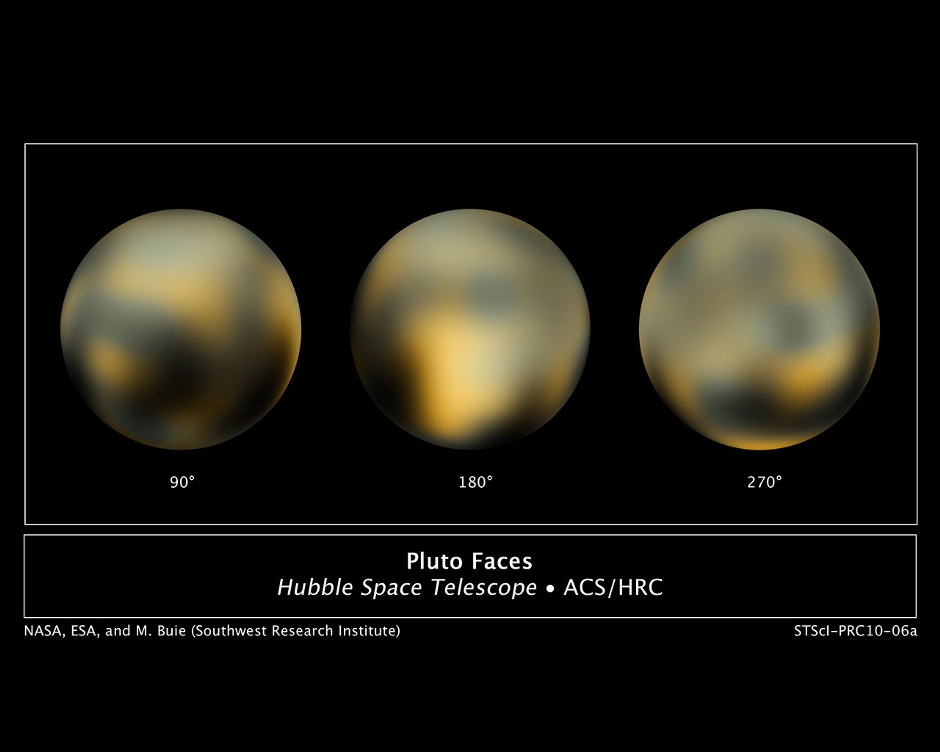
The Changing Faces of Pluto
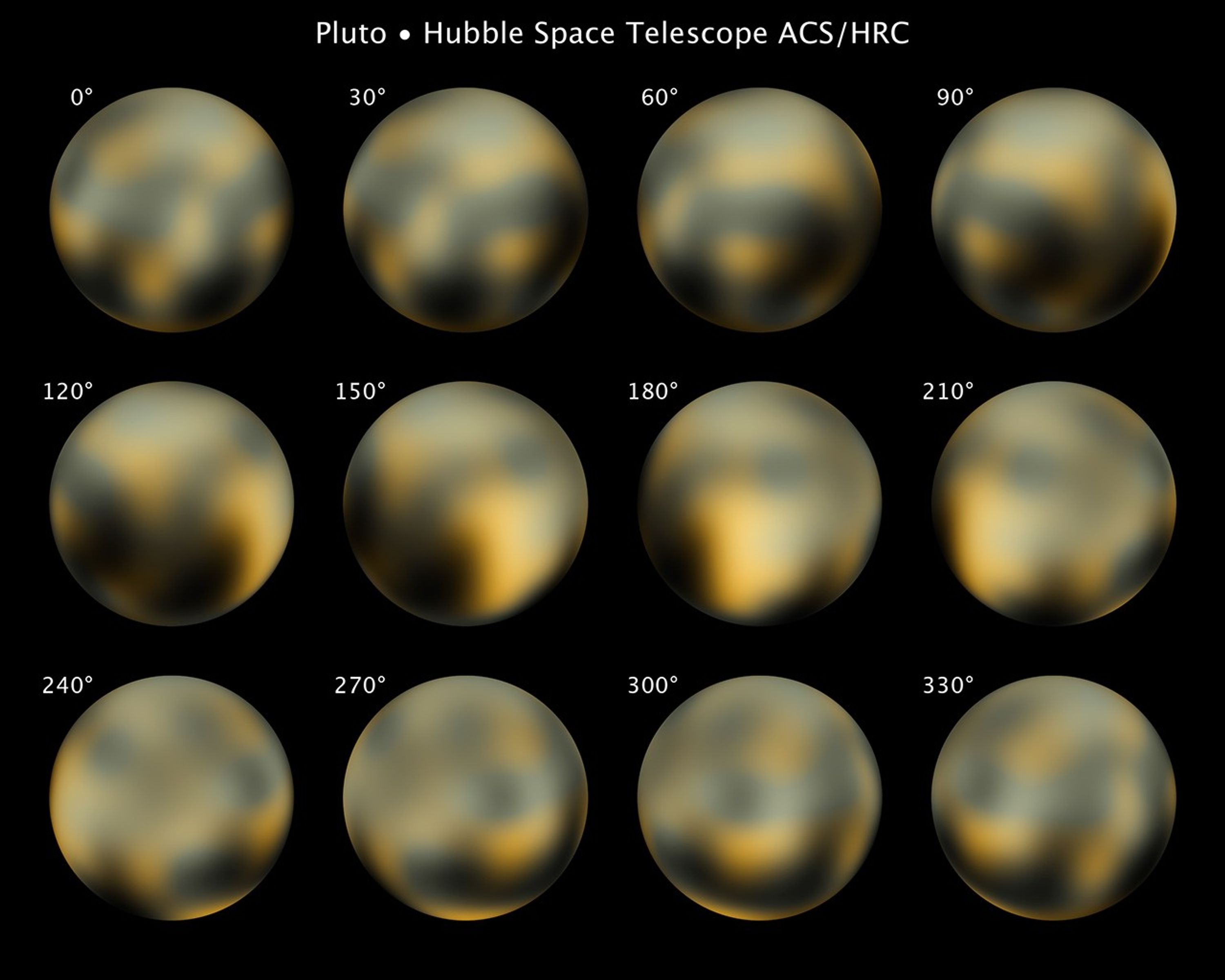
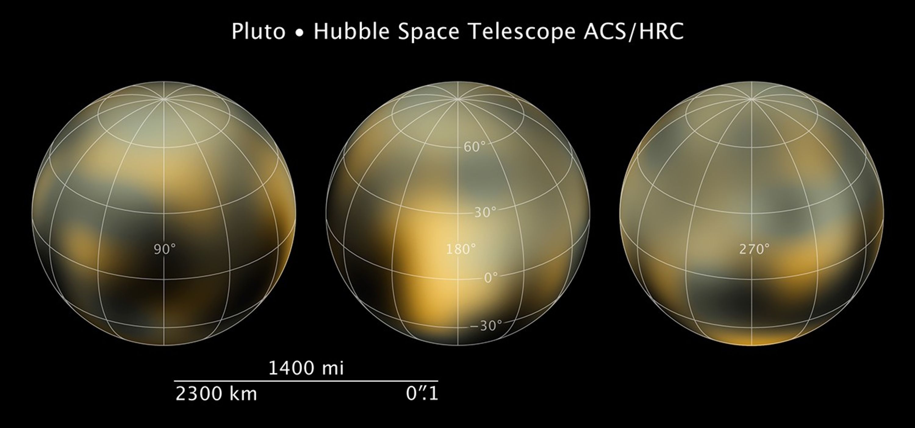
This is the most detailed view to date of the entire surface of the dwarf planet Pluto, as constructed from multiple NASA Hubble Space Telescope photographs taken from 2002 to 2003. Hubble's view isn't sharp enough to see craters or mountains, if they exist on the surface, but...


Hubble Maps Pluto's Changing Surface
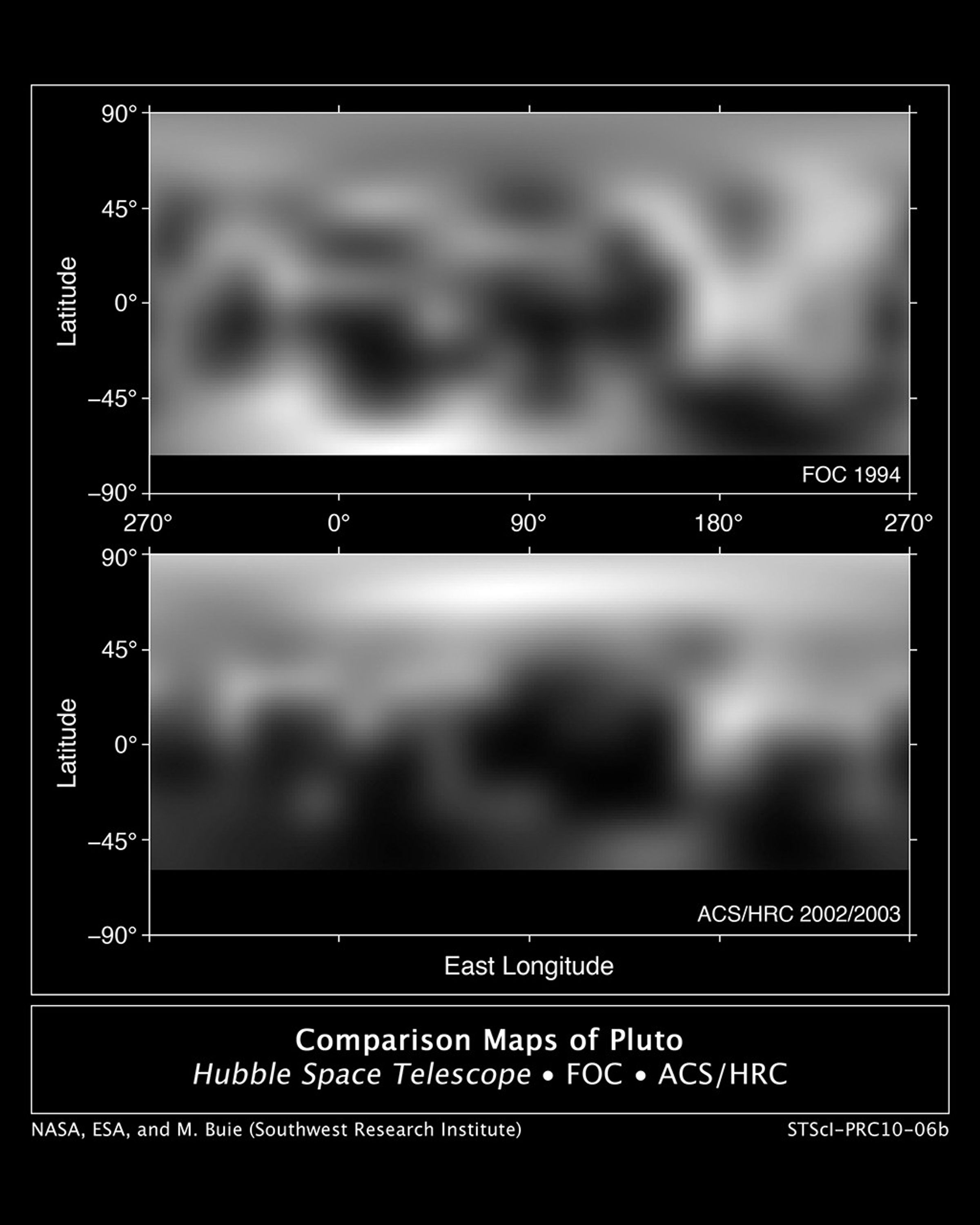
These are two Hubble photo maps of the dwarf planet Pluto, as seen in 1994 and 2002-2003. Hubble's view isn't sharp enough to see craters or mountains, if they exist on the surface, but Hubble does reveal a complex-looking and variegated world with white and charcoal-black...


Hubble's Full Photomap of Pluto
This is the most detailed view to date of the entire surface of the dwarf planet Pluto, as constructed from multiple NASA Hubble Space Telescope photographs taken from 2002 to 2003. NASA's New Horizons space probe, now halfway to Pluto, will get sharper images of Pluto when it...

Hubble Reveals Pluto's Changing Surface
This video describes how NASA's Hubble Space Telescope has provided increasingly better pictures of Pluto since the telescope's launch into Earth orbit in 1990. Since its discovery in 1930, Pluto has been a speck of light in the largest ground-based telescopes. But the Hubble...
Share
Details
Claire Andreoli
NASA’s Goddard Space Flight Center
Greenbelt, Maryland
claire.andreoli@nasa.gov