





























NASA Releases Landsat 10 Spacecraft Request for Proposal
July 17, 2026
The Landsat 10 Spacecraft Request for Proposal (RFP) is available for review via SAM.gov as of July 14, 2026. Proposals are due August 13, 2026 at 1:00 PM EDT.
The final RFP incorporates several updates from the draft version, including further definition in instrument accommodations, mission assurance implementation, mission readiness execution, spacecraft design, observatory level testing, and better alignment with commercial procurement. The RFP also introduces a $1 million incentive for early delivery of the spacecraft. The anticipated contract award and effective date is December 30, 2026, with a period of performance extending through a Launch Readiness Date of no later than December 2031, plus 100 days of nominal commissioning activities. The scope of the contract includes development, integration, testing, delivery of the spacecraft and support through launch and activation activities for the Landsat 10 Observatory.
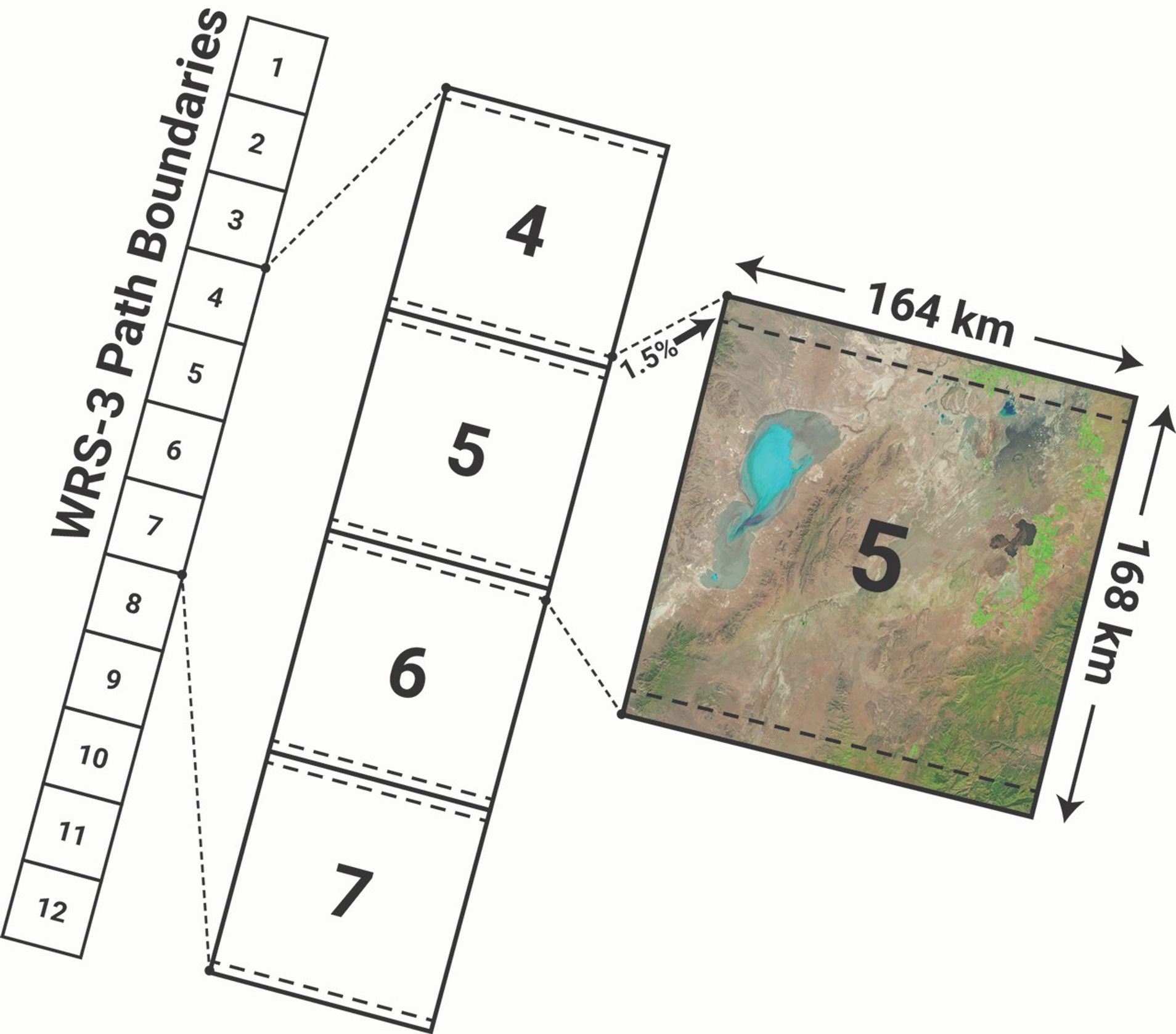
The spacecraft will fly in a sun-synchronous orbit at a 653 km altitude—slightly lower than previous missions—with a global revisit time of 18 days to meet stringent signal-to-noise ratio requirements of the Landsat record. To accommodate this new orbit, Landsat 10 will use a new Worldwide Reference System called WRS-3 as a method to acquire, index, and catalog Landsat 10 scenes. Landsat 10 is a Category 2, Class C mission with a design life of 5 years and will include a single integrated suite of sensors called LandIS (the Landsat Instrument Suite).
Under the Sustainable Land Imaging (SLI) Program, Landsat 10 will continue the long-running partnership between NASA and the USGS by acquiring high-quality, space-borne, medium-resolution global land imaging data. The mission provides key improvements in spatial and spectral capabilities that will allow Landsat 10 to capture land features and trends that could not be detected by previous Landsat missions, while maintaining continuity with the program’s invaluable half-century data record.
Landsat 10 will launch no later than 2031 and continue the Landsat legacy as the longest space-based record of Earth’s land surface.
Explore More

Heavy rains since mid-September have caused widespread flooding that has affected millions of people across the country.
Drought and an ailing aquifer were major topics of conversation when NASA scientists visited with farmers in the Texas High…
Dissolved organic matter and suspended sediment mingle in the southernmost extent of James Bay.