


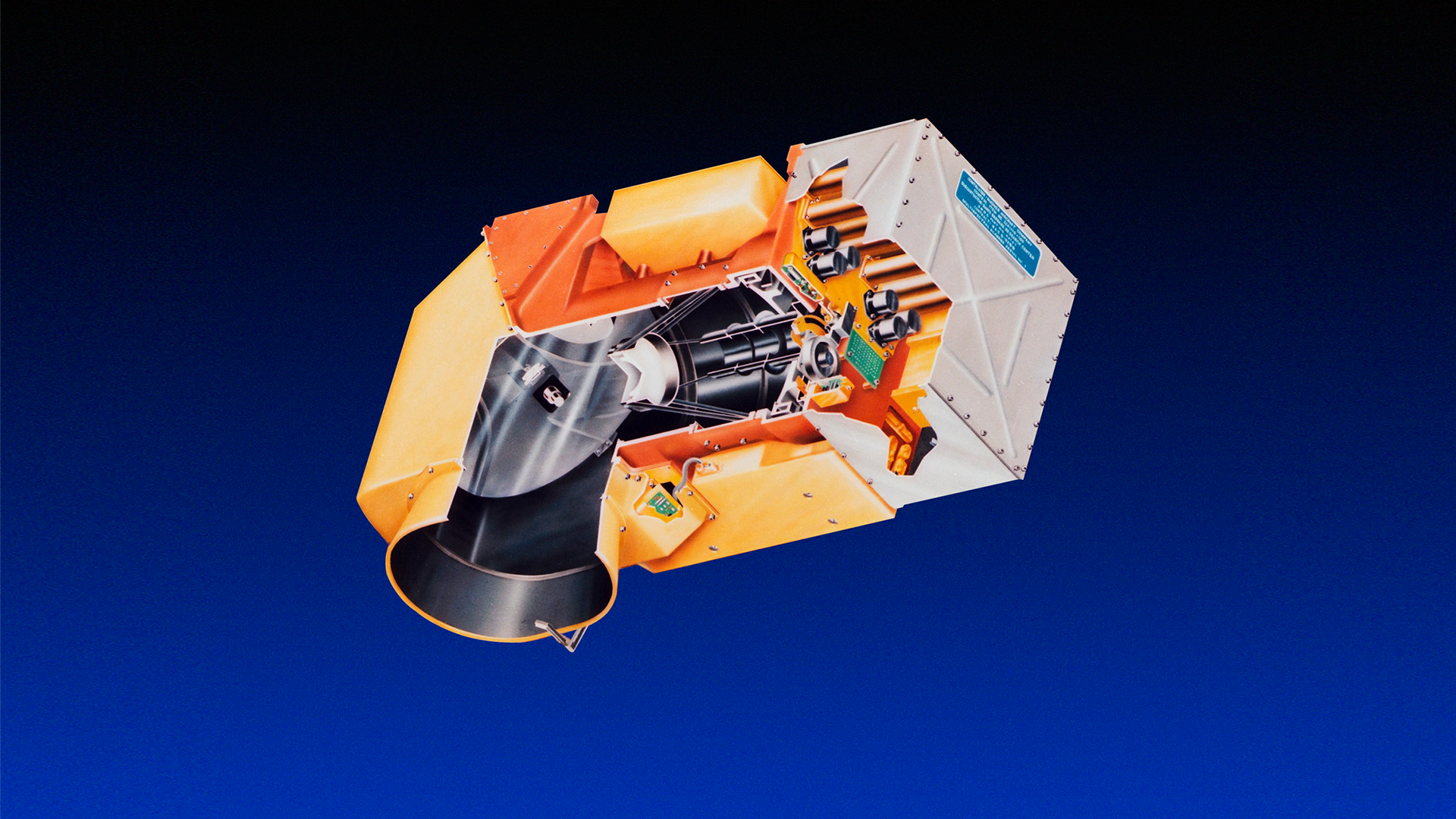
Landsat 3
Landsat 3, working alongside Landsat 2, ensured data continuity while introducing new capabilities: thermal imaging and improved RBV spatial resolution. Though it faced recurring technical issues, the mission sustained a growing user community and upheld the operational integrity of the Landsat program.
Mission Objective
Partners
Launched
decommissioned
| Quick Facts | |
|---|---|
| Sensors: RBV, MSS | Spatial Resolution: 80 m |
| Spectral Resolution: 5 bands | Temporal Resolution: 18 days |
| Radiometric Resolution: 6-bit, processed to 8-bit | Image Data: 70 scenes/day |
| Scene size: 170 km (106 mi) x 185 km (115 mi) | Swath Width: 185 km (115 mi) |
| Global Reference Grid System: WRS-1 | Altitude: 917 km (570 mi) |
| Inclination: 99.2° | Orbit: Polar, sun-synchronous |
| Equatorial Crossing Time: Nominally 9:42 AM mean local time (descending node) | Period of Revolution: 103 minutes; ~14 orbits/day |
| Design Life: 1 year |
Overview
Landsat 3, launched on March 5, 1978, extended the program during a critical period of transition. Originally, the Landsat program was envisioned to span just two satellites, but results from over 300 investigations affirmed the value of Landsat data for scientific, commercial, and governmental applications. NASA decided to embark on a third mission to maintain a continuous data record of Earth’s land surface and experiment with technological improvements.
Landsat 3 carried the same sensors as its predecessors: the Return Beam Vidicon (RBV) and the Multispectral Scanner (MSS). The RBV had an improved 38-meter spatial resolution. The MSS collected data in the same four spectral bands and added a fifth thermal band. Though the thermal band failed shortly after launch, it demonstrated the usefulness of remotely sensed thermal data.
Because it was made largely of lower quality parts left over from Landsats 1 and 2, Landsat 3 faced persistent technical issues: recurring scanning delays on the MSS and contamination in the thermal cooler which led to the failure of the thermal band. However, it served as a critical bridge that ensured data continuity while Landsat scientists and engineers developed the next generation of the program.
On September 7, 1983, Landsat 3 was decommissioned.
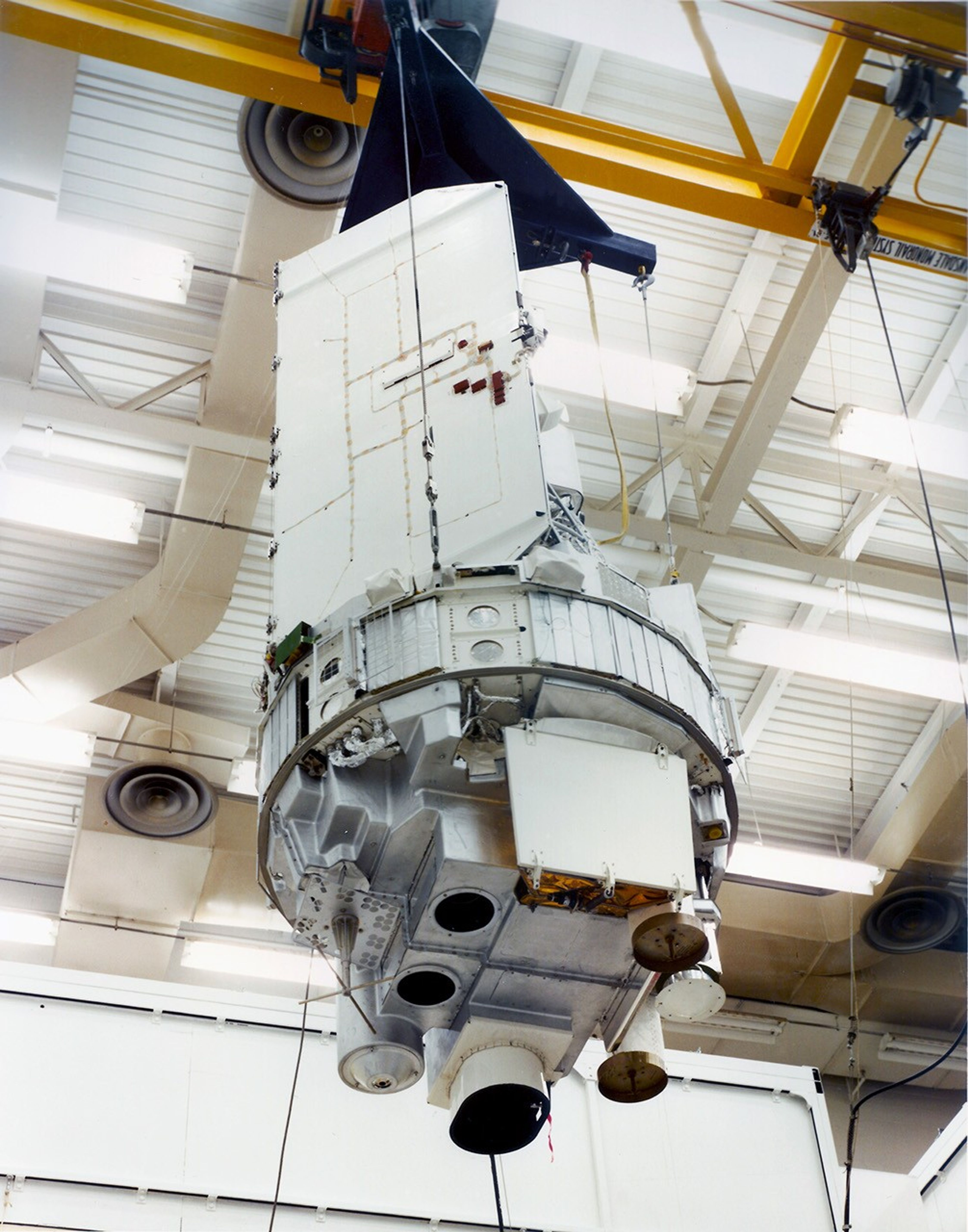
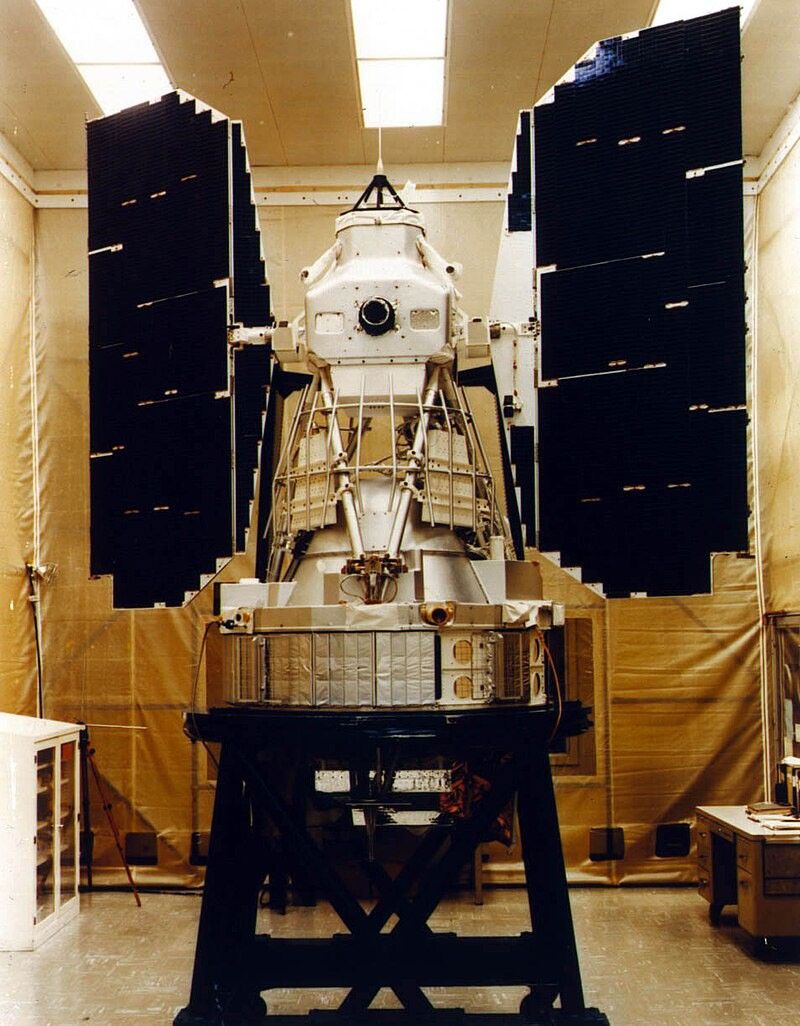
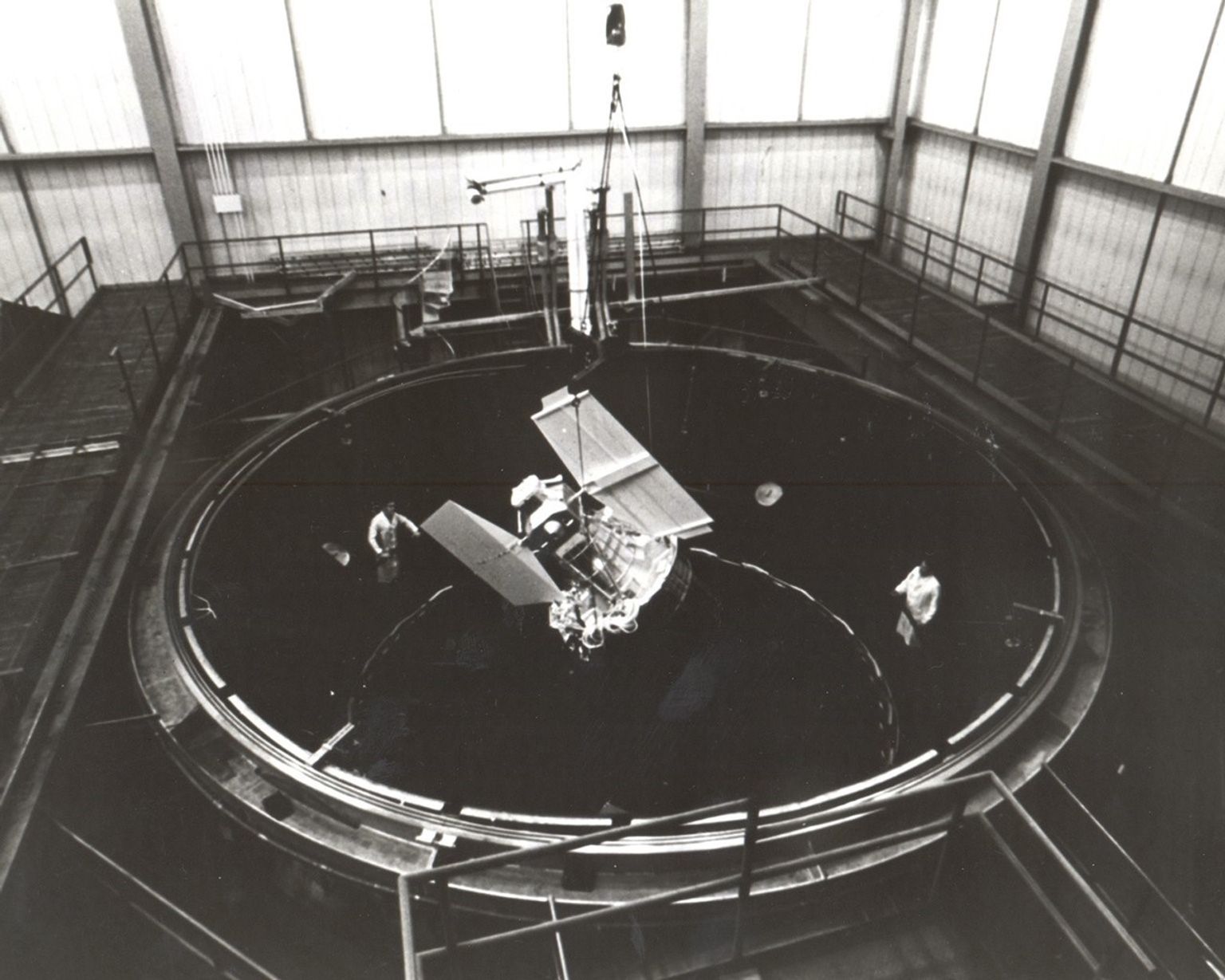
Spacecraft
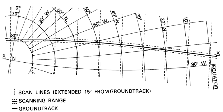
Landsat 3 was launched into Landsat 1’s orbit in order to maintain nine-day repeat coverage with Landsat 2. It carried the same two instruments as its predecessors: the Multispectral Scanner System (MSS) and the Return Beam Vidicon (RBV).

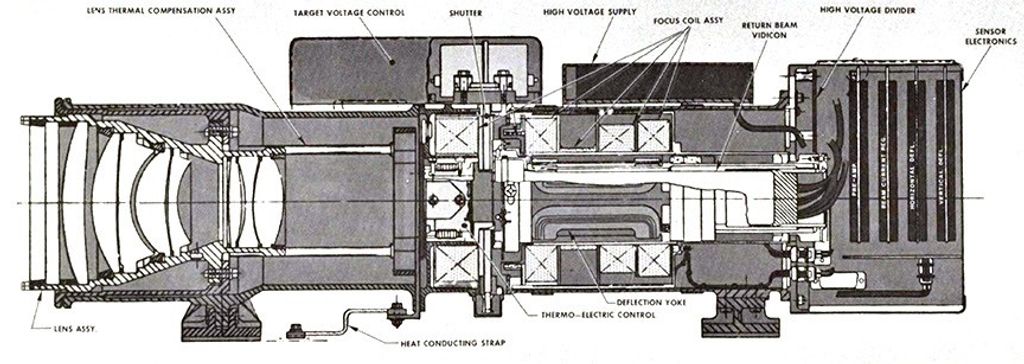
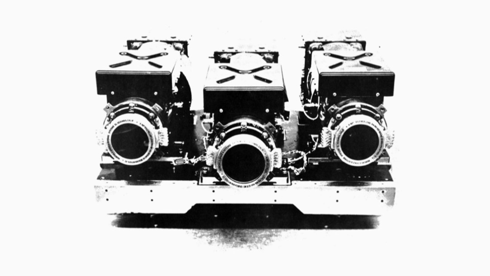
Return Beam Vidicon (RBV)
Landsat 3’s RBV system had improved 38-meter spatial resolution for a single panchromatic band. Two cameras imaged in one unnumbered broad spectral band (green to near-infrared; 0.505 – 0.750 µm), whereas its predecessors on Landsats 1-2 imaged in three separate bands (green, red, infrared).
Despite its finer spatial resolution than the MSS, RBV data had coarser radiometric resolution and more system noise making the data less suitable for digital image analysis.
Data were recorded on 70 mm black and white film rolls. In September 1980, analog RBV data were digitized before transmission to EDC, marking an advancement in data processing.
Green to near-infrared (0.505 – 0.575 µm)
Spatial resolution: 40 m
Data: 3.5 MHz FM video
Multispectral Scanner System (MSS)
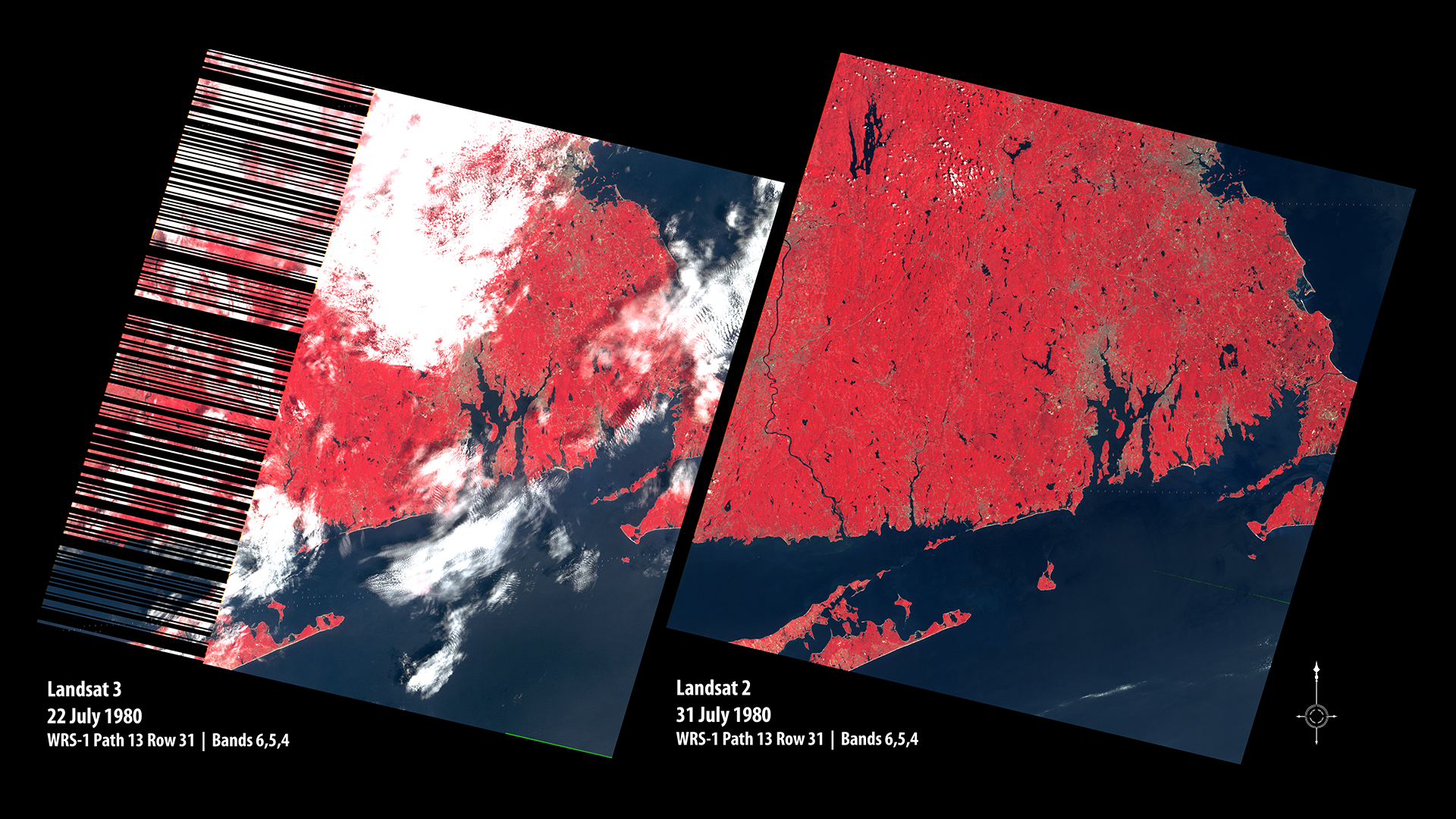
Landsat 3 introduced a fifth band designed to detect thermal-infrared energy emitted from the Earth's surface, expanding the sensor’s scientific utility. However, hardware quality issues resulted in scanning delays, causing up to 30% data loss on the western edges of scenes. A major data glitch beginning in December 1980 halted MSS operations until March 1981, when it resumed inexplicably.
Band 4: Green (0.5 – 0.6µm)
Band 5: Red (0.6 – 0.7µm)
Band 6: Near-Infrared (0.7 – 0.8µm)
Band 7: Near-Infrared (0.8 – 1.1µm)
Band 8: Thermal-infrared (10.4 – 12.6µm)
Spatial Resolution: 80 m (commonly resampled to 60 m)
Ground Sampling Interval (pixel size): 57 x 79 m
Scene size: 170 km x 185 km (106 mi x 115 mi)
March 7, 1978
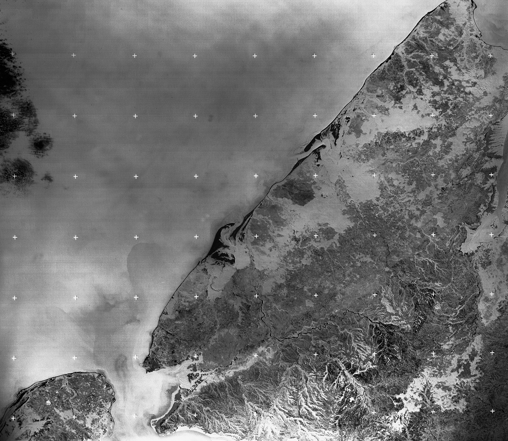
First Light
Northern California
Landsat 3’s first light image of the Santa Clara Valley south of San Francisco Bay and Monterey Bay showcases dramatic urbanization from Silicon Valley's explosive 1970s growth. Subtle linear features visible along the San Andreas fault demonstrate Landsat's ability to detect crustal fault lines, enhancing fault mapping and earthquake hazard assessment.
Learn More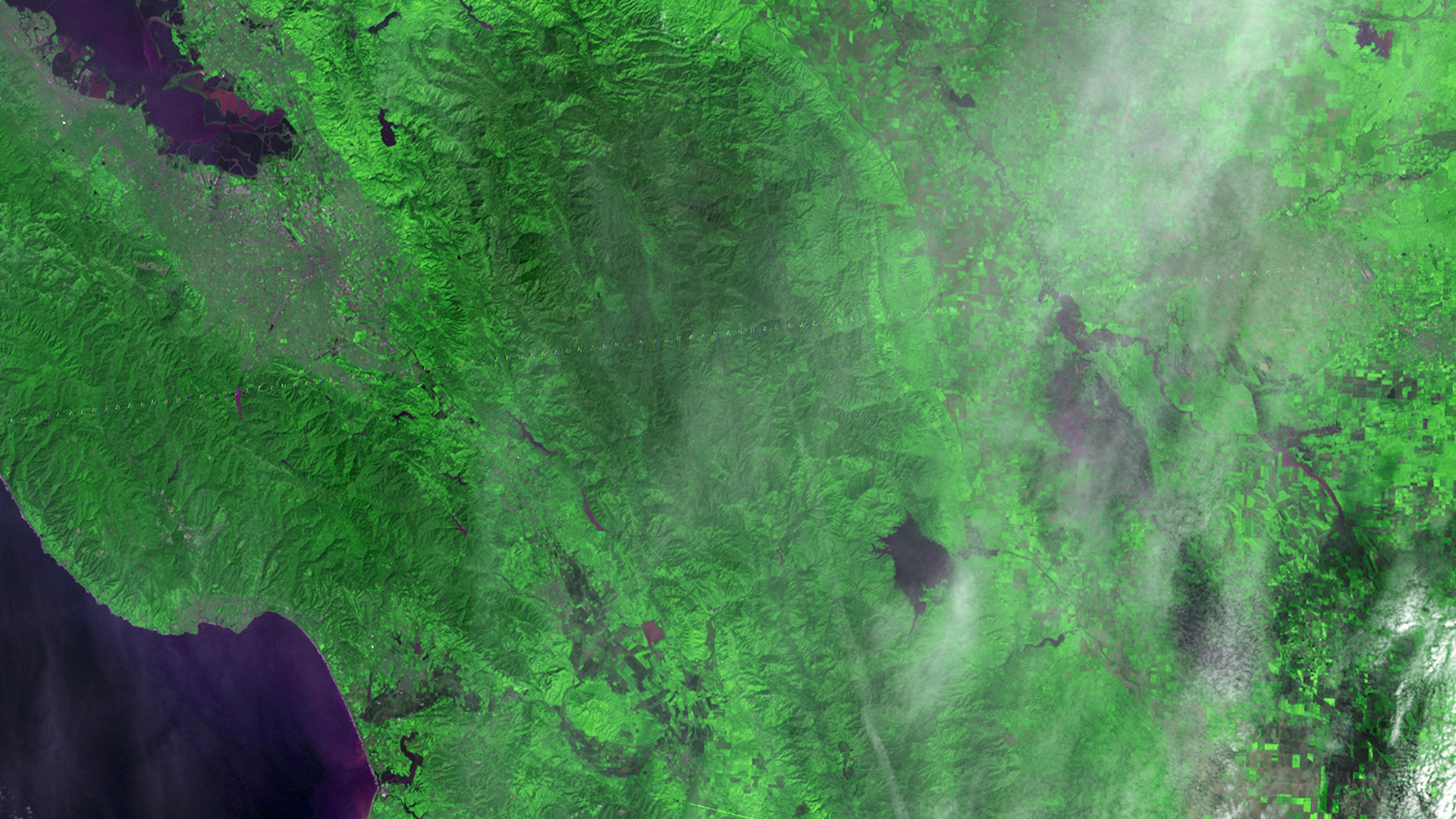
Mission Objectives
-
Technology Demonstration
Improve sensors, including adding a fifth MSS band to sense thermal-infrared wavelengths and an enhanced RBV camera with 40-meter resolution (improved from 80 meters).
-
Program Continuity
Provide continuous data with previous Landsat missions for the growing user community.
-
Bridge Missions
Serve as a transitional satellite between Landsats 1 and 2 and the next generation of Landsat satellites.

Mission Results
-
Data Collection
By the time Landsat 3 was put into a non-recoverable mode on September 7, 1983, it had collected 324,655 MSS scenes, however, they all did not make it into the archive. The USGS EROS archive now holds 156,073 MSS scenes from Landsat 3’s five-year lifespan.
Landsat 3 debuted the first thermal infrared band on a civilian Earth observation satellite—a technological milestone that paved the way for later thermal sensors.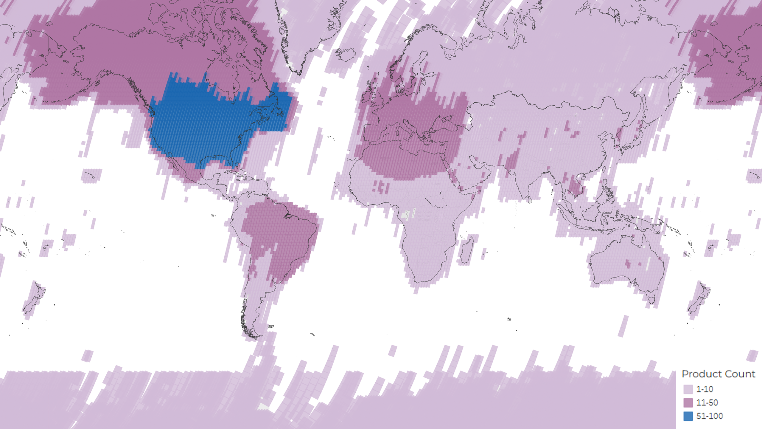 A density map showing the distribution of the total 156,073 MSS scenes acquired and archived during the lifetime of the Landsat 3 mission. The colors represent the number of products per Path/Row.USGS
 -
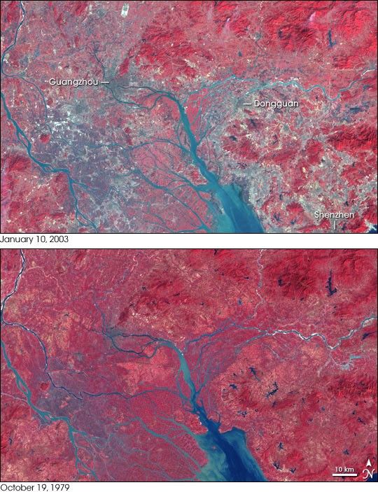
New and Enhanced Applications
Landsat 3 advanced Earth science by providing thermal data and improved panchromatic imaging. It was used for environmental monitoring, urban studies, and geological exploration.
Its MSS imagery helped define and refine spectral vegetation indices (SVIs), which are now standard tools for understanding crop health, biomass, and land surface processes.
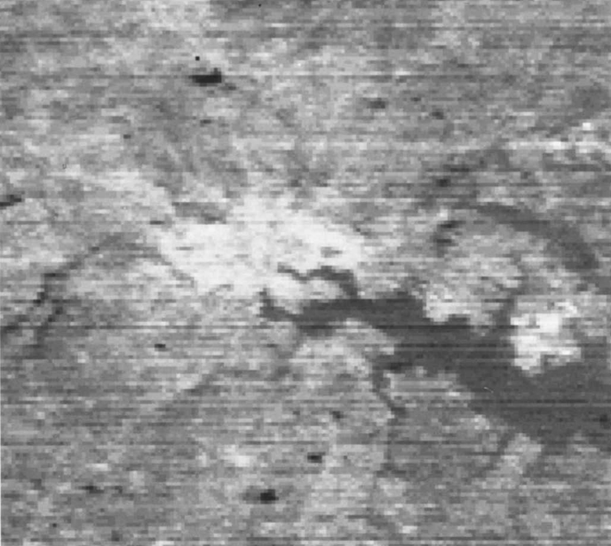
The high-resolution RBV images supported detailed mapping in Arctic regions, glacial environments, and urban areas.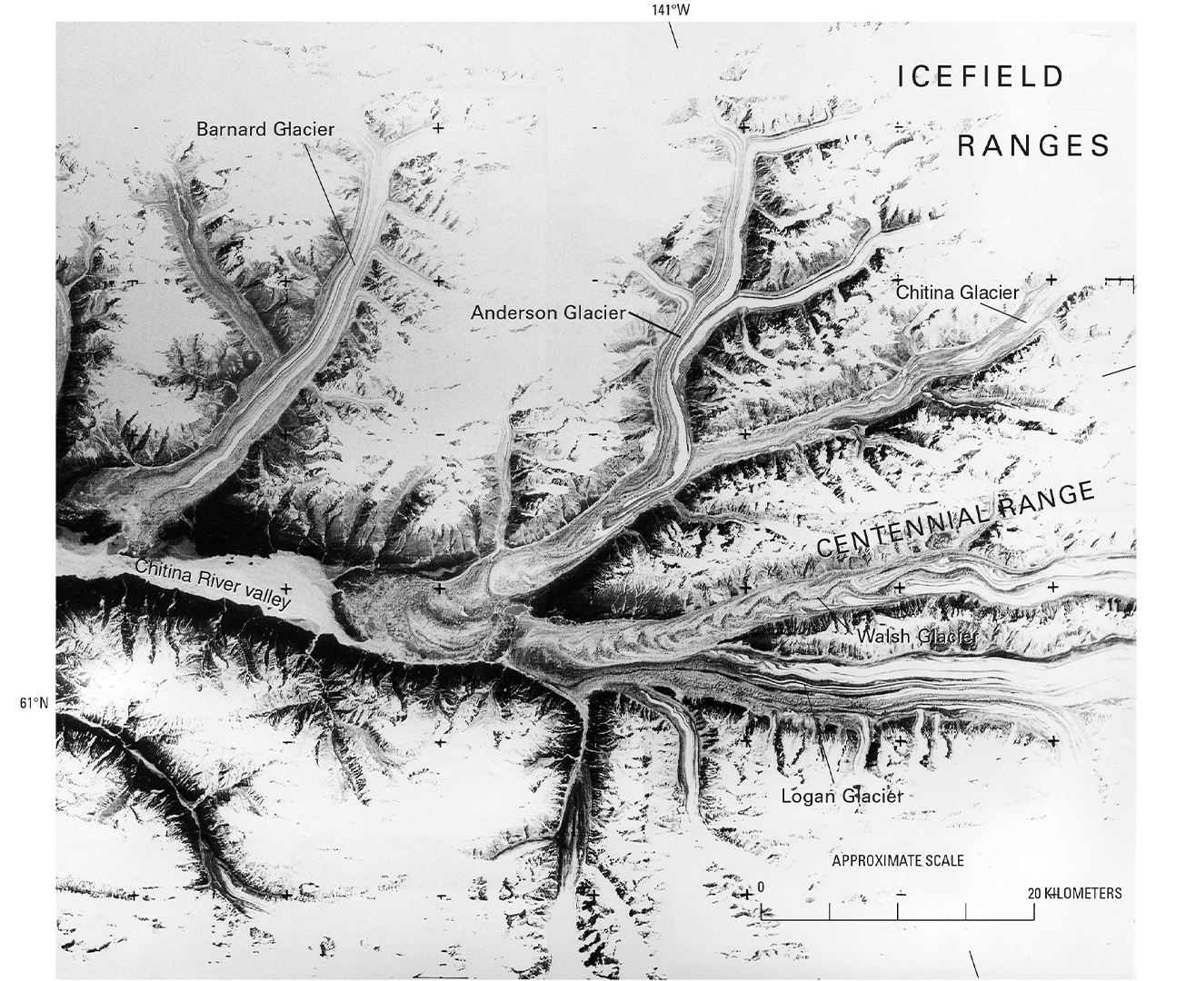 Part of a 40-meter panchromatic return beam vidicon (RBV) image (annotated) from Landsat 3, acquired on 5 July 1980 (WRS-1 Path 68 Row 17, subscene C), showing glaciers in Alaska’s Chitina River Valley near the Canadian border. Note the RBV réseau marks (small crosses) imbedded in the image.USGS
Legacy
-
Improving Global Crop Inventories
The Agriculture and Resources Inventory Surveys Through Aerospace Remote Sensing (AgRISTARS) project was created in 1979 to continue the work of the Large Area Crop Inventory Experiment (LACIE). Led by the USDA with support from NASA and other federal partners, it expanded the use of Landsat data to monitor a wider range of crops such as corn and soybeans and incorporated advanced automatic crop identification methods over large geographic areas.
AgRISTARS contributed to the Foreign Agricultural Service (FAS) global crop commodity forecasts which are still produced today. The project also generated two research paths: one highlighted the need for higher spatial and spectral resolution to improve land analyses. The other favored higher temporal resolution, specifically that of NOAA’s Advanced Very High Resolution Radiometer (AVHRR), for more frequent assessment of changing crop conditions.
Project and Program Management
James C. Welch
Program Manager,
NASA Headquarters
Stanley C. Freden
Project Scientist,
NASA Goddard Space Flight Center
Landsat 3 Graphics Library
Related Resources
Explore additional Landsat 3 resources for more background information about the development, history, and results of the mission.

USGS Landsat 3 StoryMap
This interactive story narrates the launch, history, and applications of the Landsat 3 mission.
The Use of Landsat-3 Thermal Data to Help Differentiate Land Covers
This 1982 Remote Sensing of Environment publication demonstrated the early potential of Landsat thermal data for land cover classification.
Return Beam Vidicon (RBV) Panchromatic Two-Camera System for Landsat-C
This 1977 NASA report summarizes the design and fabrication of the RBV camera system for Landsat 3.
