Separating Wheat from Chaff — from Space
By Sean Keefe
September 8, 2026
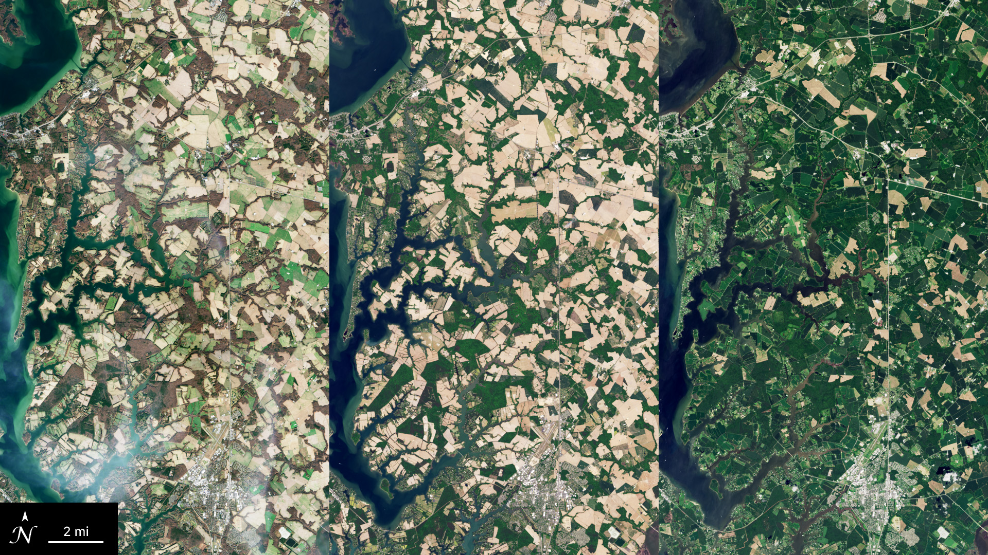
When harvesting season is over and winter comes to Maryland, the old cornfield may look brown and empty from the roadside. If these fields are left fallow with exposed bare soil during the off-season, nutrients are leached and soil is eroded into streams and rivers, which degrades soil health and water quality. But some of these checkerboard fields are hiding something growing there. Something beneficial that remains: winter cover crops.
Below the surface, mixes of winter cover crops (WCC) are fixing nitrogen in the soil. As they grow, these combinations increase overall biomass, control soil erosion, suppress weeds, and support crop biodiversity. These crops help keep nutrients and soil from leaving agricultural fields and eroding into streams, rivers, and eventually drinking-water systems. Less erosion also keeps waterways like the Chesapeake Bay cleaner.
Cover crops are so important to ecosystems that agencies like the Maryland Department of Agriculture are designing incentive programs so that farmers will grow more acres of them. For example, every autumn on Maryland’s Eastern shore, farmers in the Maryland Cover Crop Program carefully select and plant mixes of cover crops such as rye, barley, clover, and radish to maximize the unique benefits of each species.
The problem is that there is no centralized, comprehensive way for conservation program managers and researchers to see exactly where and when those cover crops are growing and measure their impact. This is where the view from space can help.
A team of researchers led by Feng Gao, Research Physical Scientist at the USDA-ARS Hydrology and Remote Sensing Laboratory and member of the interagency Landsat Science Team, have developed a novel process of using Harmonized Landsat and Sentinel-2 (HLS) imagery along with field observations and planting records to capture the seasonal rhythm of the fields. HLS combines imagery from NASA/USGS Landsat and the European Space Agency (ESA) Sentinel-2 satellites to provide observations nearly every day —frequent enough to track small changes in the lifecycle of a plant.
Using the new method, HLS data can help researchers identify what is growing in farmers’ fields remotely without sending anyone into the field. After selecting satellite images of 31 fields over a 6-year period to show change over time, researchers developed an algorithm that can watch when vegetation appears, how long it grows, and when it disappears. That seasonal “fingerprint” can help distinguish a cover crop from a field of weeds or a field of wheat. This study of plant lifecycles is called phenology.
The researchers’ phenology-based mapping system uses a weighted scoring system — an algorithm that relies on a combination of temporal and spectral indices calculated from near-infrared, red, and shortwave infrared satellite bands — to map which fields are most likely to have WCCs. The results from Gao et al., 2026 show that the new algorithm has a high success rate of predicting and identifying winter cover crops, with a balanced overall accuracy of 75%-85%. In some tests, the ability to detect WCC fields exceeded 90%. With this method, satellites could detect cover crops relatively early in the winter and early spring, providing a way to check fields before the WCC growing season is over.
If this method works at scale, it could help researchers measure conservation across entire regions and help agencies verify the crops they’re paying farmers to plant without visiting every field. With the ability to efficiently detect WCCs, it’s also easier to see where conservation of soil is working and where it isn’t. Beyond verifying crop types and locations, the new phenology method helps researchers understand how WCCs perform in various seasons.
With a reliable way to map winter cover crops from space, it’s easier to understand where farmers are using a practice that helps keep nutrients in their fields instead of washing into nearby streams and rivers. That has a significant impact on the ~13.5 million people who live in and around the Chesapeake Bay, the largest estuary in the US. Water quality (clarity, nutrient load and algae content), impacts the vitality of its estimated $100 billion dollars of natural resources.
HLS is funded by NASA and is a deliverable of the Satellite Needs Working Group (SNWG), an interagency effort of the U.S. Government dedicated to identifying and addressing Earth observation needs across U.S. civilian federal agencies.