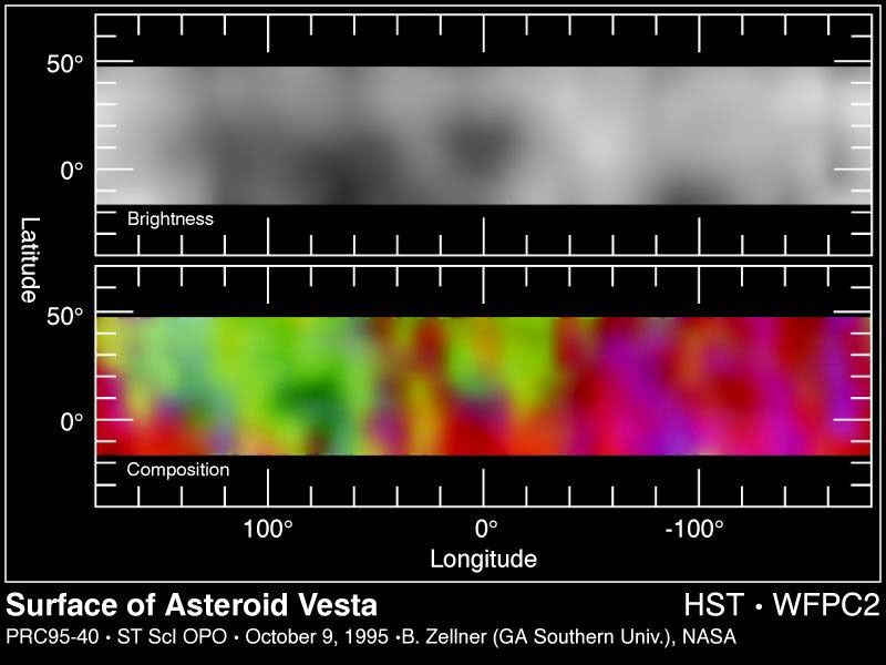
These two maps are derived from images of asteroid 4 Vesta taken between November 28 and December 1, 1994 with the Wide Field Planetary Camera-2 (in PC mode) aboard NASA's Hubble Space Telescope. Hubble images show surface details as small as 35 miles across. The mid latitude...
These two surface maps of the asteroid Vesta are derived from Hubble telescope images taken between November 28 and December 1, 1994. The pictures show surface details as small as 35 miles across. Vesta is 320 miles in diameter, and the map covers the asteroid's entire surface area, about 200,000 miles.
The top panel indicates sharp contrasts in Vesta's surface color. The surface markings may represent ancient volcanic activity such as lava flows and, in addition, regions where major collisions have stripped away the surface. The bottom panel reveals that Vesta's surface is made up of igneous rock, indicating that either the entire surface was once melted or lava flowing from its interior once completely covered its surface.