


CSDA Vendor - Satellogic
NASA's Commercial Satellite Data Acquisition (CSDA) program has acquired commercial datasets from Satellogic.
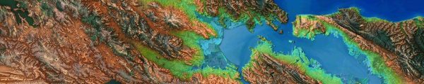
Satellogic operates a vertically integrated constellation of high-resolution multispectral Earth observation satellites designed for frequent global monitoring and geospatial data delivery. Their multispectral constellation captures imagery in the visible (Blue, Green, Red) and Near-Infrared (NIR) spectral bands, enabling applications such as environmental monitoring, agriculture, mining, and disaster response. The products are provided as high-resolution GeoTIFFs accompanied by detailed metadata describing acquisition parameters, calibration information, and geolocation accuracy.
Authorized Data Use and Users
All members of the U.S. Government, and researchers funded by the U.S. Government, have access to the Satellogic Level 1D Orthorectified multispectral archive and tasked data products from Satellogic.
End User License Agreement
Obtaining Data
To request access to CSDA-distributed data, complete the CSDA Authorization form. The CSDA team will verify if the user is authorized for data access.
Copyright
Data products and derivatives for imagery must contain the following copyright markings (YYYY is the year of the image acquisition):
- For data products: "© Satellogic YYYY. All rights reserved."
- For derivatives: "Includes copyrighted material of Satellogic, All rights reserved."
- A joint copyright notice may be used as appropriate
Authorized users should send CSDA a courtesy copy of any publications that include CSDA-provided data.
CSDA Acknowledgment
To help CSDA identify your publications, we request that you include the following acknowledgment when publishing work created using these data:
"This work utilized data made available through the NASA Commercial Satellite Data Acquisition (CSDA) Program."
Evaluations
The Satellogic NewSat Radiometric & Geometric Quality Assessment Report data evaluation is complete and the data acquired during the evaluation are in the Satellite Data Explorer tool (SDX).
Satellogic Data Available through NASA’s CSDA Program
| Data Product Name | Description |
| Archive data | This product provides images covering 25,000 square kilometers (km2) of the Satellogic archive. |
| Standard Tasking with cloud cover protection of less than 5% | This data product offers a total of 1,050 observations of 50 km2. |
| Priority Tasking with cloud cover protection of less than 5% | This data product offers a total of 100 observations of 50 km2. |
| Rush Tasking | This data product offers a total of 10 observations of 50 km2. |
| Area Tasking with cloud cover protection of less than 5% | This data product offers a total of 75 observations of 250 km2. |
For every data product, imagery can be delivered in any of the following 4 processing levels:
| Processing Level | Description |
| L1 Basic | 4-band (RGB+NIR) top-of-the-atmosphere reflectance product characterised by its low processing time. It is geolocated and projected to the ground but not orthorectified and it is presented at native resolution. This implies that different captures may have different pixel sizes depending on the altitude and the off-nadir angle of the satellite at capture time. |
| L1 Ortho-Ready | 4-band (RGB+NIR) top-of-the-atmosphere reflectance product designed for users who wish to perform their own orthorectification using a Digital Elevation Model (DEM) of their choice. The rasters are provided with Rational Polynomial Coefficients (RPCs). By combining the imagery, the RPCs, and a DEM, users can generate their own geometrically corrected, orthorectified images. |
| L1 Ortho | 4-band (RGB+NIR) top-of-the-atmosphere reflectance product, orthorectified and resampled at fixed GSD (70cm for Mark-V and 99cm for Mark-IV). |
| L1 Ortho SR | 4-band (RGB+NIR) top-of-the-atmosphere reflectance orthorectified product. Resolution is increased (Super Resolution) using Machine Learning (Deep Learning) techniques, so final GSD is 50cm for Mark-V and 70cm for Mark-IV. |