







CSDA Vendor - Capella
NASA's Commercial Satellite Data Acquisition (CSDA) program has acquired commercial datasets from Capella for government use.
Capella provides high-resolution Synthetic Aperture Radar (SAR) data that delivers persistent, all-weather, day-and-night visibility of Earth’s surface. Capella’s SAR satellite constellation enables reliable monitoring of dynamic environments, supporting applications across disaster response, environmental monitoring, and scientific research. For CSDA users, Capella offers access to a growing archive of more than 30,000 SAR images collected since 2020, supporting time-series analysis and benchmarking for global change detection. Capella also provides InSAR-ready datasets, enabling users to easily analyze surface deformation and monitor subtle changes over time with greater consistency and speed.
Obtaining Data
- To request access to CSDA-distributed data, complete the CSDA Authorization form. The CSDA team will verify if the user is authorized for data access.
- Search and download Capella data using the CSDA Satellite Data Explorer (SDX). Access requires an Earthdata Login.
Copyright
Data products and derivatives for imagery must contain the following copyright markings (YYYY is the year of the image acquisition):
- For data products: “© Capella YYYY. All rights reserved.”
- For derivatives: “Includes copyrighted material of Capella. All rights reserved.”
- A joint copyright notice may be used as appropriate
CSDA Acknowledgment
To help CSDA identify your publications, we request that you include the following acknowledgment when publishing work created using these data:
"This work utilized data made available through the NASA Commercial Satellite Data Acquisition (CSDA) program." Authorized users should send CSDA a courtesy copy of any publications that include CSDA-provided data.
Evaluation
The completed Capella Principal Investigator Evaluation Summary, and the Capella Radiometric & Geometric Quality Assessment Report are available for review.
Constellation
Capella has five of their Acadia class satellites in operation, as of August 2025. Orbital planes for each:
- o C11 (Acadia-1): Mid-latitude 53 degrees
- o C13 (Acadia-3): Mid-latitude 53 degrees
- o C14 (Acadia-4): Mid-latitude 45 degrees
- o C15 (Acadia-5): Sun synchronous orbit 98 degrees
- o C17 (Acadia-7): Sun synchronous orbit 98 degrees
In addition, there is archive data for 10 satellites of their previous classes that have reached their end of life. They were in operation between 1 and 4 years.
Imaging modes
| Acquisition Mode | Scene Size | Resolution |
| Spotlight - Ultra | 5x5km | 0.25m |
| Spotlight | 5x5km | 0.5m |
| Spotlight - Wide | 10x20km | 1.00m |
| Stripmap - 20 | 10x20km | 1.20m |
| Stripmap - 50 | 10x50km | 1.20m |
| Stripmap - 100 | 10x100km | 1.20m |
Authorized Data Use and Users
Access to this data is governed by the CSDA End User License Agreements (EULAs). The minimum access level for data is the USG license. Depending on the specific data products provided, some or all data may also be available under higher-tier CSDA licenses, including USG‑Plus and Public licenses.
Under the applicable license tier, authorized users may include:
- U.S. Government federal employees
- State, local, territorial, and tribal government personnel
- U.S. Government contractors and subcontractors
- U.S. Government–funded researchers and academic partners
- Other users authorized under applicable CSDA license levels (USG, USG‑Plus, or Public)
All data use must comply with the terms of the EULA. All data requests must be reviewed and approved by NASA’s Commercial Satellite Data Acquisition (CSDA) program.
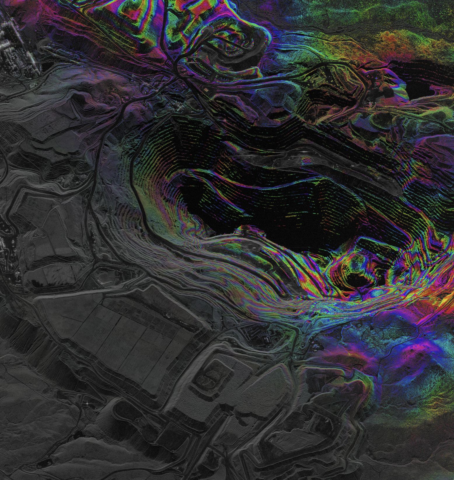
Image: Capella InSAR interferogram time series of Mission Mine in Tucson, Arizona, derived from two Spotlight SAR collections on June 24, 2024, visualizing subtle ground deformation and surface movement over time.
Credit: © Capella 2024. All rights reserved.