


![Request for Information – Potential [Placeholder for Prize]](https://assets.science.nasa.gov/dynamicimage/assets/science/psd/solar/2023/09/s/solarsystem_0.jpg?w=1024)


CSDA Vendor - ICEYE US
NASA's Commercial Satellite Data Acquisition (CSDA) program has acquired commercial datasets from ICEYE US.
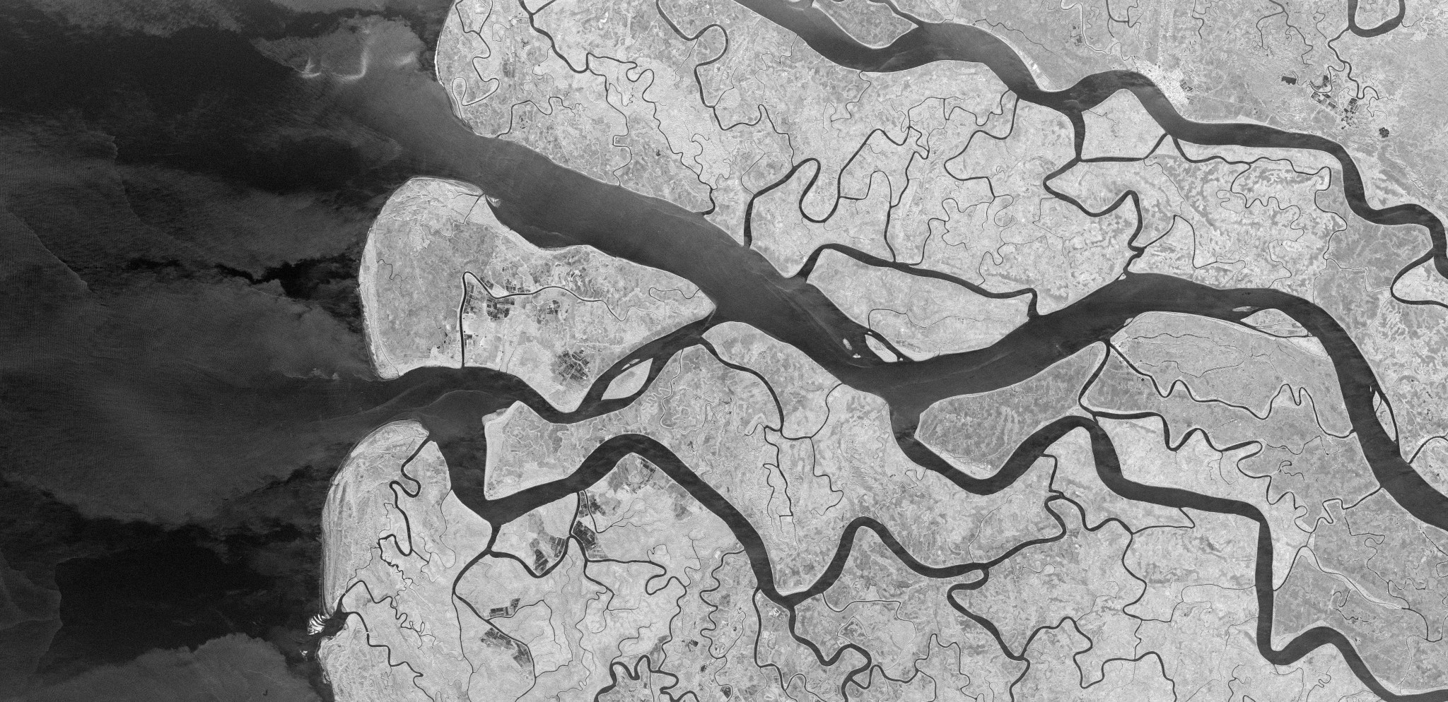
ICEYE US is providing high-resolution Synthetic Aperture Radar (SAR) commercial Earth-observation data products—offering imaging down to 25 cm resolution. ICEYE US’s constellation of SAR satellites offer high-resolution Earth-observation data and imagery in near real-time and in a range of modes to support operational applications including climate research, disaster response, environmental monitoring, international commerce, and maritime awareness. The company’s satellites are positioned in specialized, daily repeat orbits that with the same acquisition time, collection geometry, and location for indefinite periods. These orbits enable ICEYE US to create Amplitude Change Detection (ACD) and Coherent Change Detection (CCD) product stacks of images collected over desired locations.
Obtaining Data
- To request access to ICEYE US data, complete the CSDA Authorization form. The CSDA team will verify if the user is authorized for data access.
- Search and download ICEYE data using the CSDA Satellite Data Explorer (SDX). An Earthdata Login is required.
Copyright
Data products and derivatives must contain the following copyright markings (where YYYY is the year of the image acquisition):
- For ICEYE data: “© ICEYE US, Inc., YYYY. All Rights Reserved.”
- For derivatives: "Includes copyrighted material of Umbra, Inc., All Rights Reserved.”
- A joint copyright notice may be used as appropriate
CSDA Acknowledgment
To help CSDA identify your publications, we request that you include the following acknowledgment when publishing work created using these data:
"This work utilized data made available through the NASA Commercial Satellite Data Acquisition (CSDA) program."Authorized users should send CSDA a courtesy copy of any publications that include CSDA-distributed data.
Evaluations
The ICEYE U.S. Radiometric & Geometric Quality Assessment Report and PI Evaluation Summary reports are now available.
Authorized Data Use and Users
Access to this data is governed by the CSDA End User License Agreements (EULAs). The minimum access level for data is the USG license. Depending on the specific data products provided, some or all data may also be available under higher-tier CSDA licenses, including USG‑Plus and Public licenses.
Under the applicable license tier, authorized users may include:
- U.S. Government federal employees
- State, local, territorial, and tribal government personnel
- U.S. Government contractors and subcontractors
- U.S. Government–funded researchers and academic partners
- Other users authorized under applicable CSDA license levels (USG, USG‑Plus, or Public)
All data use must comply with the terms of the EULA. All data requests must be reviewed and approved by NASA’s Commercial Satellite Data Acquisition (CSDA) program.
Learning Resources
For more information about the commercial data from ICEYE available through the CSDA program, see the ICEYE NASA CSDA Vendor Focus webinar.
Image: A frozen river system imaged by the ICEYE synthetic aperture radar (SAR) constellation on February 11, 2026, demonstrating high-resolution SAR data available through NASA's CSDA program. CREDIT: ICEYE US