


![Request for Information – Potential [Placeholder for Prize]](https://assets.science.nasa.gov/dynamicimage/assets/science/psd/solar/2023/09/s/solarsystem_0.jpg?w=1024)


CSDA Vendor - Tomorrow.io
NASA's Commercial Satellite Data Acquisition (CSDA) program has acquired commercial datasets from Tomorrow.io.
Tomorrow.io's constellations of radar and microwave sounder satellites provide frequent and global observations of atmospheric and weather data to support accurate and timely forecasts. The company's Pathfinder satellites feature Ka-band radar instruments that offer detection of near-surface precipitation and surface scatterometry and its constellation of microwave sounder satellites provides global, high-frequency measurements of atmospheric temperature, water vapor, and precipitation to support forecasting and weather prediction, climate science, hazard risk assessment, and other applications.
Obtaining Data
- To request access to CSDA-distributed data, complete the CSDA Authorization form. The CSDA team will verify if the user is authorized for data access.
- Search and download Tomorrow.io data using the CSDA Satellite Data Explorer (SDX). An Earthdata Login is required
Copyright
The CSDA program subscriber agrees that any portion of the Solution that incorporates and presents Datafeed shall prominently display the message "Powered by Tomorrow.io" in a legible manner near such data or any information derived from it. This message shall open a link to https://www.tomorrow.io/ when clicked or touched. View Tomorrow.io Terms of Service.
CSDA Acknowledgment
To help CSDA identify your publications, we request that you include the following acknowledgment when publishing work created using these data: "This work utilized data made available through the NASA Commercial Satellite Data Acquisition (CSDA) Program."
Authorized users should send CSDA a courtesy copy of any publications that include CSDA-distributed data.
Evaluation
The Tomorrow.io radar data quality assessment evaluation report is now available.
Documentation
- Product Information: Level 1C geolocated, calibrated radar reflectivity profiles (L1C-GEOPROF)
- Product Information: Level 2A radar precipitation (L2A-PRECIP) data products.
Tomorrow.io Constellation
All approved CSDA users have access to the Tomorrow.io Level 1C geolocated, calibrated radar reflectivity profiles (L1C-GEOPROF) and the Level 2A radar precipitation (L2A-PRECIP) data products—which include hydrometer water content, characteristic size, and phase (ice or liquid), as well as the surface precipitation rate and phase. Additional outputs include a probabilistic classification of each profile in four categories (probability of surface precipitation, probability of frozen precipitation, probability of convective precipitation, and probability of hail) in the profile.
| Mission Characteristics | Information |
| Number of Satellites | 2 (TR 1, TR 2) |
| Orbit Altitude | 550 km in Sun-Synchronous Orbit |
| LTAN | Approx. 1045 (TR1) and 0110 (TR2) drifting |
| Sensor Type | Radar |
| Frequency | 35.5-36 GHz (Ka-band) |
| Ground Footprint Size | 4.5 km |
| Vertical Resolution | 250 m |
| Granule Size | Variable |
| Revisit Time | Variable |
Authorized Data Use and Users
Access to this data is governed by the CSDA End User License Agreements (EULAs). The minimum access level for data is the USG license. Depending on the specific data products provided, some or all data may also be available under higher-tier CSDA licenses, including USG‑Plus and Public licenses.
Under the applicable license tier, authorized users may include:
- U.S. Government federal employees
- State, local, territorial, and tribal government personnel
- U.S. Government contractors and subcontractors
- U.S. Government–funded researchers and academic partners
- Other users authorized under applicable CSDA license levels (USG, USG‑Plus, or Public)
All data use must comply with the terms of the EULA. All data requests must be reviewed and approved by NASA’s Commercial Satellite Data Acquisition (CSDA) program.
Learning Resources
For more information about the commercial data from Tomorrow.io available through the CSDA program, see the Tomorrow.io NASA CSDA Vendor Focus webinar.
Additional Information
For more information about Tomorrow.io's commercial data holdings available through NASA's CSDA program access their data catalogue.
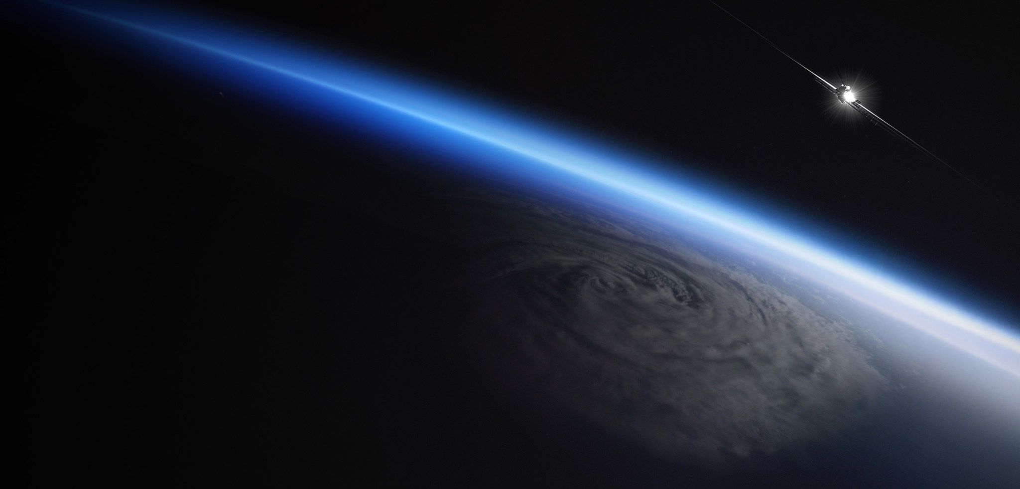
Image: Tomorrow.io operates a first-of-its-kind commercial weather satellite constellation that combines Ka-band precipitation radars and microwave sounders to deliver a ~60-minute global revisit rate, including over oceans and regions without ground-based radar coverage. Credit: Tomorrow.io