


CSDA Data Partner - Polar Geospatial Center
NASA's Commercial Satellite Data Acquisition (CSDA) program has acquired digital elevation models from the Polar Geospatial Center for scientific purposes.
Among other support to the Polar science community, the Polar Geospatial Center (PGC) at the University of Minnesota produces high-resolution, digital elevation maps (DEMS) of the Arctic and the Earth. The DEMs are part of the PGC EarthDEM Project, a collaboration between PGC, the Byrd Polar Research Center at The Ohio State University, the National Center for Supercomputing Applications at the University of Illinois, and government partners to produce high-resolution terrain maps for temperate and tropic regions. The DEMs are derived from panchromatic Vantor satellite imagery obtained through a license with the National Geospatial - Intelligence Agency.
EarthDEM products include hundreds of thousands of individual time-stamped, 2 m resolution elevation models spanning more than 10 years as well as a seamless mosaic model. The elevation models are constructed using images acquired between 2009 and present by the WorldView-1, WorldView-2, WorldView-3, and GeoEye-1 small satellites (SmallSats) operated by Vantor.
Obtaining Data
- To request access to CSDA-distributed data, complete the CSDA Authorization form. The CSDA team will verify if the user is authorized for data access.
- Search and download EarthDEM data from the Satellite Data Explorer (SDX). An Earthdata Login is required.
Citing Data
EarthDEM screenshots and figures of DEM products can be used in publications without restriction.
EarthDEM products should contain attribution as specified in the Polar Geospatial Center Acknowledgment Policy. Include the following note for any DEM figures: "DEM(s) created by the Polar Geospatial Center from Maxar, Inc. imagery." A citation of the EarthDEM project also must be included.
CSDA Acknowledgment
To help CSDA identify your publications, we request that you include the following acknowledgment when publishing work created using these data:
"This work utilized data made available through the NASA Commercial Satellite Data Acquisition (CSDA) Program." Authorized users should send CSDA a courtesy copy of any publications that include CSDA-provided data.
Authorized Data Use and Users
Access to this data is governed by the CSDA End User License Agreements (EULAs). The minimum access level for data is the USG license. Depending on the specific data products provided, some or all data may also be available under higher-tier CSDA licenses, including USG‑Plus and Public licenses.
Under the applicable license tier, authorized users may include:
- U.S. Government federal employees
- State, local, territorial, and tribal government personnel
- U.S. Government contractors and subcontractors
- U.S. Government–funded researchers and academic partners
- Other users authorized under applicable CSDA license levels (USG, USG‑Plus, or Public)
All data use must comply with the terms of the EULA. All data requests must be reviewed and approved by NASA’s Commercial Satellite Data Acquisition (CSDA) program.
Documentation
For more information about the EarthDEM product, please see the PGC product documentation.
Additional Information
Please visit the PGC EarthDEM website for additional information.
Further information on The Polar Geospatial Center (PGC) can be found at the University of Minnesota.
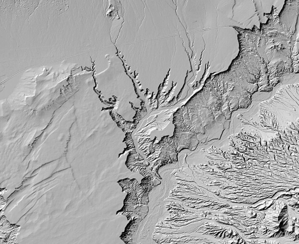
Image: Shaded relief rendering of EarthDEM data showing the Virgin River, Nevada. DEM derived from Vantor imagery. Credit: EarthDEM Project.