


![Request for Information – Potential [Placeholder for Prize]](https://assets.science.nasa.gov/dynamicimage/assets/science/psd/solar/2023/09/s/solarsystem_0.jpg?w=1024)


Available Datasets
CSDA offers access to data products from multiple commercial Earth observation data providers.

NASA’s Commercial Satellite Data Acquisition (CSDA) program is the agency’s central mechanism for identifying, acquiring, and evaluating commercial Earth observation (EO) data. The program augments NASA’s and partner agencies’ observations by acquiring commercial satellite data that offer higher spatial resolution, increased revisit frequency, and complementary measurement capabilities.
These data products allow NASA scientists and partners to observe Earth systems with enhanced detail and timeliness to improve research, disaster response, environmental monitoring, and associated applications across government and industry.
Data Evaluation
NASA’s Commercial Satellite Data Acquisition (CSDA) Program ensures that commercial Earth observation data meet rigorous standards for Earth science research and applications through an evaluation process. NASA’s gold‑standard data assessments give commercial providers trusted validation that supports market growth and customer adoption.
Evaluation Criteria include:
● Data quality
● Usefulness Accessibility
● And other vendor characteristics
NASA’s evaluation process leverages the ESA–NASA Joint Earth Observation Mission Quality Assessment Framework. The is a shared approach that helps both agencies consistently review the quality of commercial satellite data. As more companies provide Earth‑observation imagery and products, ESA and NASA developed a joint framework to ensure that the data they may acquire meets trusted and transparent standards.
The data quality assessment and principal investigator evaluation reports are open access reports that are published and serve as a seal of approval.
Data Summary
CSDA provides access to high-resolution multispectral and hyperspectral data, digital elevation models, methane emission data, synthetic aperture radar (SAR), precipitation radar, and Global Navigation Satellite System Radio Occultation (GNSS-RO) data products from multiple commercial Earth Observation data providers.
Available data
Synthetic Aperture Radar (SAR)
SAR can observe Earth's surface day and night through most weather conditions to support a wide range of science and applications.


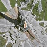
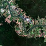
Multispectral / Electro-Optical Data
Multispectral satellite imagery captures light from across multiple electromagnetic wavelengths to reveal hidden environmental data like vegetation health, soil moisture, and mineral composition.


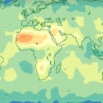
Methane Emissions
Methane emissions data are used to measure and track methane emissions released into the atmosphere during a specific time.
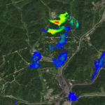
Precipitation Radar
Precipitation radar data allows forecasters to map storms, track precipitation in real-time, and estimate rainfall accumulation.

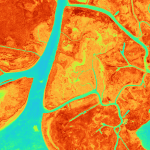
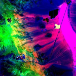
Hyperspectral
Hyperspectral data are produced from a highly detailed form of remote sensing that captures images across hundreds of contiguous, narrow wavelength bands to identify the unique chemical signatures of materials.

Digital Elevation Models
Digital Elevation Models (DEMs) provide quantitative, georeferenced measurements of elevation (such as height and slope) over a given area.


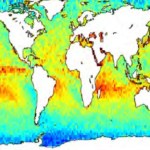
Navigation and Radio Occultation
Radio occultation (RO) is a remote sensing technique that uses navigation satellite signals to assess characteristics of Earth's atmosphere and calculate precise, high-resolution vertical profiles of temperature, pressure, and humidity.
GeoOptics
GeoOptics operated the Community Initiative for Cellular Earth Remote Observation constellation of Earth observing nanosatellites from late 2018 to January 2022, providing radio occultation data products from their Global Navigation Satellite Systems (GNSS) Radio Occultation (GNSS-RO) receivers.

Authorized Data Use and Users
Access to the commercial data available through the CSDA program is governed by CSDA End User License Agreements (EULAs). The minimum access level for data is the USG license. Depending on the specific data products provided, some or all data may also be available under higher-tier CSDA licenses, including USG Plus and Public licenses.
Under the applicable license tier, authorized users may include:
● U.S. Government federal employees
● State, local, territorial, and tribal government personnel
● U.S. Government contractors and subcontractors
● U.S. Government–funded researchers and academic partners
● Other users authorized under applicable CSDA license levels (USG, USG Plus, or Public)
All data use must comply with the terms of the EULA. All data requests must be reviewed and approved by NASA’s CSDA program.
Learn more about the CSDA licenses.
Become an Authorized Data User
Researchers, government personnel (federal, state, local), tribal governments, and eligible partners can request access to CSDA data by completing the CSDA Data Authorization Form. Once approved, users may request archived or taskable commercial EO data under the applicable license tier.
Data Access
Search and download data using the CSDA Satellite Data Explorer (SDX). An Earthdata Login is required.