


CSDA Vendor - Pixxel
NASA's Commercial Satellite Data Acquisition (CSDA) program has acquired commercial datasets from Pixxel for scientific purposes.
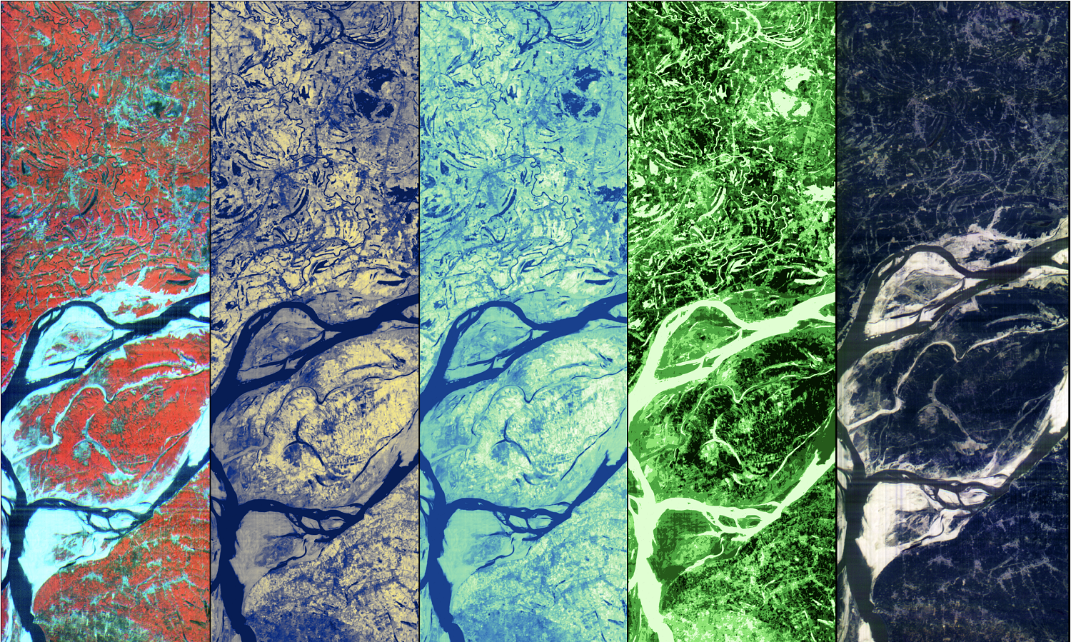
Pixxel operates a constellation of high-resolution hyperspectral Earth observation satellites designed to deliver precise spectral measurements of Earth’s surface for frequent global monitoring. Its operational Firefly constellation provides analysis-ready data across more than 135 spectral bands in the visible and near-infrared (VNIR) range at a 5-meter ground sample distance. This rich hyperspectral imagery supports a wide range of applications, including agricultural monitoring, water quality assessment, forest and ecosystem health, mineral exploration, infrastructure surveillance, and disaster response.
Obtaining Data
To request access to CSDA-distributed data, complete the CSDA Authorization form. The CSDA team will verify if the user is authorized for data access.
Copyright
Data products and derivatives for imagery must contain the following copyright markings (YYYY is the year of the image acquisition):
- For data products: “© Pixxel YYYY. All rights reserved.”
- For derivatives: “Includes copyrighted material of Pixxel. All rights reserved.”
- A joint copyright notice may be used as appropriate
CSDA Acknowledgement
To help CSDA identify your publications, we request that you include the following acknowledgment when publishing work created using these data:
"This work utilized data made available through the NASA Commercial Satellite Data Acquisition (CSDA) program." Authorized users should send CSDA a courtesy copy of any publications that include CSDA-distributed data.
Capabilities of the Firefly Constellation
| Imaging Mode | Pushbroom Line Scanning Array |
| Wavelength range | 470 - 900 nm (VNIR) |
| Total available bands | 135 bands |
| Total selectable bands | 45 bands |
| GSD | 5.36 meters |
| Swath | 40 km |
| Image Size | Minimum 10x10 km; Capture up to 40x80 km |
| Orbit | Sun Synchronous Orbit (SSO), 97.65° inclination |
| Altitude | 590 km |
| Off-nadir angle /slew | +/- 30° (+/-20° recommended) |
| Revisit time | 1 - 2 days (based on latitude)* |
| Captures per Day | 40 per satellite |
| Imagery bit depth | 10 bit |
Documentation
Pixxel Hyperspectral Imagery Product Specifications (May 2026, Version 3.2)
Authorized Data Use and Users
Access to this data is governed by the CSDA End User License Agreements (EULAs). The minimum access level for data is the USG license. Depending on the specific data products provided, some or all data may also be available under higher-tier CSDA licenses, including USG‑Plus and Public licenses.
Under the applicable license tier, authorized users may include:
- U.S. Government federal employees
- State, local, territorial, and tribal government personnel
- U.S. Government contractors and subcontractors
- U.S. Government–funded researchers and academic partners
- Other users authorized under applicable CSDA license levels (USG, USG‑Plus, or Public)
All data use must comply with the terms of the EULA. All data requests must be reviewed and approved by NASA’s Commercial Satellite Data Acquisition (CSDA) program.
Image: Pixxel commercial satellite false color imagery composites of the Ganga River Delta, India. The images were generated with various RGB band combinations across the Visible and Near-Infrared spectrum and used to monitor soil moisture and vegetation health. Credit: Pixxel