





























CSDA Vendor - ImageSat
NASA's Commercial Satellite Data Acquisition (CSDA) program has acquired commercial datasets from ImageSat.
ImageSat operates a constellation of four optical satellites: EROS‑C2, EROS‑C3, EROS‑B, and Runner. The EROS‑C pair forms the backbone of the constellation, providing consistent, near‑global measurements. These two satellites fly in mid‑inclination low Earth orbit and carry very high‑resolution optical payloads, enabling daily revisits and uniform radiometry and geometry for global change detection. Their instruments collect very high‑resolution panchromatic and multispectral imagery, along with standard mono and stereo acquisition modes to support time‑series analysis.
In addition to the EROS-C pair, EROS-B, the constellation’s heritage platform, has collected high-resolution optical data that provides a valuable dataset for researchers investigating long-term environmental change. Lastly, Runner (launched in 2023) augments the constellation, enhancing observational frequency while maintaining data quality.
Obtaining Data
All newly awarded commercial data provider products are currently undergoing CSDA evaluation. If you have any questions about these products, please email CSDA Support.
Copyright
Data products and derivatives for imagery must contain the following copyright marking (YYYY is the year of the image acquisition):
- © YYYY ImageSat. Licensed by ImageSat International (I.S.I) Ltd.
CSDA Acknowledgment
To help CSDA identify your publications, we request that you include the following acknowledgment when publishing work created using these data:
"This work utilized data made available through the NASA Commercial Satellite Data Acquisition (CSDA) Program."
Authorized users should send CSDA a courtesy copy of any publications that include CSDA-provided data.
ImageSat Data Available through NASA’s CSDA Program
Constellation and Data Characteristics
| Attribute | EROS C3 | EROS C2 | EROS B |
| Spatial Resolution (GSD @ Nadir) | PAN: 0.43 m; MS: 0.86 m | PAN: 0.43 m | PAN: 0.50 m |
| Spectral Bands | PAN: 450 - 900 nm; MS: Blue 450 - 510 nm, Green 510 - 580 nm, Red 630 - 690 nm, NIR 770 - 895 nm | PAN: 450 - 900 nm | PAN: 450 - 900 nm |
| Swath Width | 12.5 km | 12.5 km | 7 km |
| Imaging Modes | Spot, Strip, Stereo, Triplet, Mosaic, Orthophoto | Spot, Strip, Stereo, Triplet, Mosaic, Orthophoto | Spot, Strip |
| Mean Revisit* | 0.6 - 1.6 days | 0.7 - 1.4 days | N/A |
| Data Availability | 2023 – present | 2021 - present | 2006 - Feb 2026 (historical archive) |
Available Data Products
| Data Product | Satellite(s) | Processing Levels | Description |
| PAN | EROS C3, EROS C2 | Level 1A, Level 1C | Panchromatic imagery. |
| RGB | EROS C3 | Level 1A, Level 1C | True-color imagery produced from the red, green, and blue bands. |
| PSR | EROS C3 | Level 1A, Level 1C | Pansharpened imagery combining panchromatic imagery with the red, green, and blue bands. |
| PAN - Historical | EROS B | Level 1A, Level 1B | Panchromatic imagery from the historical EROS B archive. |
Authorized Data Use and Users
Access to this data is governed by the CSDA End User License Agreements (EULAs). The minimum access level for data is the USG license. Depending on the specific data products provided, some or all data may also be available under higher-tier CSDA licenses, including USG‑Plus and Public licenses.
Under the applicable license tier, authorized users may include:
- U.S. Government federal employees
- State, local, territorial, and tribal government personnel
- U.S. Government contractors and subcontractors
- U.S. Government–funded researchers and academic partners
- Other users authorized under applicable CSDA license levels (USG, USG‑Plus, or Public)
All data use must comply with the terms of the EULA. All data requests must be reviewed and approved by NASA’s Commercial Satellite Data Acquisition (CSDA) program.
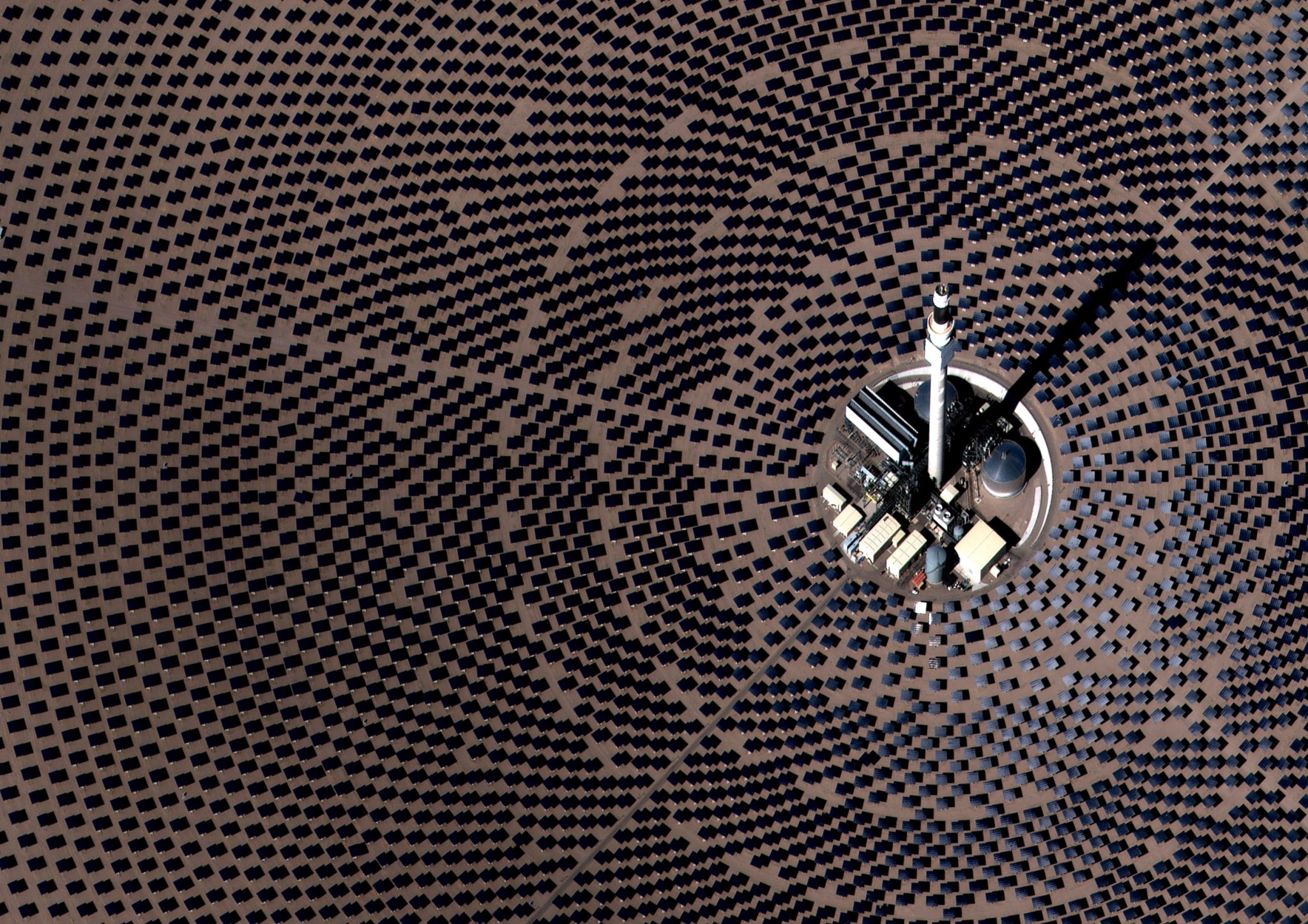
Top Banner Image: High-resolution color EROS satellite imagery shows the Crescent Dunes Solar Energy Project near Tonopah, Nevada. Thousands of heliostats are arranged in curved rows around a central solar power tower, creating a distinctive geometric pattern across the desert landscape. The heliostats track the Sun and direct concentrated sunlight toward a receiver at the top of the tower, where molten salt is heated for thermal energy storage and electricity generation. Credit: © 2026 ImageSat. Licensed by ImageSat International (I.S.I) Ltd.