




























CSDA Vendor - Muon Space
NASA's Commercial Satellite Data Acquisition (CSDA) program has acquired commercial datasets from Muon Space.
Muon Space operates a constellation of high-performance Global Navigation Satellite System–Reflectometry (GNSS-R) satellites. Its six satellite GNSS-R constellation provides GNSS-R data products to enable Earth science research and applications through use of its Level 1 delay Doppler maps (DDMs) and calibrated surface reflectivity and normalized bistatic radar cross section (NBRCS) observations. It also produces Level 2 retrievals of near surface (0–5 cm) soil moisture and ocean surface wind speed.
Muon's GNSS-R measurements build on and expand the legacy of NASA's Cyclone GNSS (CYGNSS) mission. Several satellites in the Muon constellation offer advances in measurement capabilities:
- MuSat2 and MuSat3 provide dual‑polarized (LHCP/RHCP) surface reflections, enabling potential mitigation of surface‑roughness effects in soil moisture retrievals.
- MuSat4 (FireSat Protoflight) and the three operational FireSat satellites feature a higher peak receive antenna gain (20 dBi) than earlier GNSS‑R missions. This increased gain can reduce error in high wind speed retrievals and improve soil moisture estimation beneath dense vegetation canopies.
Obtaining Data
All newly awarded commercial data provider products are currently undergoing CSDA evaluation. If you have any questions about these products, please email CSDA Support.
Copyright
Data products and derivatives must contain copyright markings as specified below, where YYYY is the year of the acquisition.
- For data products: “© Muon Space YYYY. All rights reserved.”
- For derivatives: “Includes copyrighted material of Muon Space. All rights reserved.”
- A joint copyright notice may be used as appropriate.
CSDA Acknowledgment
To help CSDA identify your publications, we request that you include the following acknowledgment when publishing work created using these data:
“This work utilized data made available through the NASA Commercial Satellite Data Acquisition (CSDA) Program.” Authorized users should send CSDA a courtesy copy of any publications that include CSDA-distributed data.
Muon Space Data Available from the CSDA Program
Muon Space provides both Level 1 and Level 2 data products from its GNSS-R constellation. The table below summarizes Muon’s GNSS-R instruments that are currently available to the NASA CSDA Program and its data products.
GNSS-R Data Available through the CSDA program
| MuSat2 | MuSat4 | |
| Launch Date | March 2024 | March 2025 |
| Orbit | 590 km SSO | 590 km SSO |
| Peak Rx Gain (dBi) | 14 | 20 |
| Polarization | LHCP / RHCP | LHCP |
| Signals Collected | GPS, Galileo | GPS |
| Bus | ESPA-Class | Condor-M |
| Status | Operational | Operational |
| Level 1 Availability & Dates | Available: 2024-06-20 to 2026-07-20 | Available: 2025-11-07 to 2026-07-20 |
| Level 2 Ocean Wind Speed Availability & Dates | Available (GPS only): 2024-08-01 to 2026-06-30 | Not yet available |
| Level 2 Soil Moisture Availability & Dates | Available (GPS only): 2024-08-01 to 2026-06-30 | Not yet available |
Authorized Data Use and Users
Access to this data is governed by the CSDA End User License Agreements (EULAs). The minimum access level for data is the USG license. Depending on the specific data products provided, some or all data may also be available under higher-tier CSDA licenses, including USG‑Plus and Public licenses.
Under the applicable license tier, authorized users may include:
- U.S. Government federal employees
- State, local, territorial, and tribal government personnel
- U.S. Government contractors and subcontractors
- U.S. Government–funded researchers and academic partners
- Other users authorized under applicable CSDA license levels (USG, USG‑Plus, or Public)
All data use must comply with the terms of the EULA. All data requests must be reviewed and approved by NASA’s Commercial Satellite Data Acquisition (CSDA) program.
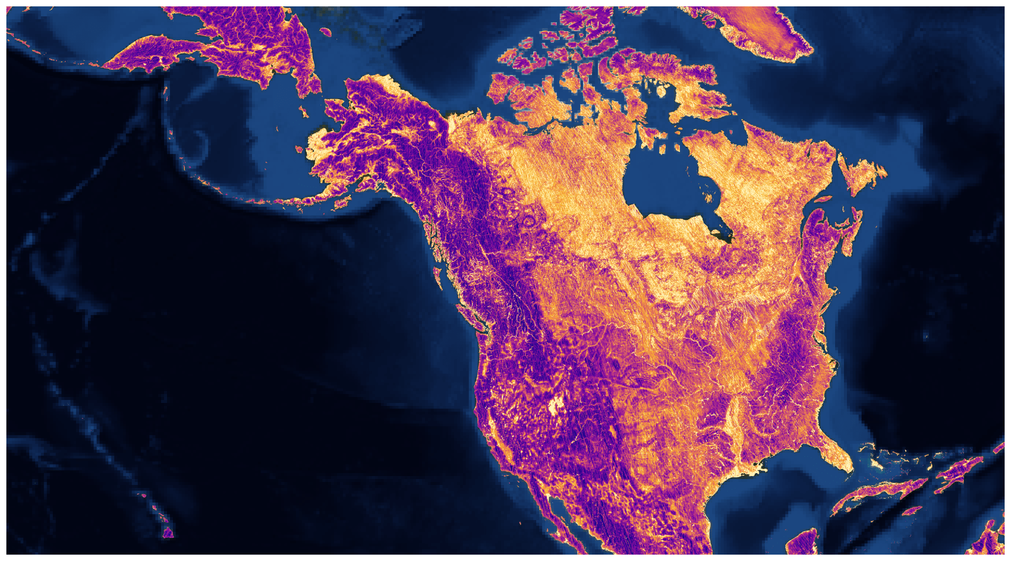
Top Banner Image: 3-km land surface reflectivity observations from the GNSS-R instrument onboard Muon Space's MuSat2 satellite over North America. Credit: Muon Space, Inc.